|
The waterfalls shown on this page will be presented by county, starting in the western Upper Peninsula and working our way east.
NOTE: The file sizes of these photos are mostly in the 180KB - 280KB range (about three times larger than other files on this site), so they may take a little longer to load
(Click on a description to see the photo)
(Click your Browser's "Back" button to return here)
Gogebic County (new content from a 2008 trip in this section - look for this symbol:  ): ):
The Black River contains many waterfalls as it flows into Lake Superior. Here are five of them:
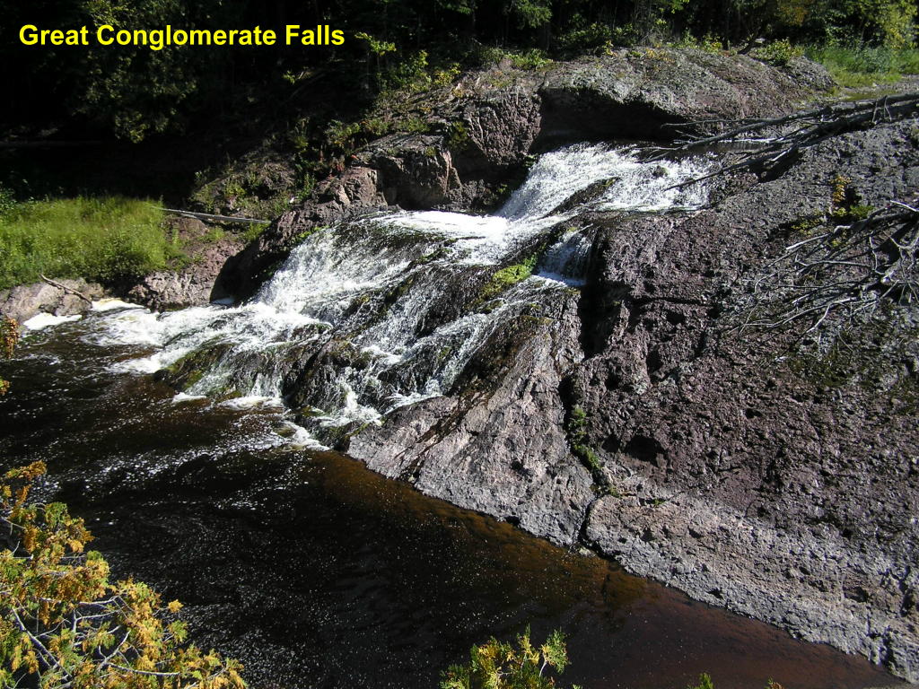
Great Conglomerate Falls - The fifth falls up-river from the mouth at Lake Superior
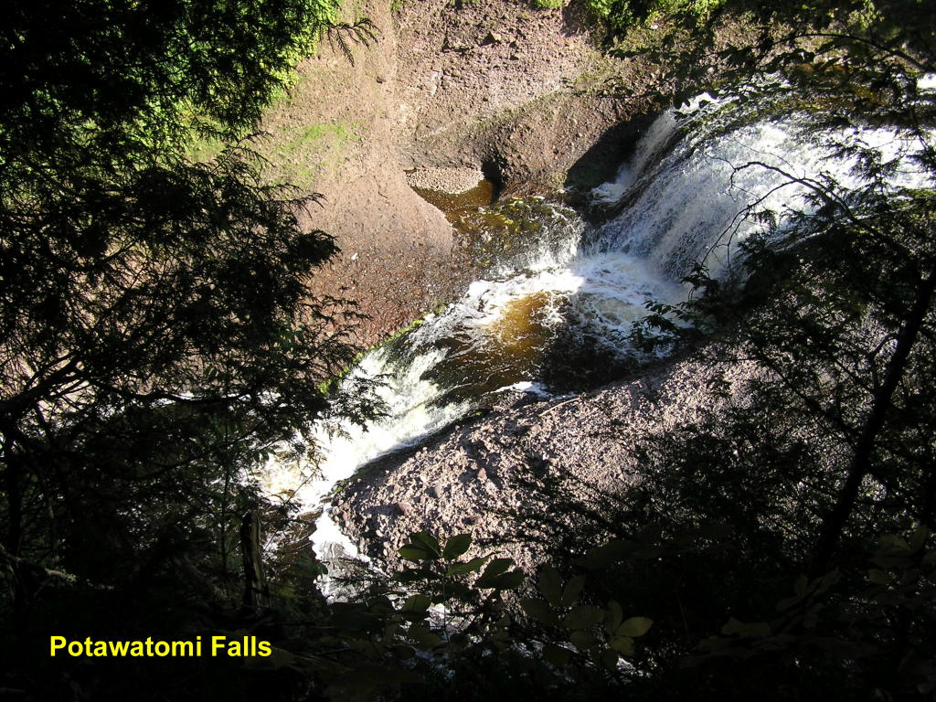
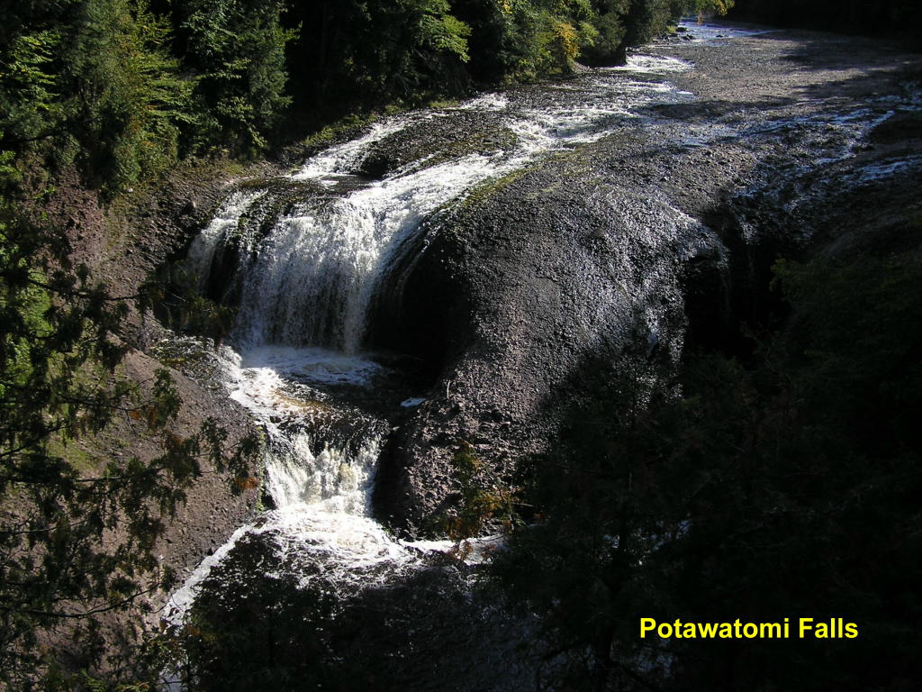
Potawatomi Falls - The fourth falls up-river
Potawatomi Falls - Another view
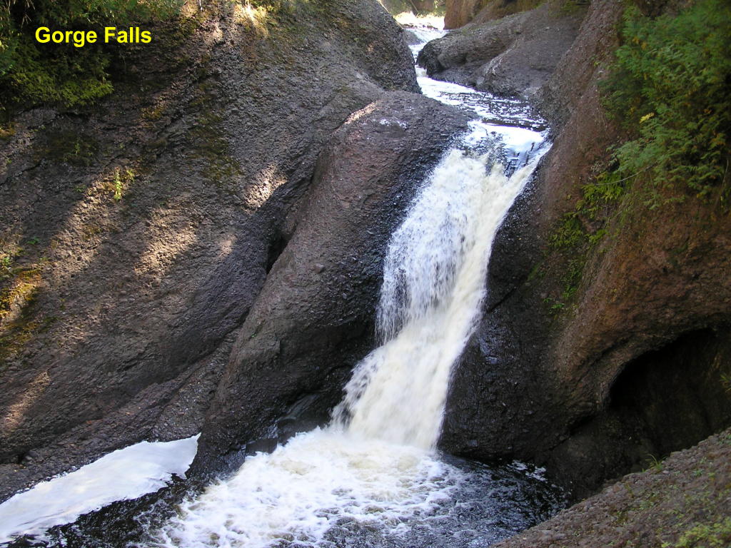
Gorge Falls (prelude) - This area of the falls leads to the main falls (next photo), which are the third falls up-river
Gorge Falls - This is the actual "Gorge Falls"
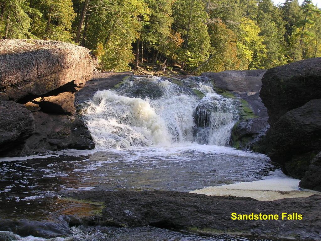
Sandstone Falls - The second falls up-river
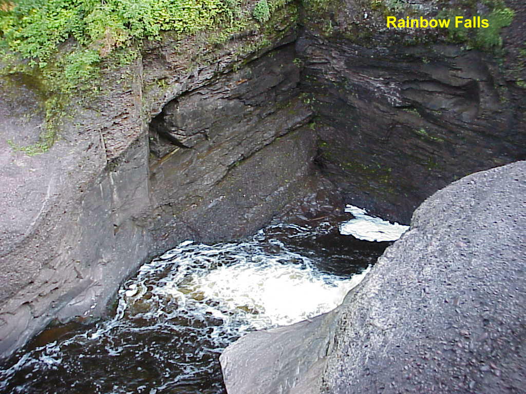
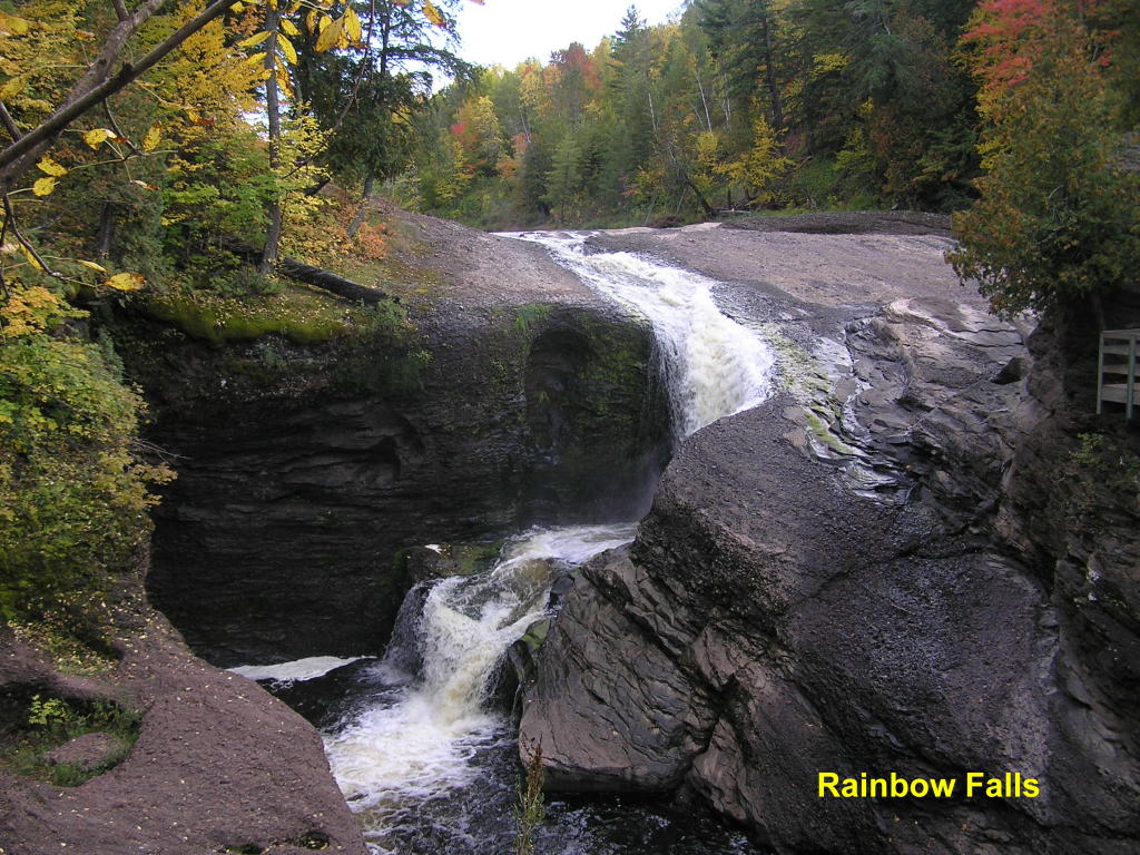
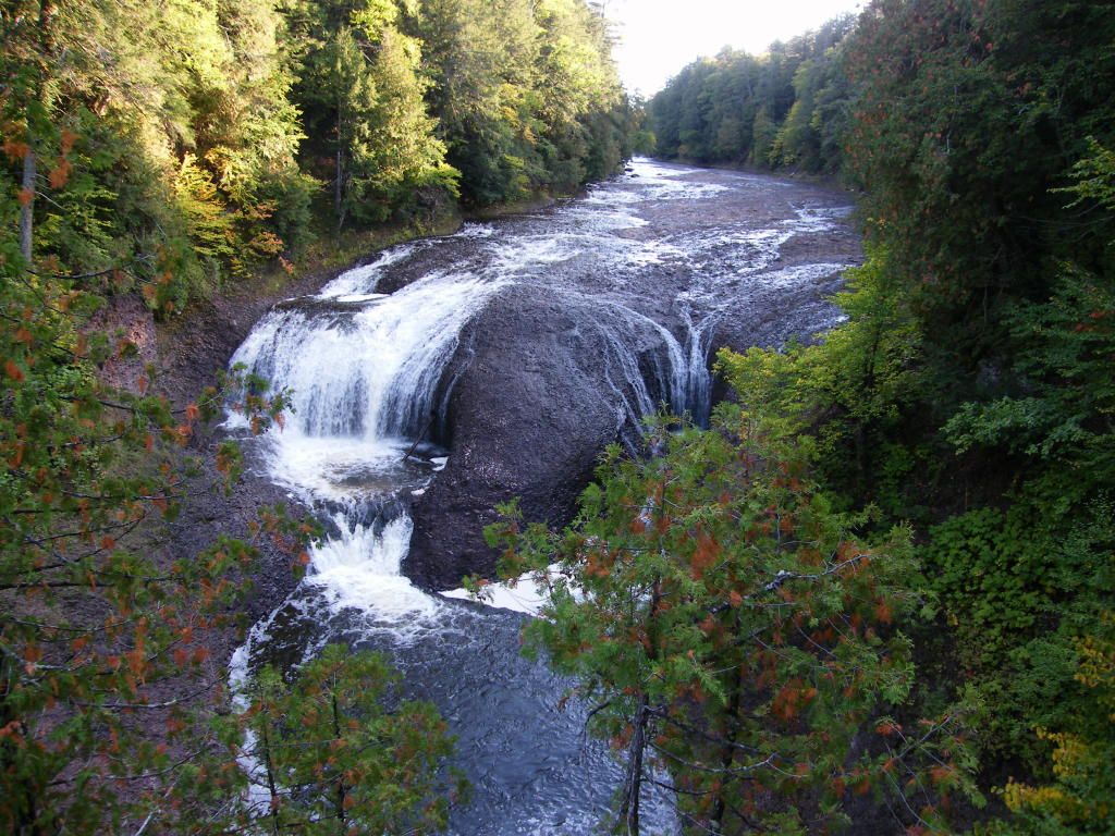
Rainbow Falls (prelude) - This area of the falls leads to the main falls (next photos), and are near the mouth of the Black River
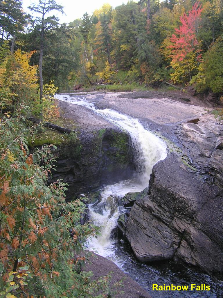
Rainbow Falls - The falls as viewed from the west side of the river
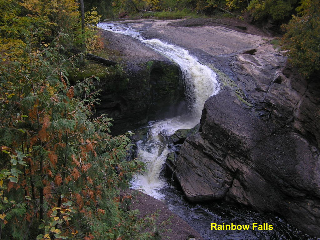
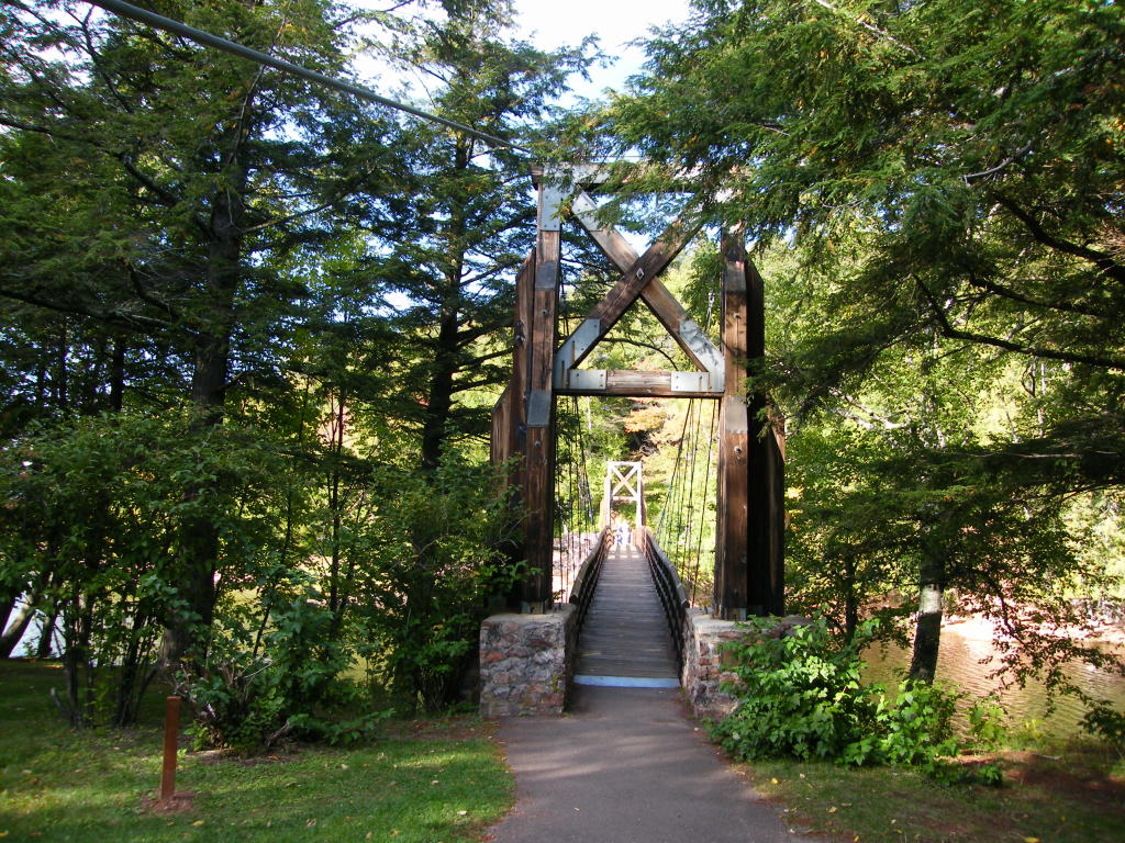
Rainbow Falls - To see this view of the falls, you must cross the suspension footbridge and walk up the east side trail
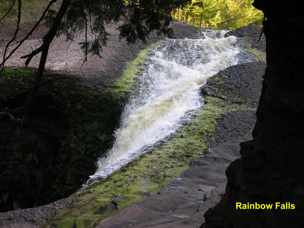
Rainbow Falls - A closer look at the falls
Rainbow Falls - ... and another look
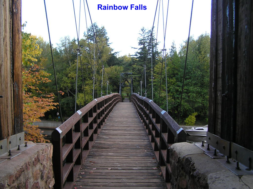
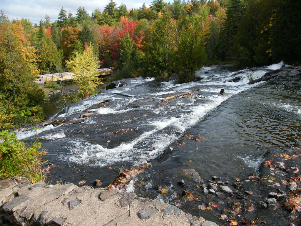
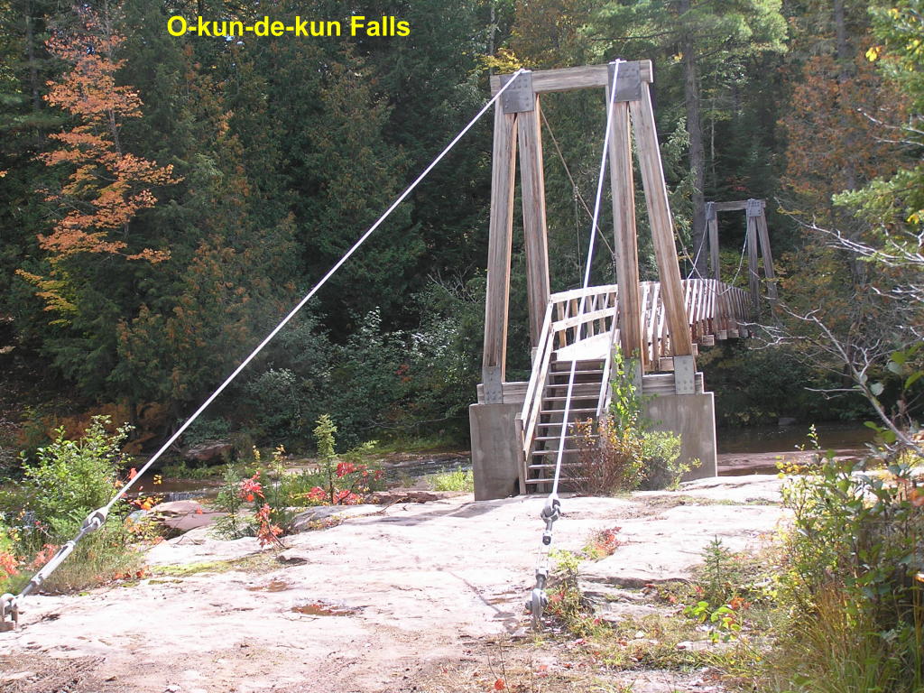
Suspension Footbridge - This walking-only bridge was built during the WPA days (in the 1930's)
Potawatomi Falls - A view of the falls and river from above
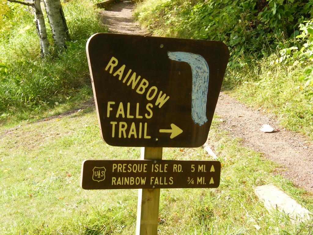
Rainbow Falls - Signpost for the falls
Rainbow Falls - The suspension walking bridge leading to the opposite side of the falls
Rainbow Falls - Wide view of the falls area
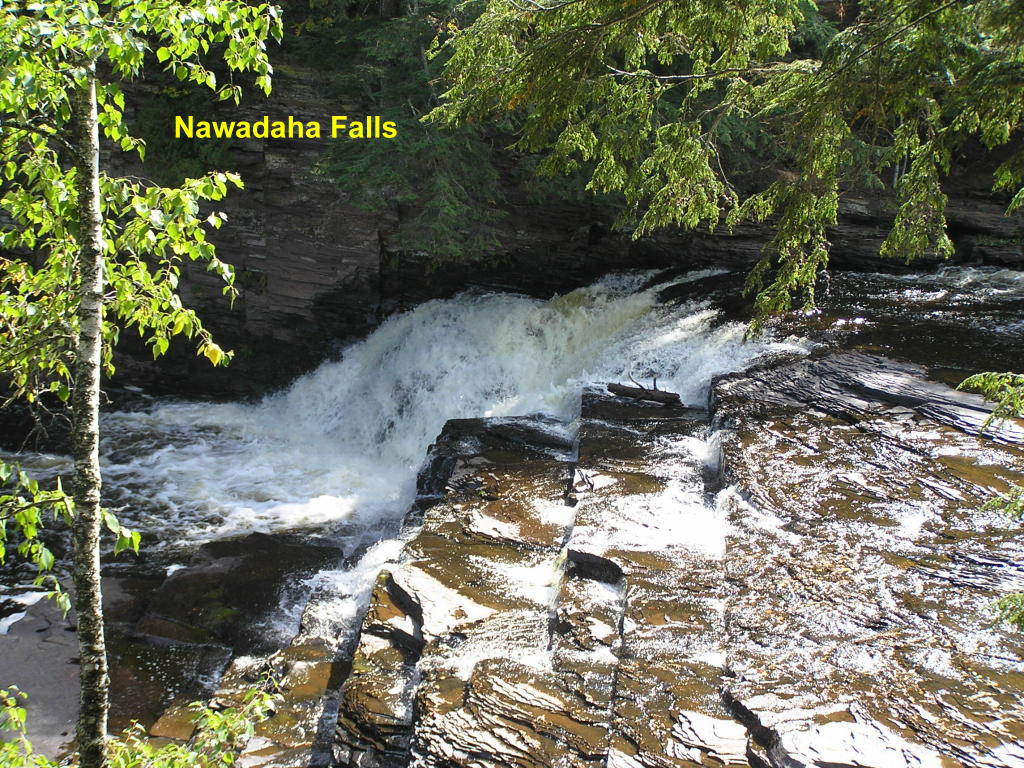
The Presque Isle River also contains many waterfalls as it flows into Lake Superior. Here are four of them:
Nawadaha Falls - The fourth falls up-river from the mouth as the river flows to Lake Superior
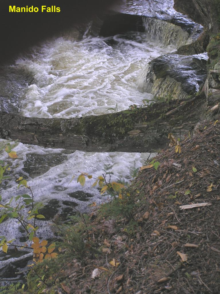
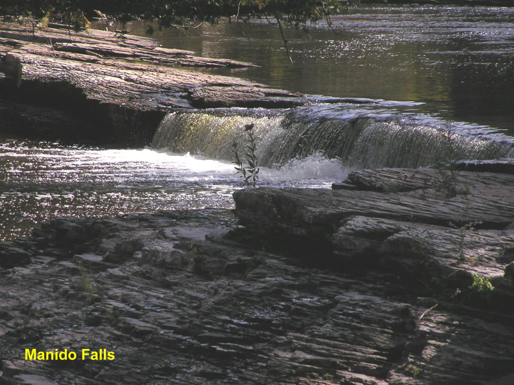
Manido Falls (prelude) - This area of falls leads to the main falls (next photo) and is the third up-river from the mouth
Manido Falls - This is the main falls
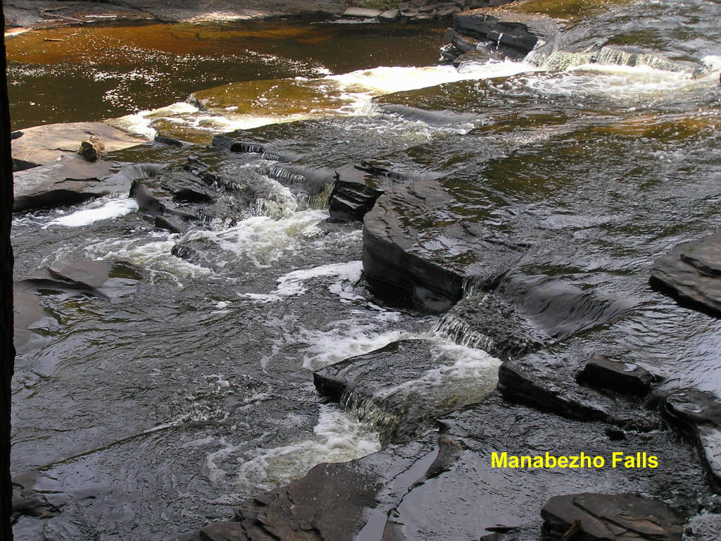
Manabezho Falls (prelude) - These small falls lead to the main falls (next photo) and are the second falls up-river
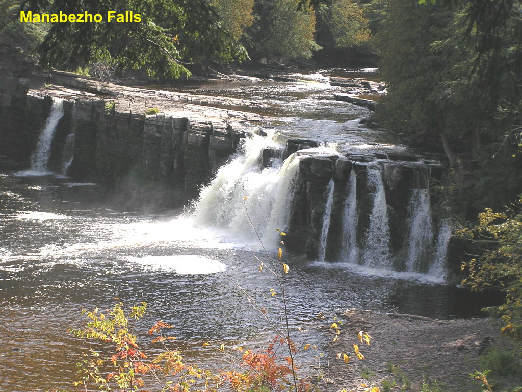
Manabezho Falls - The beautiful main falls
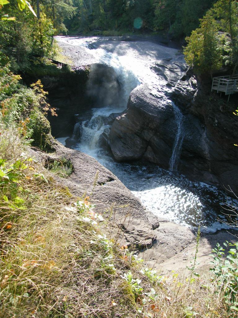
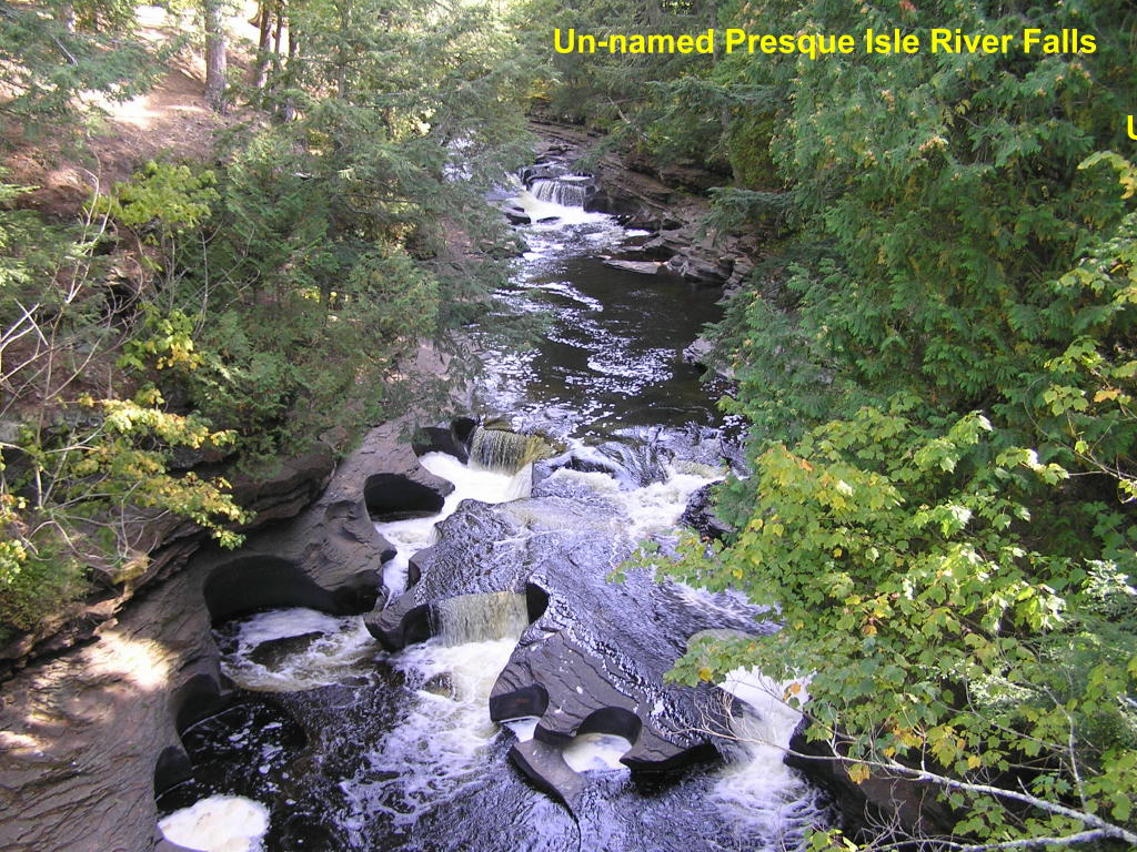
Un-named Presque Isle River Falls - This picturesque series of falls is near the mouth of the river
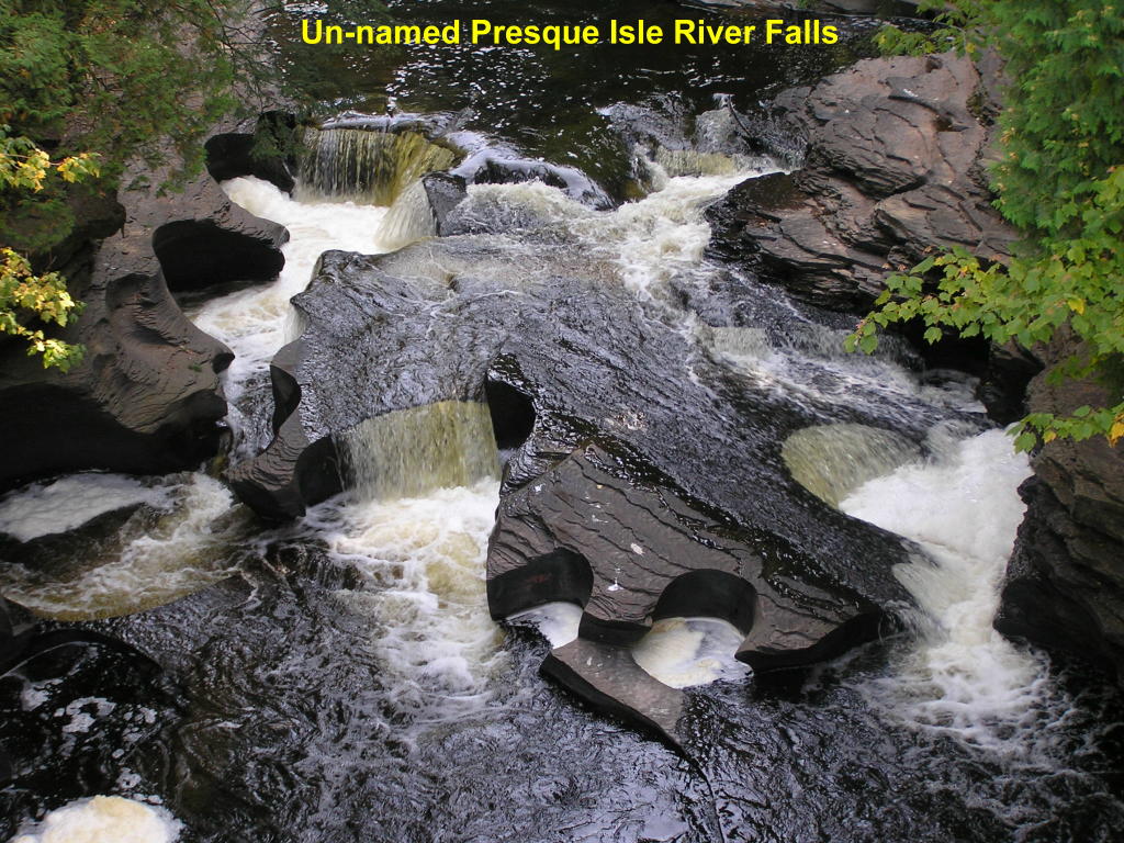
Un-named Presque Isle River Falls - Close-up of the falls - the circular cut-outs in the rock in the riverbed is caused by the swirling waters of the falls
Other waterfalls in Gogebic County:
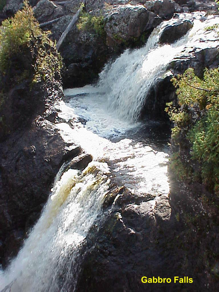
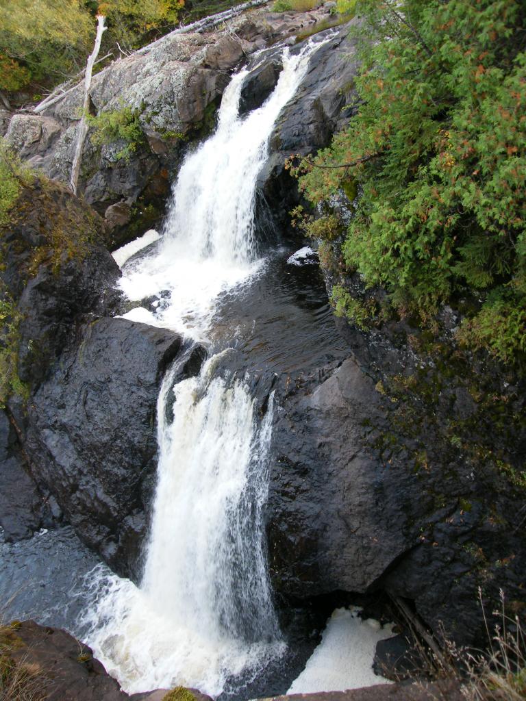
Gabbro Falls - Another falls further up the Black River
Gabbro Falls - A little better look at this two-tiered waterfall
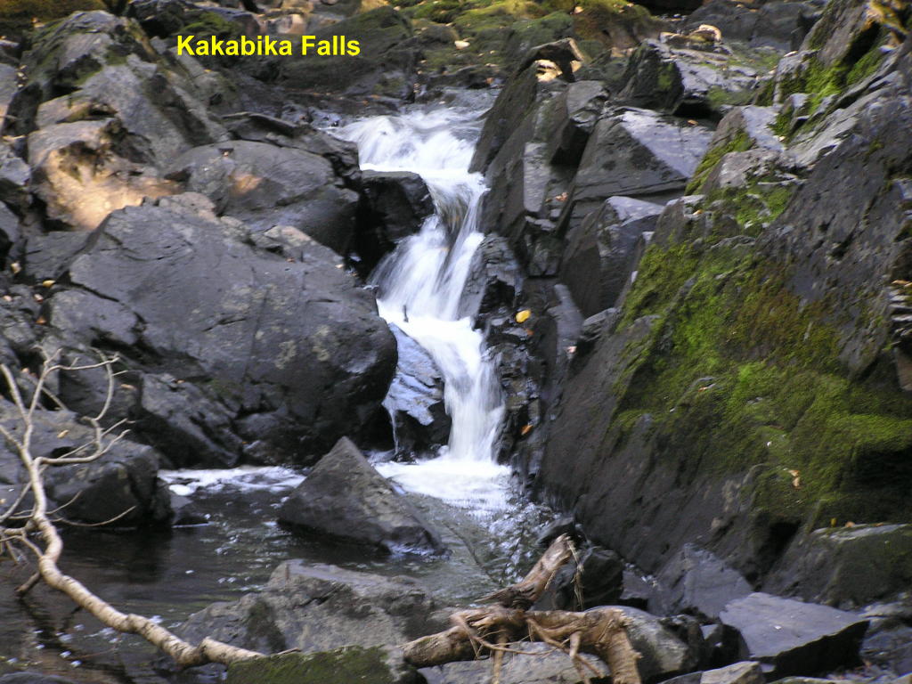
Kakabika Falls - Located on the Cisco Branch of the Ontonagon River
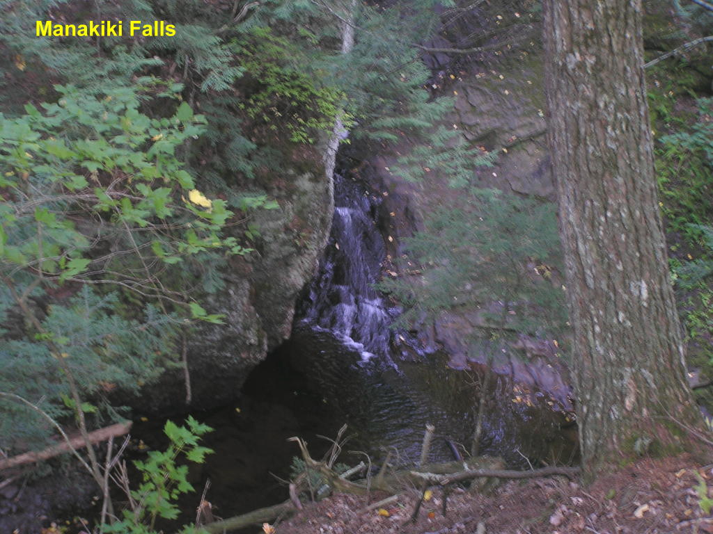
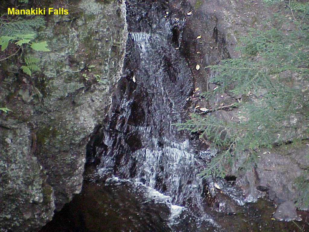
Manakiki Falls - This falls is tucked away in the woods along Maple Creek with very little room for photos
Manakiki Falls - Close-up (as best I could get)
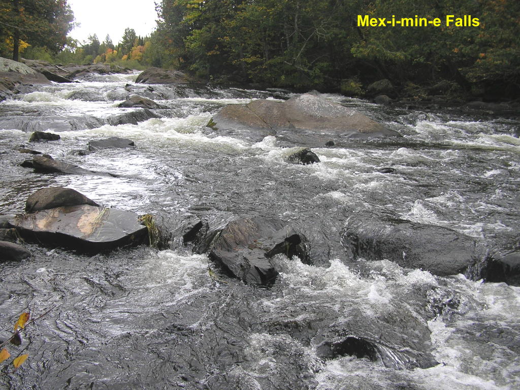
Mex-i-min-e Falls - These falls on the Middle Branch of the Ontonagon River are also known as the Burned Dam Falls
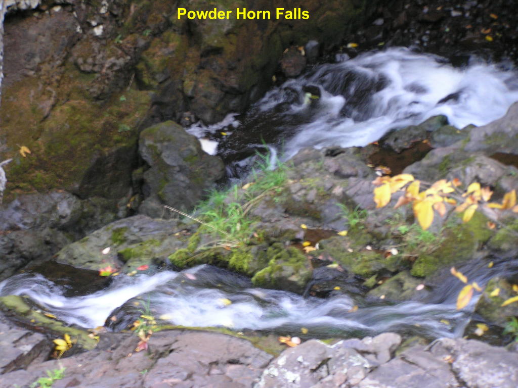
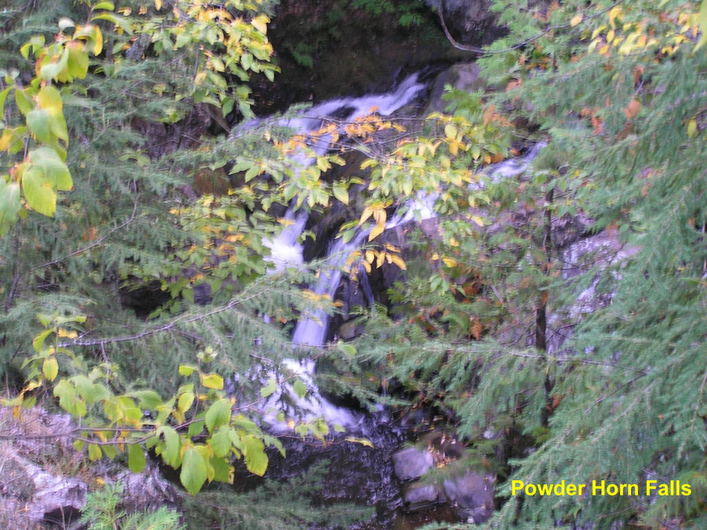
Powder Horn Falls (prelude) - This area of falls on Powder Mill Creek is above the main falls (next photo), and are located on Powder Mill Creek
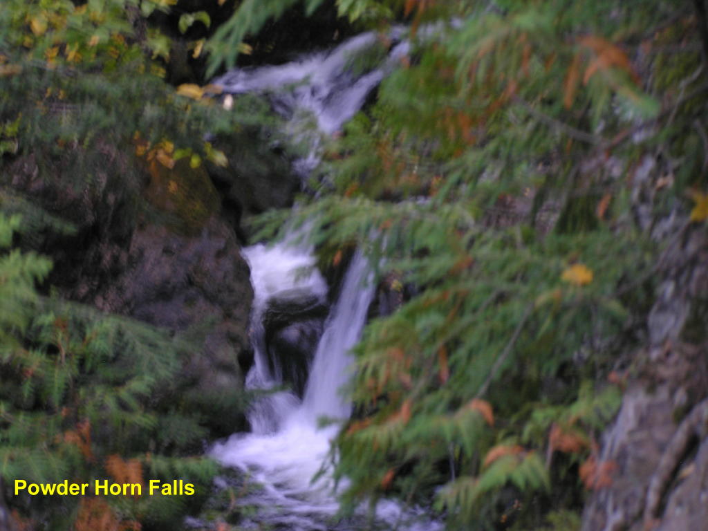
Powder Horn Falls - This was another very difficult falls to photograph
Powder Horn Falls - Close-up (as best I could get)
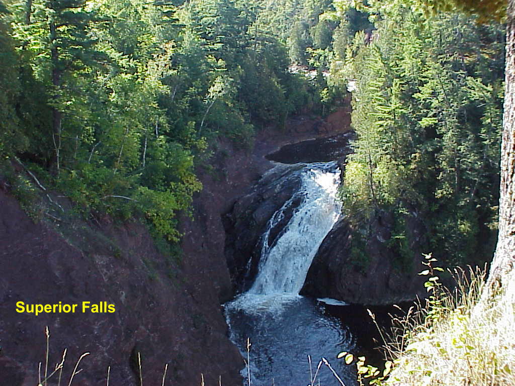
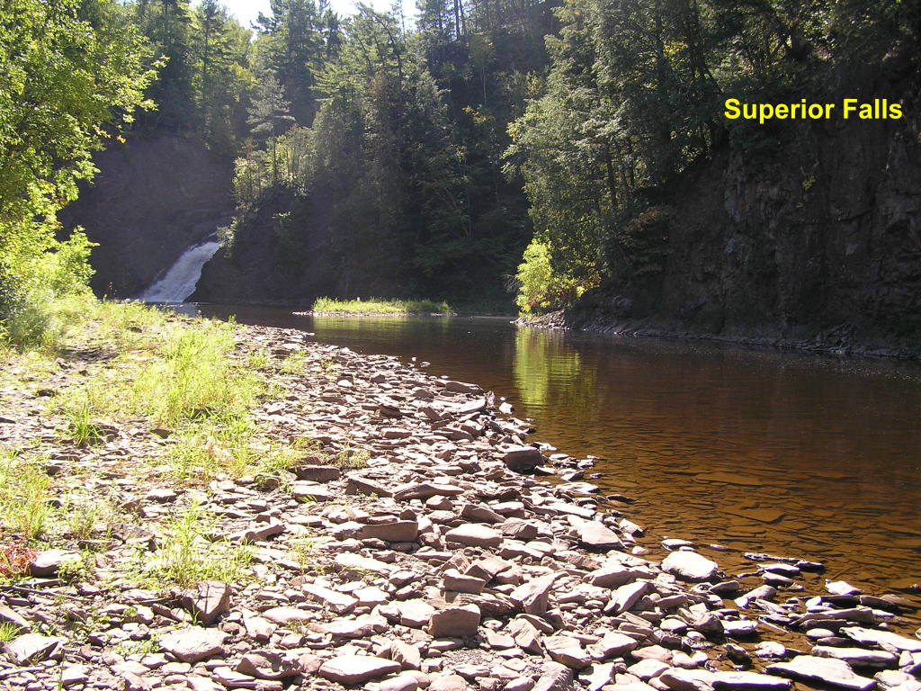
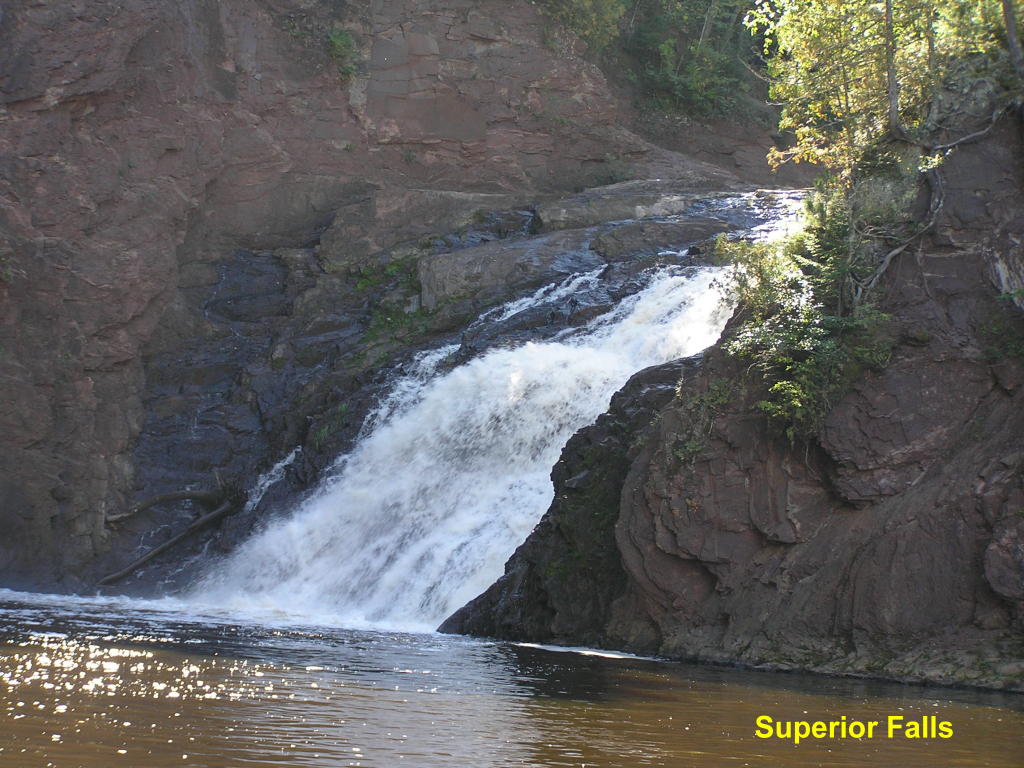
Superior Falls - These falls on the Montreal River are in the very northwestern tip of the Upper Peninsula
Superior Falls - Wide-angle view from river-level
Superior Falls - Close-up from river-level
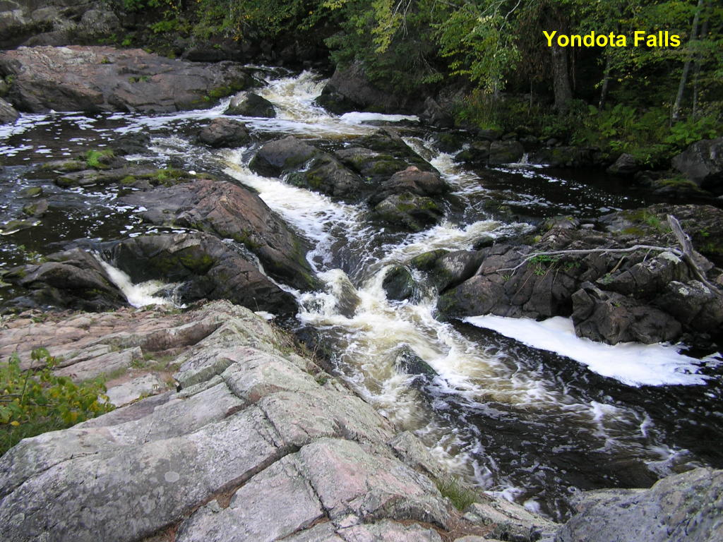
Yondota Falls - Another small falls on the Presque Isle River
Ontonagon County (new content from a 2008 trip in this scetion - look for this symbol: ):
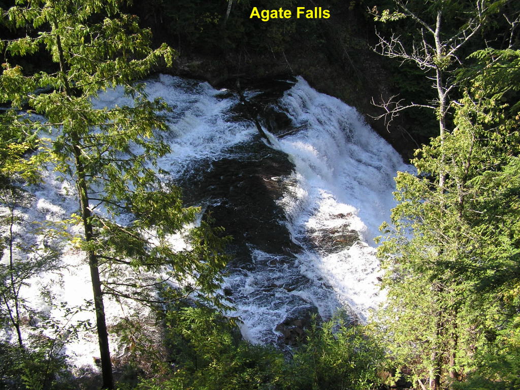
Agate Falls - There is an improved trail and a viewing platform for these falls along the Middle Branch of the Ontonagon River; but, this is the best view from there
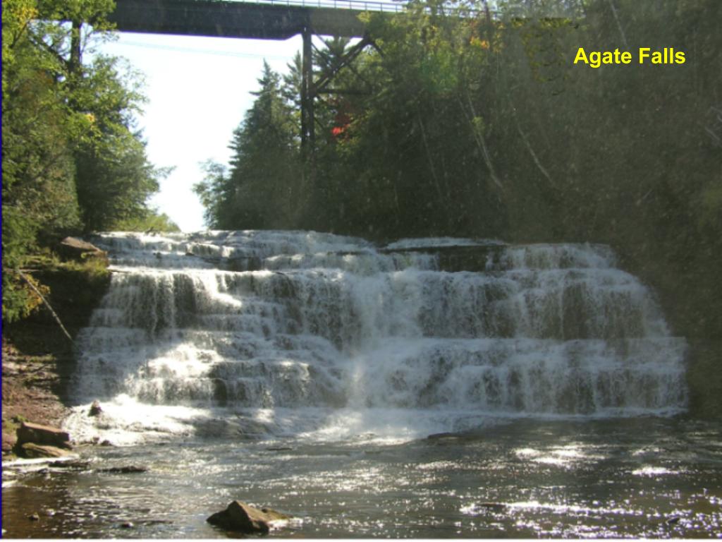
Agate Falls - To get this magnificent view, you will need to climb down a fairly steep hill with no set trail
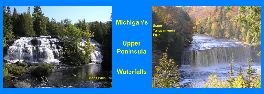
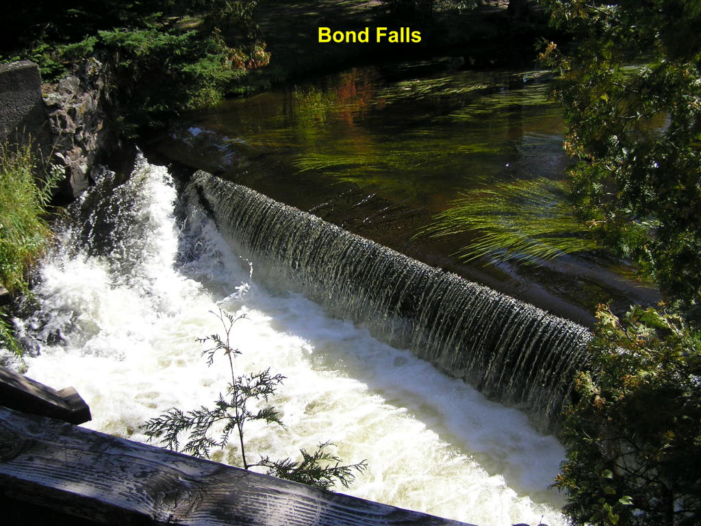
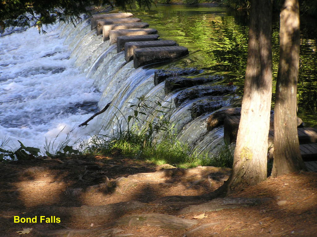
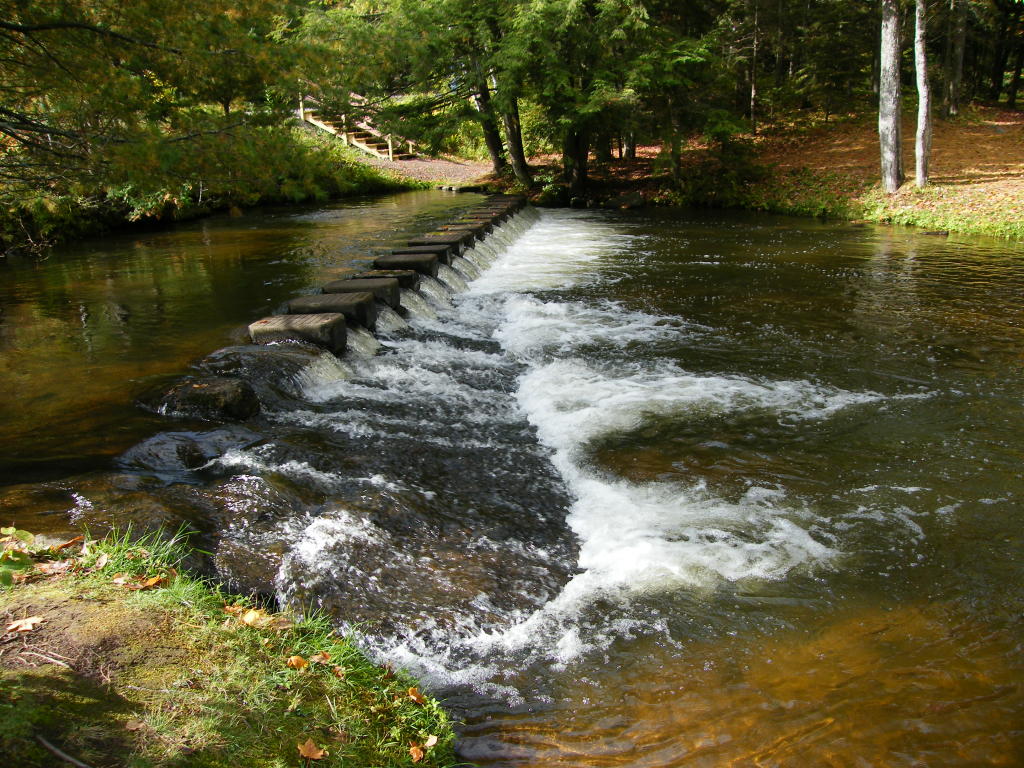
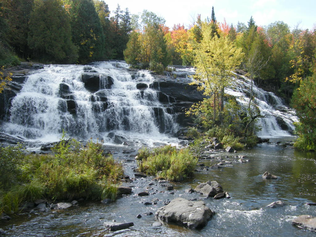
Bond Falls - The walk down to the main falls , also on the Middle Branch of the Ontonagon River, begins with this small falls
Bond Falls - A little further down the trail is this (partially man-made) falls
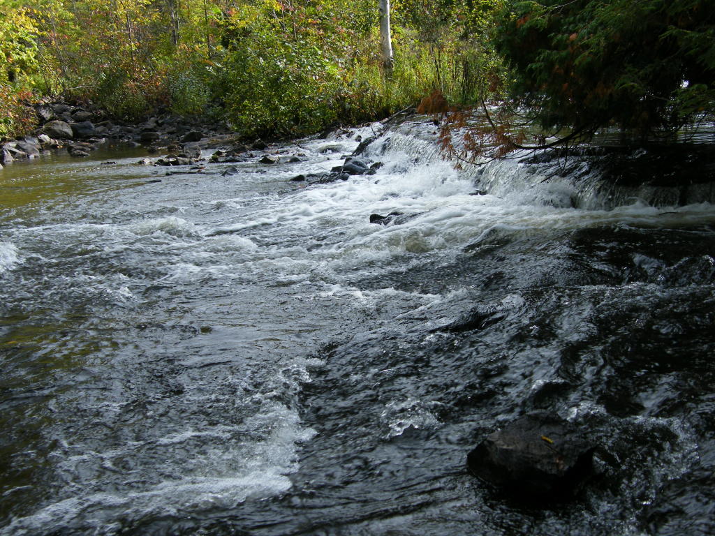
Bond Falls - A little further yet and the falls really begin to rumble (but this is still not the main falls)
Bond Falls - Further still, and the river continues to tumble toward the main falls
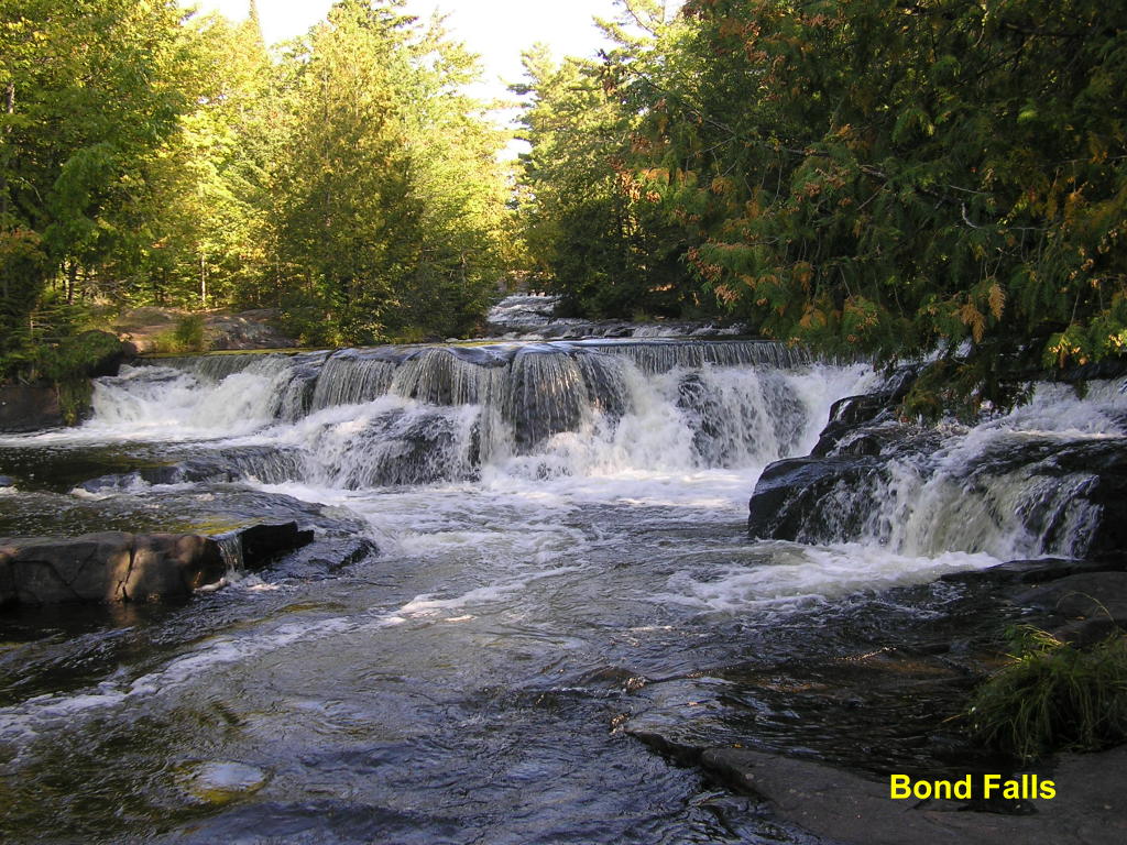
Bond Falls - A set of steps takes you right alongside the main falls
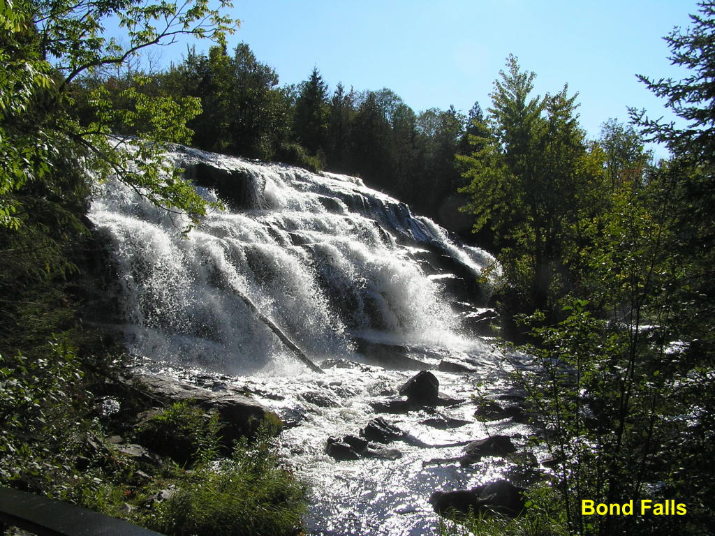
Bond Falls - As you follow the trail, you come to half of the main falls
Bond Falls - Follow the trail to its end and you come to the other half of the main falls
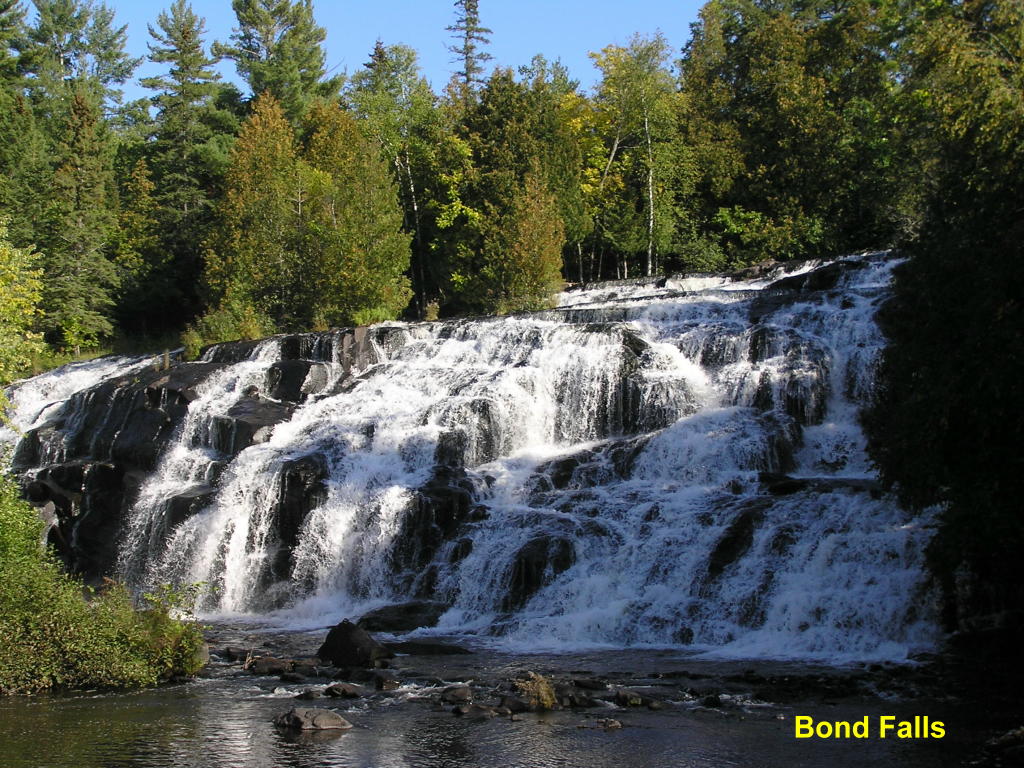
Bond Falls - ... And here is almost the entire main falls - WOW!!!
Agate Falls - A bit of a blue sky above a railroad trestle, which is above the falls makes for a nice setting
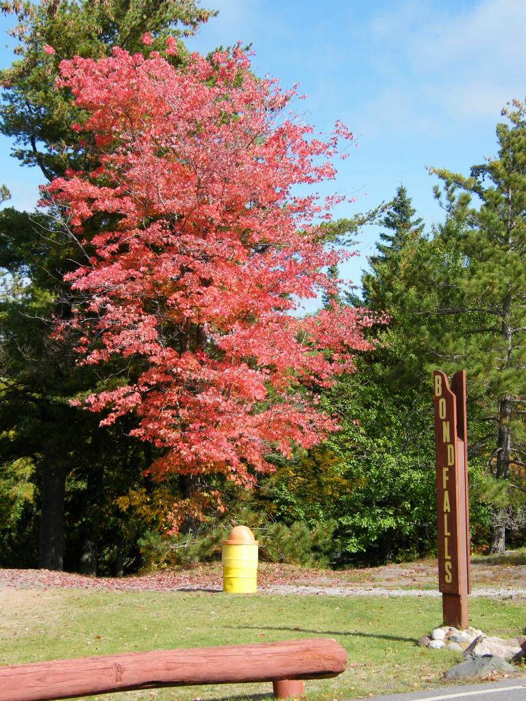
Bond Falls - A beautiful red tree enhances the sign for Bond Falls at the head of the trail.
Bond Falls - The upper man-made part of the falls from the side opposite the main trail
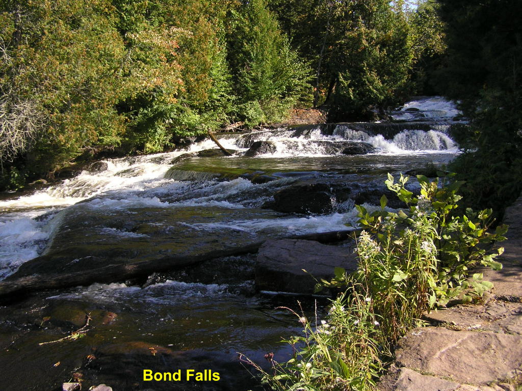
Bond Falls - Part of the numerous falls above the main falls
Bond Falls - More of the falls above the main falls with a bit of fall color thrown in
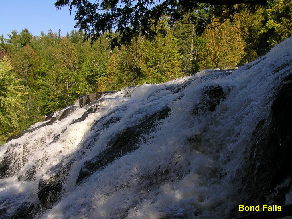
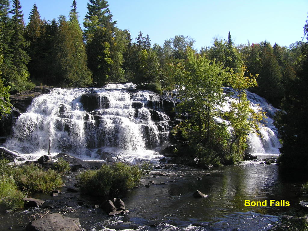
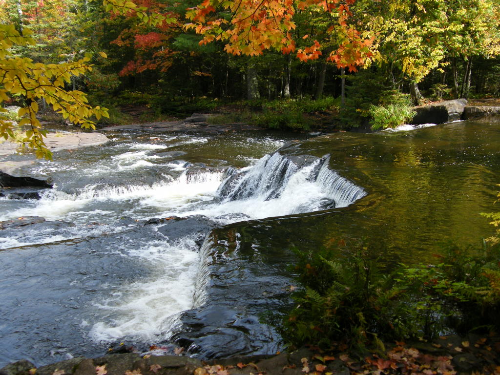
Bond Falls - Looking downstream at the main falls with plenty of fall colors brightening up the scene
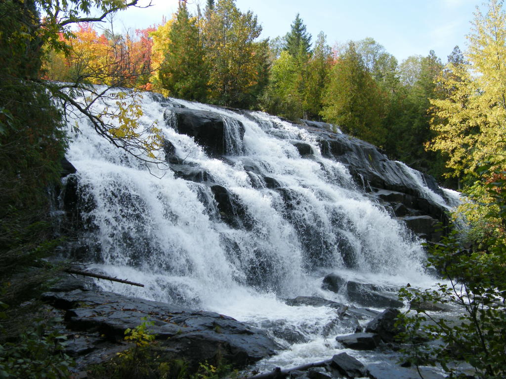
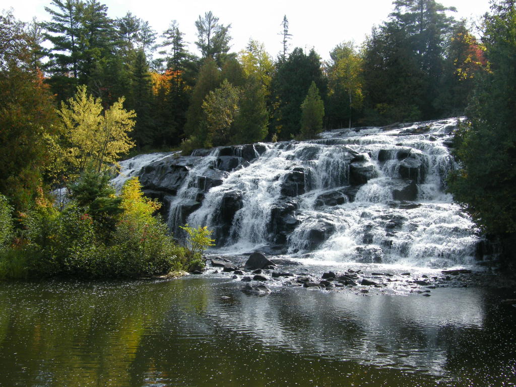
Bond Falls - Wide view of the entire Bond Falls (main)
Bond Falls - The left side of the Bond Falls (as viewed from the trail)
Bond Falls - ... and the right side
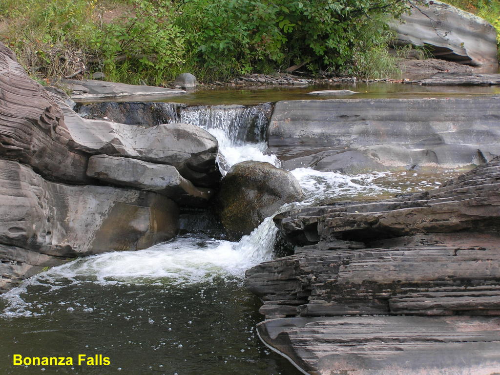
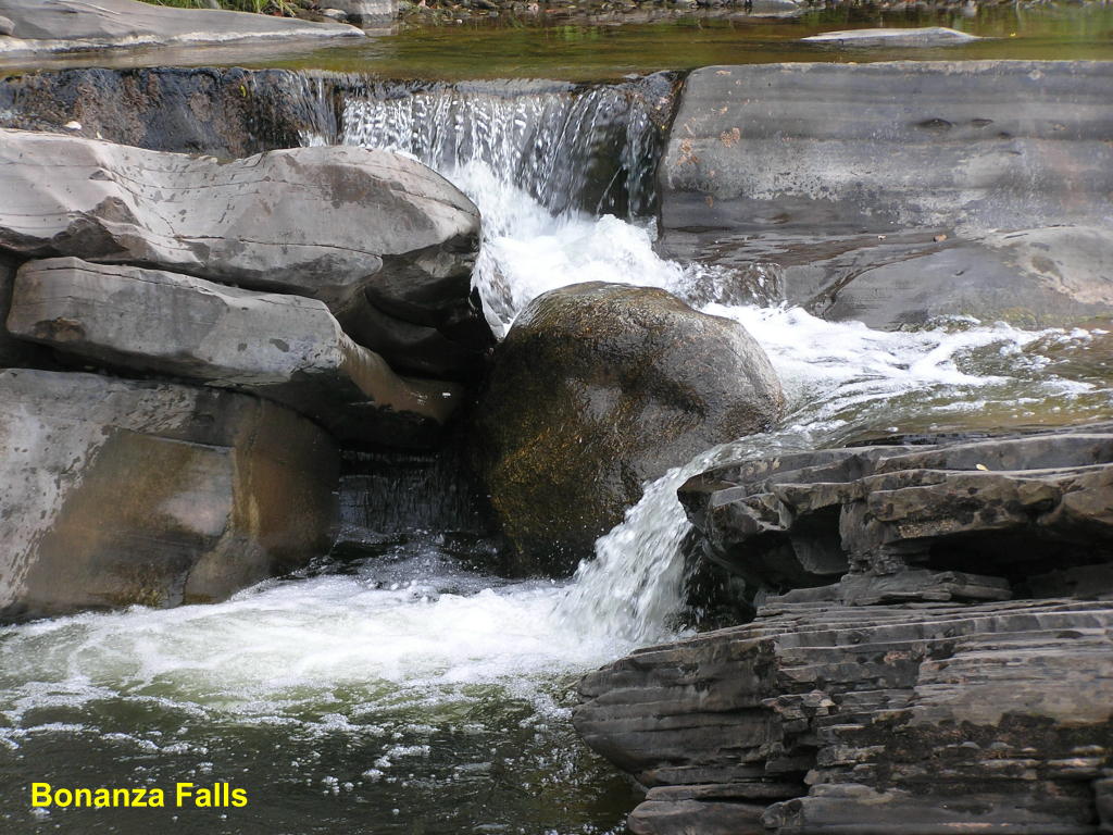
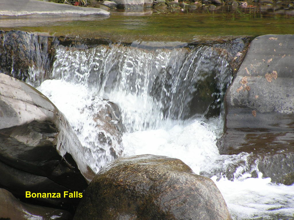
Bonanza Falls - Wide view of the falls along the Big Iron River
Bonanza Falls - Close-up of the entire falls
Bonanza Falls - Close-up of the top of the falls
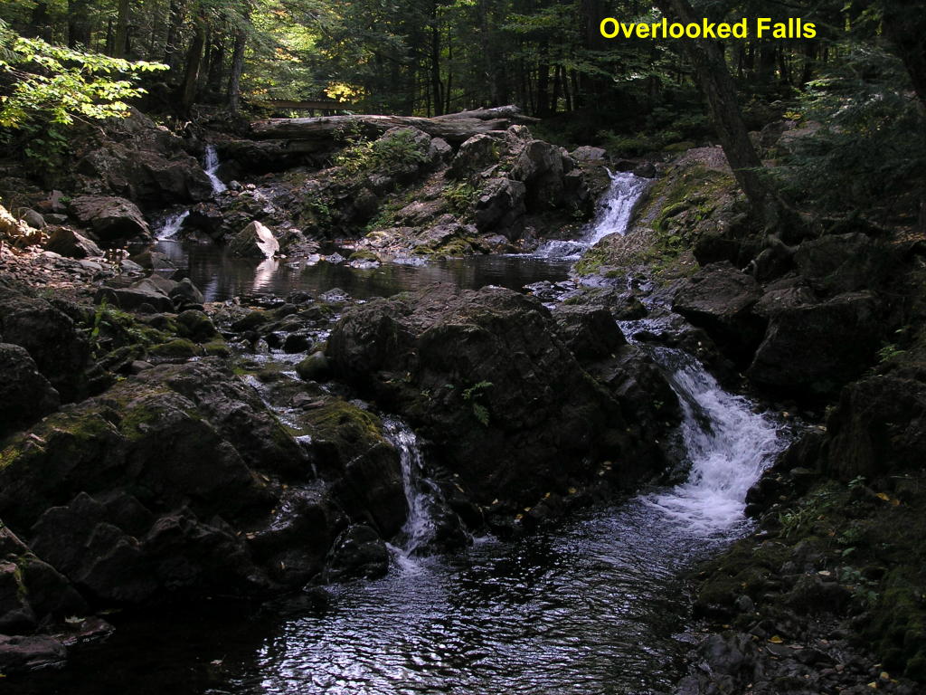
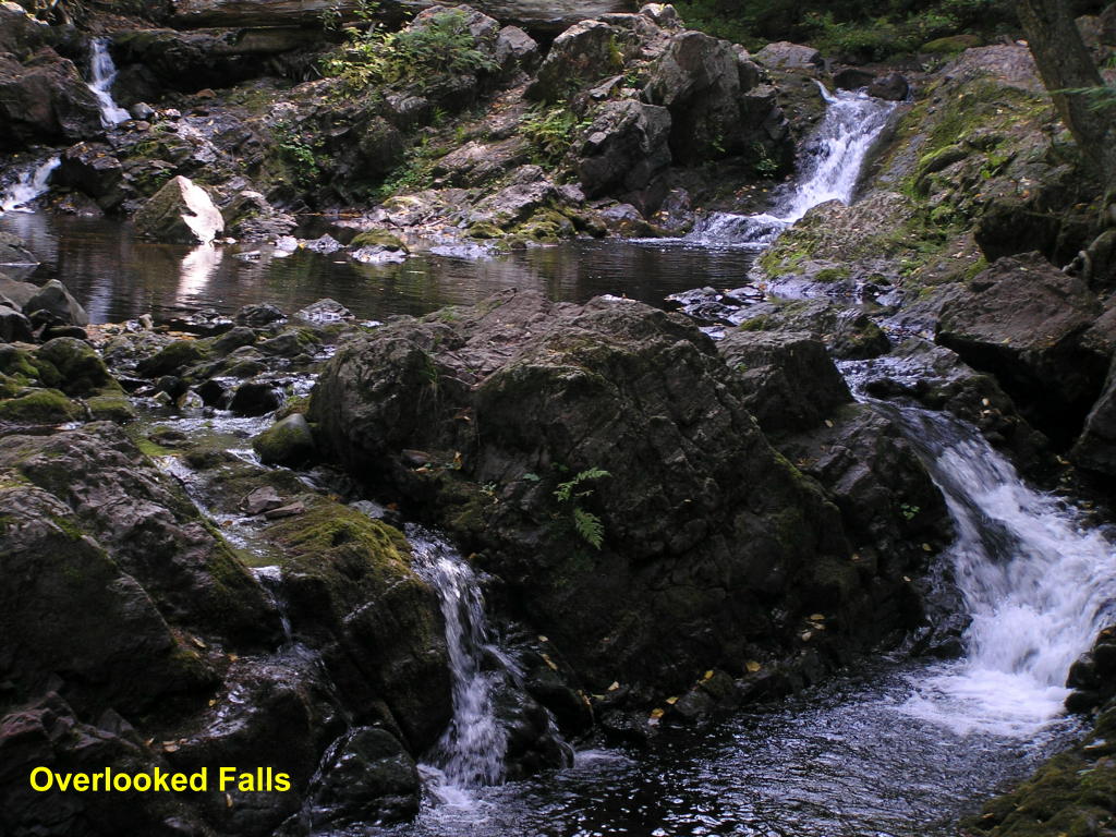
Overlooked Falls - Along the South Boundary Road in the Porcupine Mountain State Park is this unique falls on the Little Carp River
Overlooked Falls - Close-up
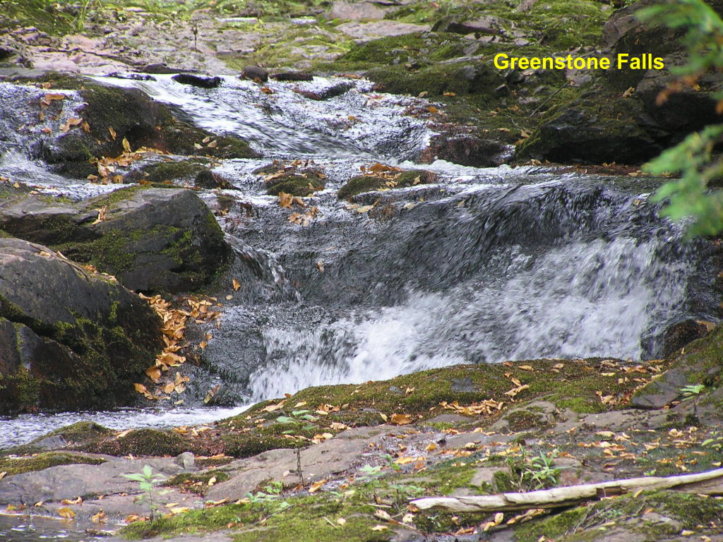
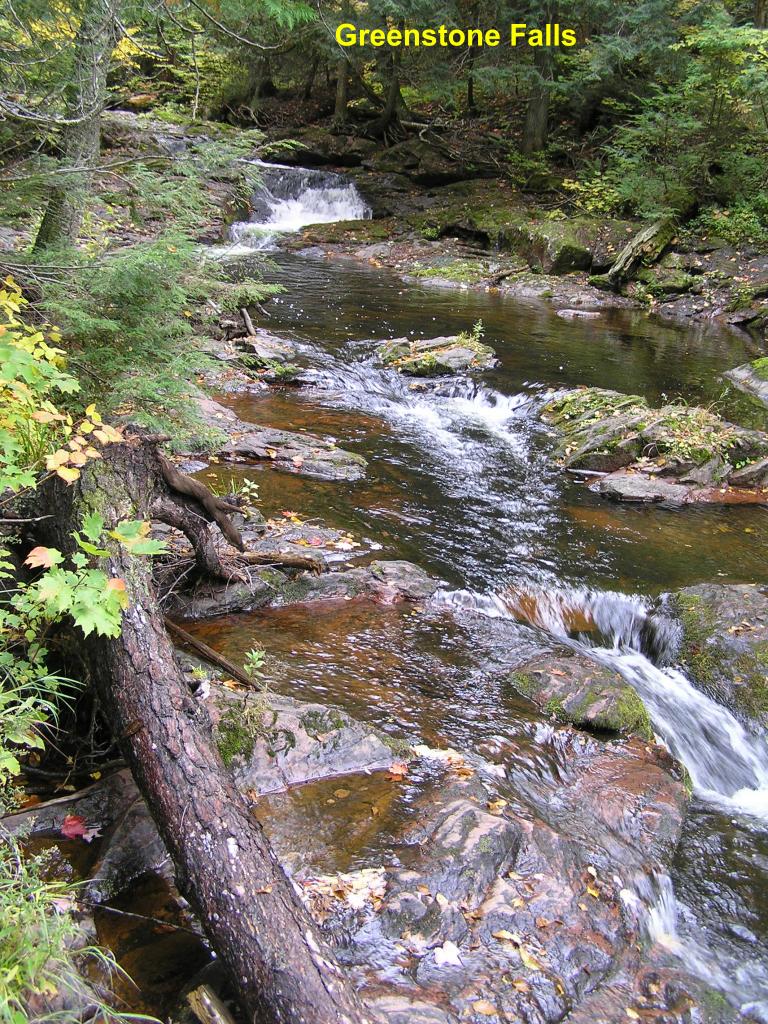
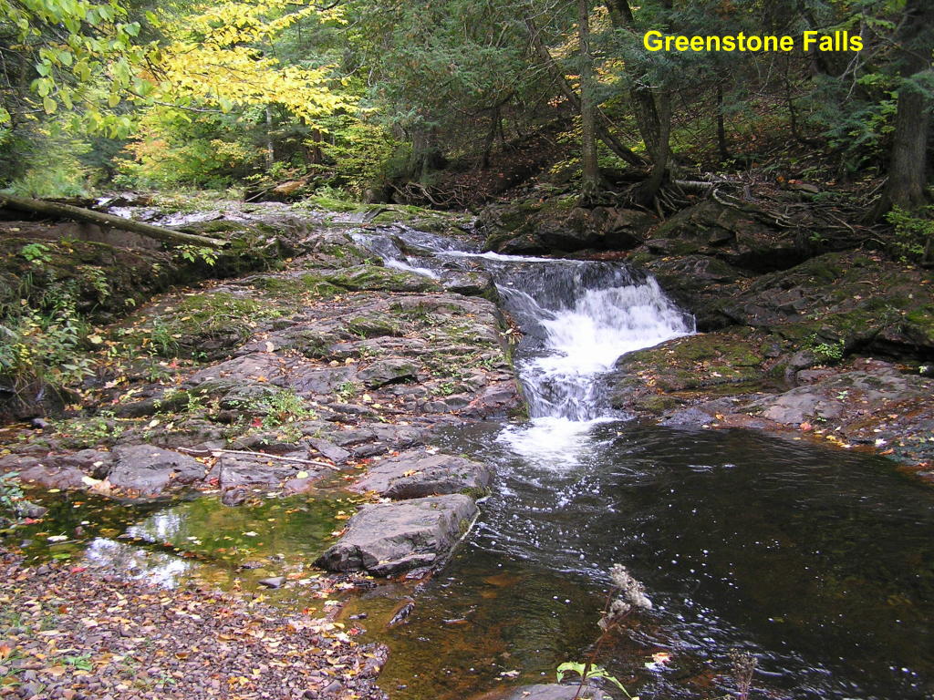
Greenstone Falls - A little further down the Little Carp River from the Overlooked Falls is another set of falls
Greenstone Falls - A wide view of the series of falls from the opposite side of the river
Greenstone Falls - Close-up of the main falls
O-kun-de-kun (Baltimore) Falls - A mile-and-a-third walk into the woods brings you to a suspension-type foot bridge over the Baltimore River
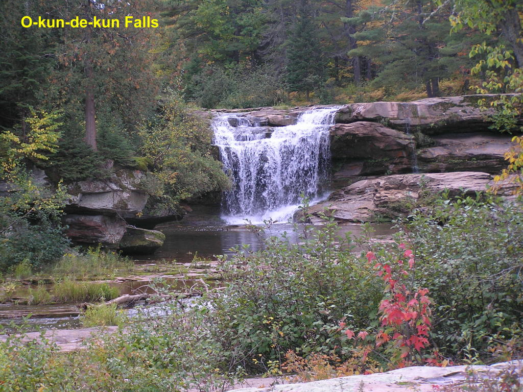
O-kun-de-kun (Baltimore) Falls - The falls are just upstream (and viewable) from the bridge
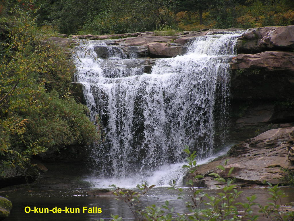
O-kun-de-kun (Baltimore) Falls - Close-up
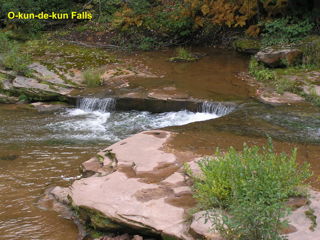
O-kun-de-kun (Baltimore) Falls - These little over-falls are on the downstream side of the bridge
Houghton County:
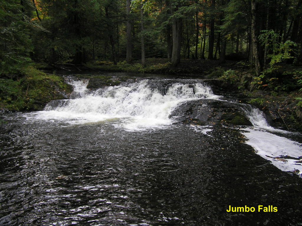
Jumbo Falls - A short walk takes you to this small falls on the Jumbo River
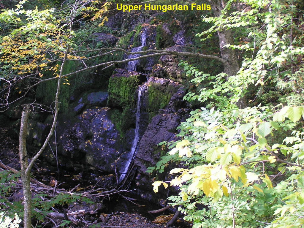
Upper Hungarian Falls - A walk along a deep ravine brings you to one of five falls on Hungarian Creek
Upper Hungarian Falls - Another view
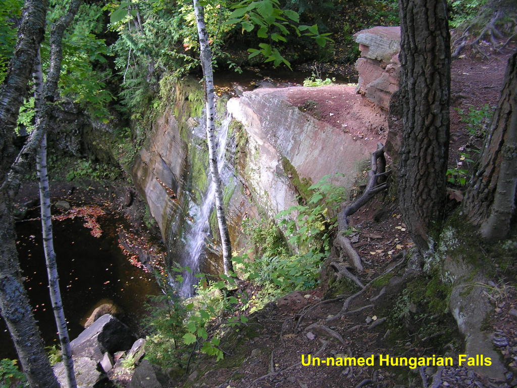
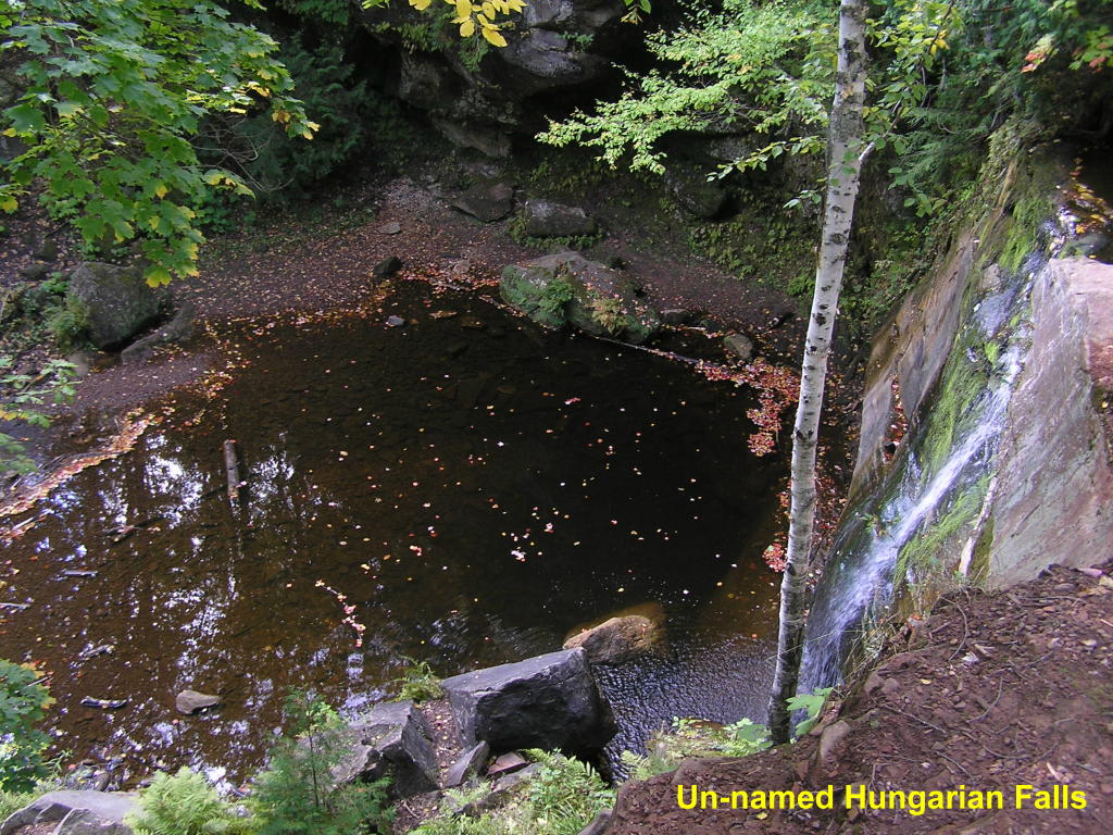
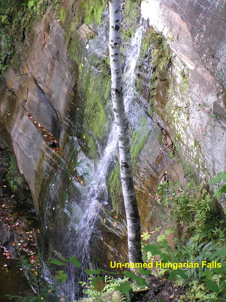
Un-named Hungarian Falls - One of three un-named falls along Hungarian Creek (the other two are quite small)
Un-named Hungarian Falls - The falls drops into a deep pool at the base of the falls
Un-named Hungarian Falls - A different view of the falls and rock formation
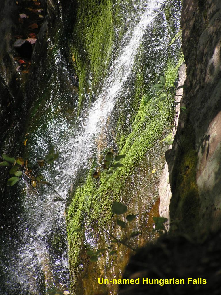
Un-named Hungarian Falls - Close-up of the moss-covered rock
Lower Hungarian Falls - The lower falls were quite pretty, but there was no angle from which to photograph them
Keweenaw County:
A fairly dry summer led to some pretty dry conditions for the waterfalls in the Keweenaw Peninsula. Use your imagination and think of what these falls would look like during the Spring run-off after the snow melts.
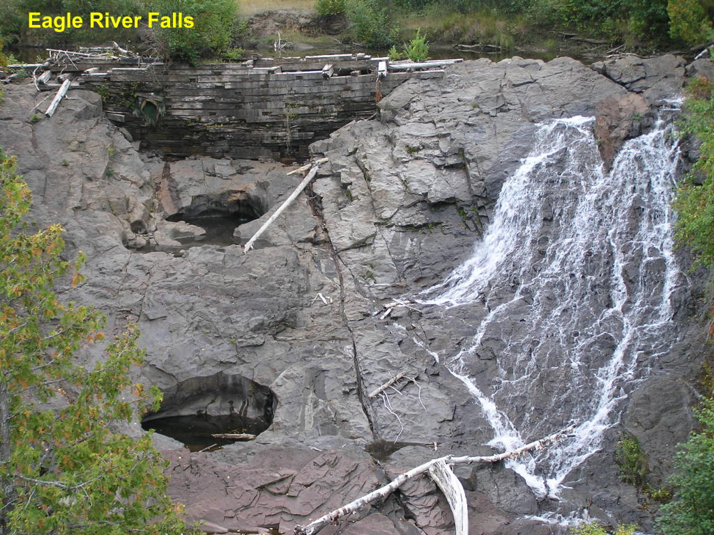
Eagle River Falls - These falls are visible from M-26 in the town of Eagle River along the Eagle River (note the old wooden dam to the left - when the Spring run-off comes, the water will completely fill this area, including over-flowing the dam)
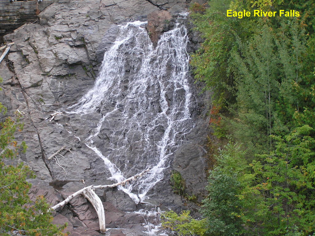
Eagle River Falls - Close-up of what little water is in these falls
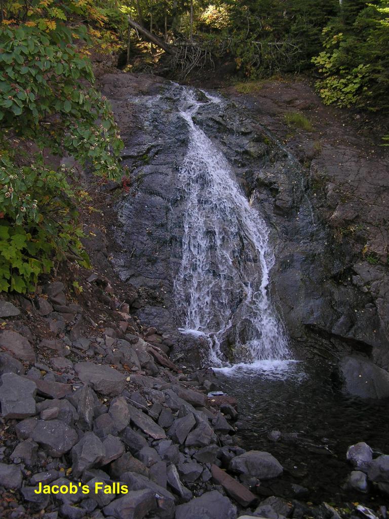
Jacob's Falls - Further north up M-26 is this roadside falls on Jacob's Creek
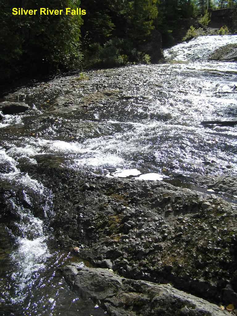
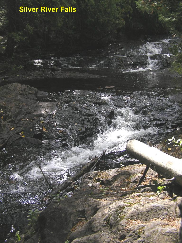
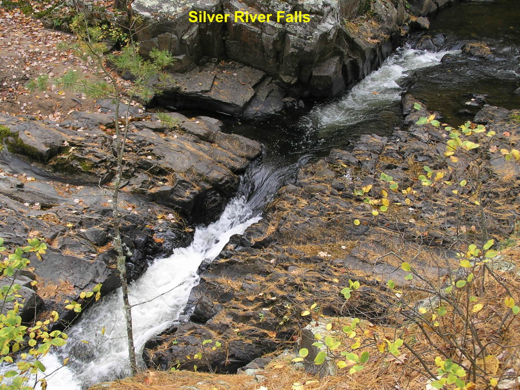
Silver River Falls - This falls along the Silver River north of Eagle Harbor begins as a long series of rapids
Silver River Falls - Wide view of the falls
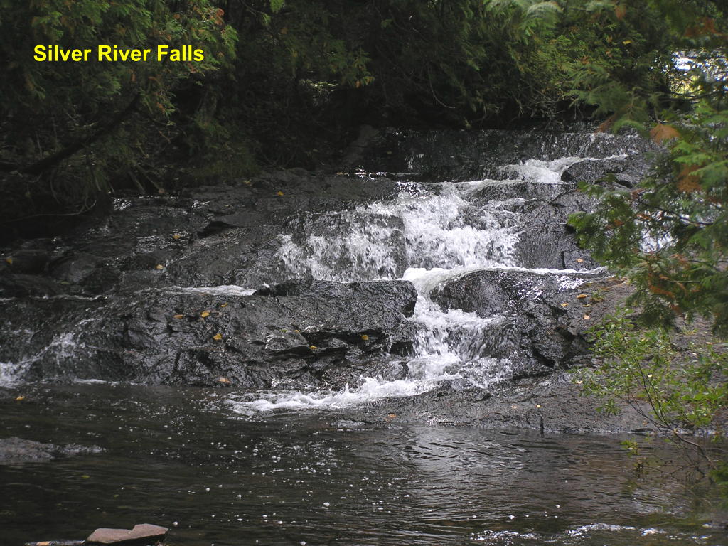
Silver River Falls - Close-up of the main falls
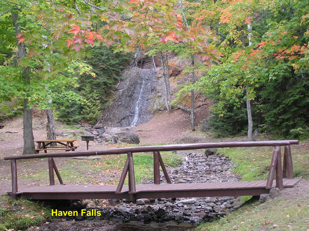
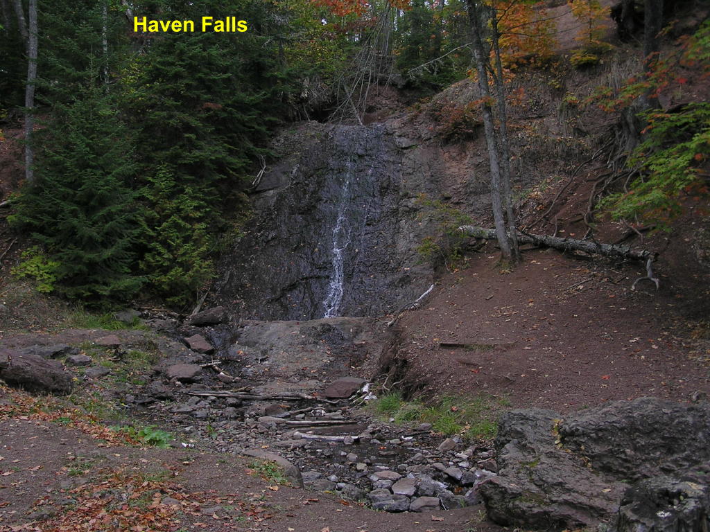
Haven Falls - A roadside park is at the foot of the falls on Haven Creek (I said there wasn't much water up here) :O)
Haven Falls - Close-up (notice the wet area on the rock wall, and you will see how much water can come over this falls
Baraga County:
The Falls River has a multitude of waterfalls along its drop to Lake Superior. Here are some of them:
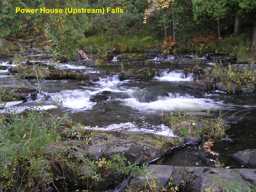
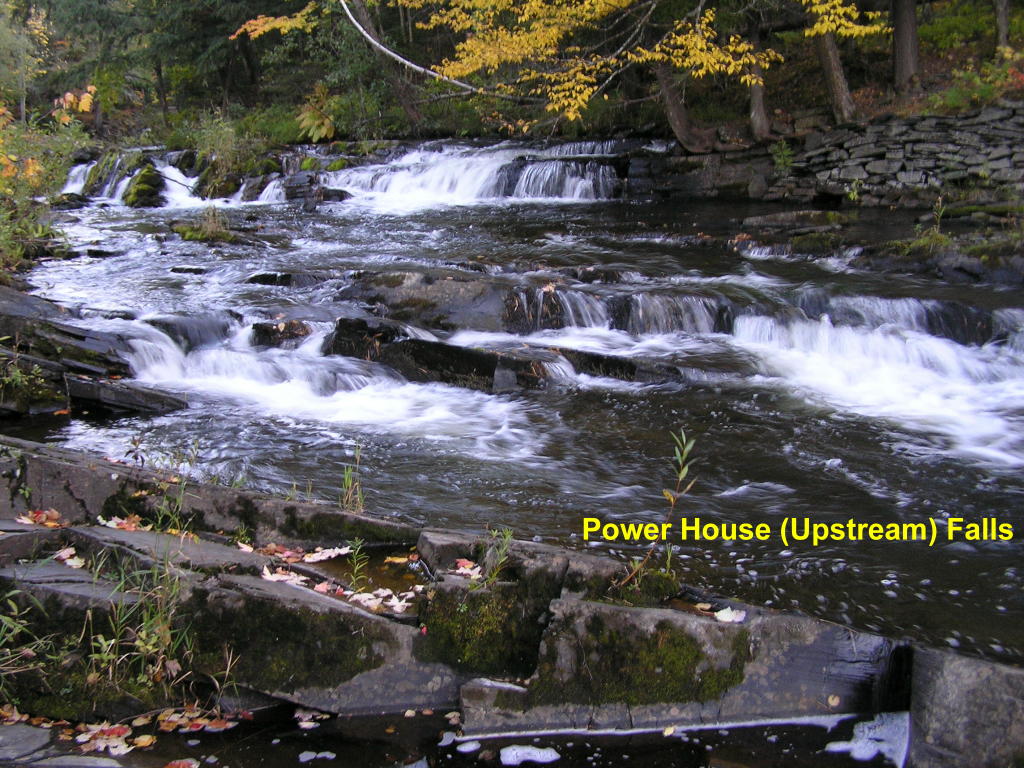
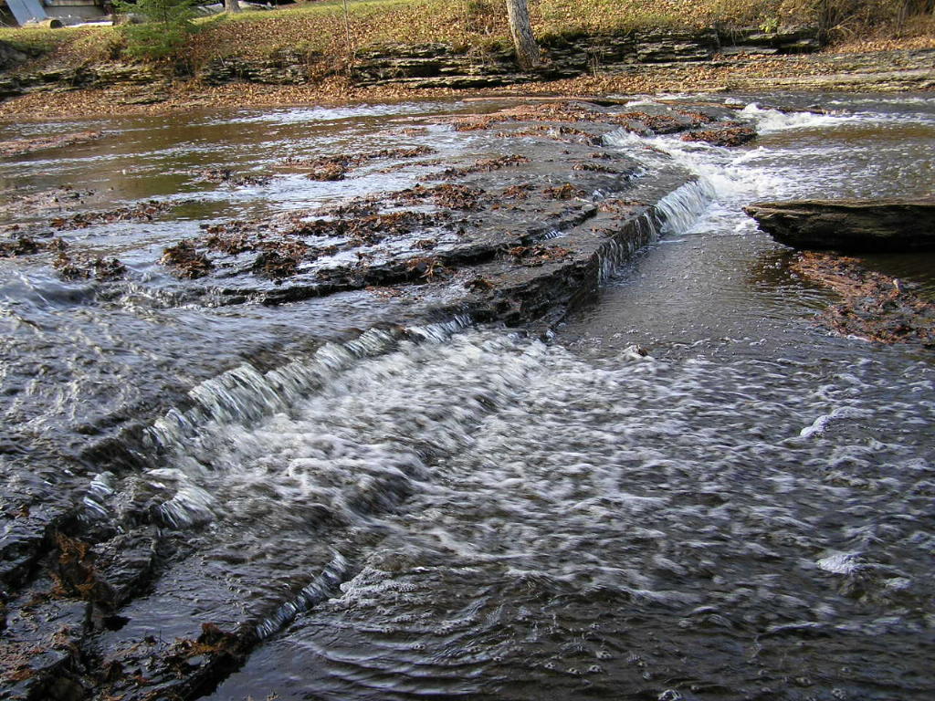
Power House (Upstream) Falls - Furthest upstream on the Falls River are two sets of falls within a short space. The two sets of falls are on either side of an old Power House; these are upstream from the structure.
Power House (Upstream) Falls - Close-up of these pretty falls
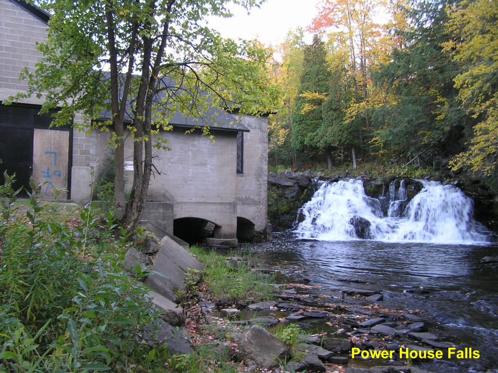
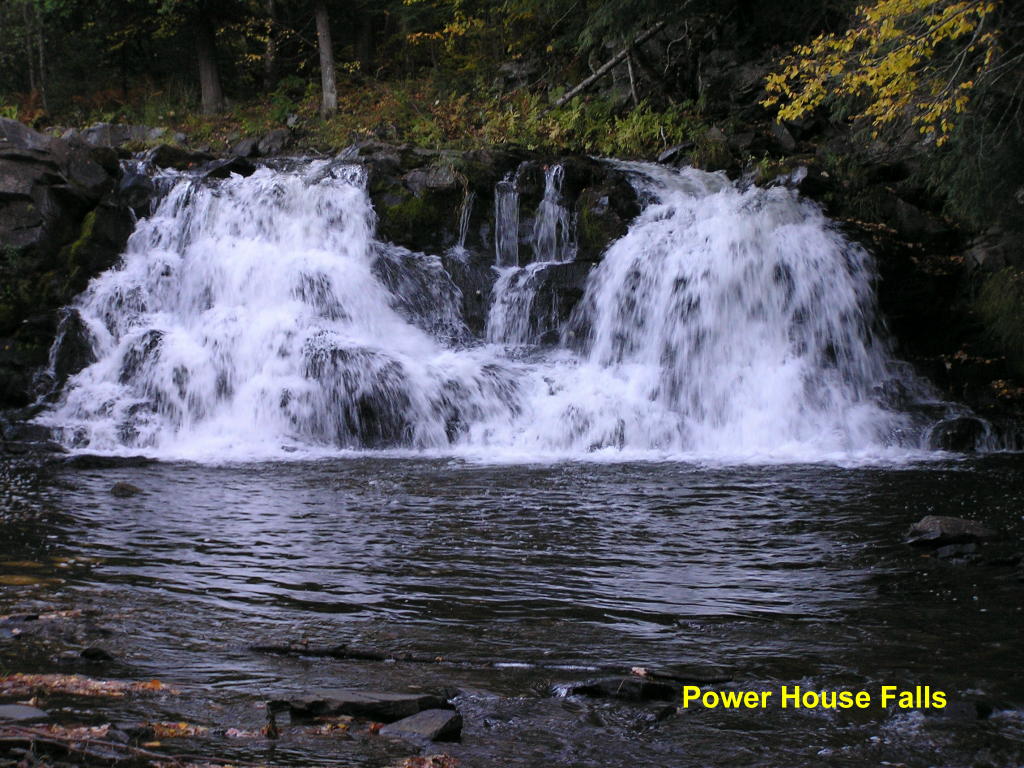
Power House Falls - Here is the power house and the downstream falls
Power House Falls - Close-up
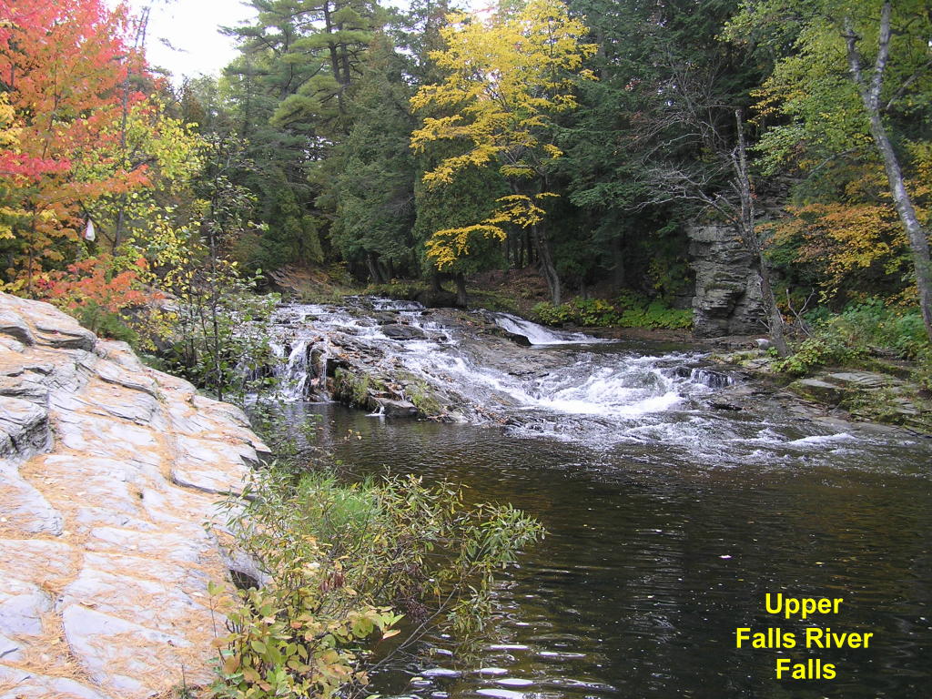
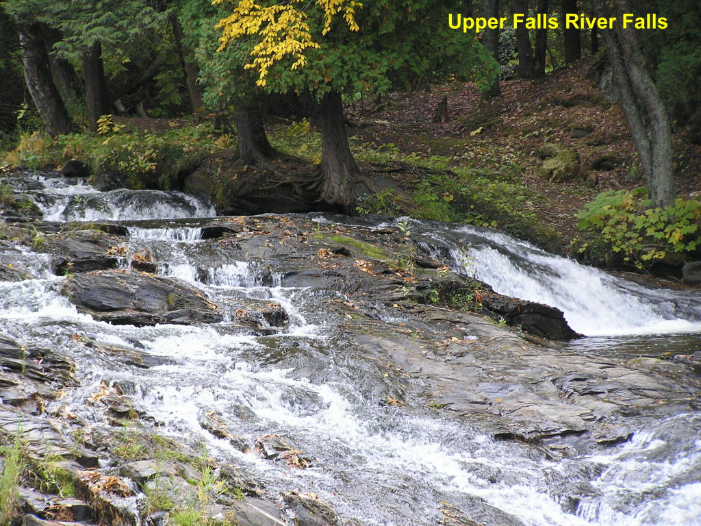
Upper Falls River Falls Falls - The Upper Falls are next in line
Upper Falls River Falls Falls - Close-up
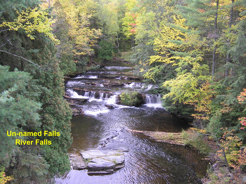
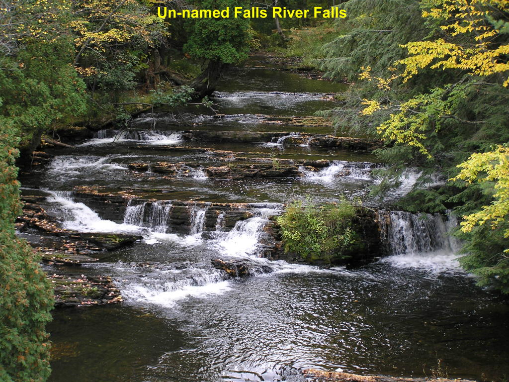
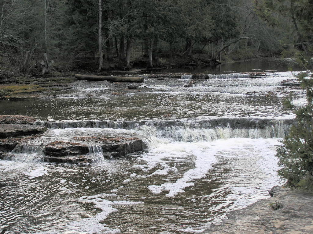
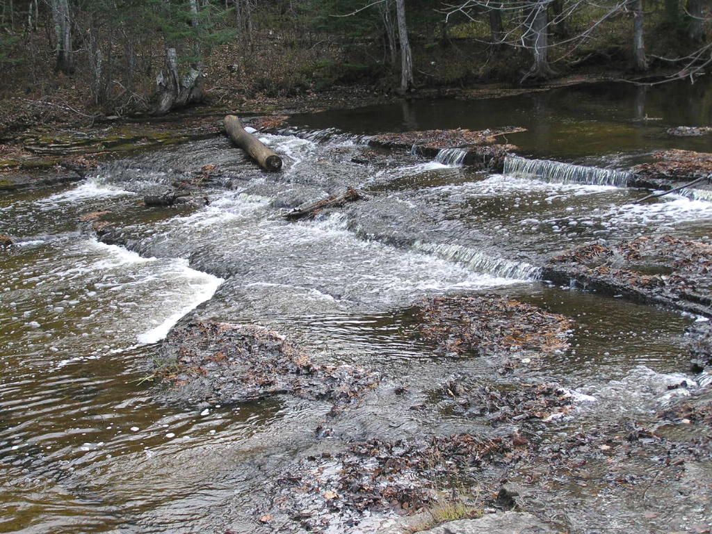
Un-named Falls River Falls Falls - An un-named falls is next.
Un-named Falls River Falls - Close-up
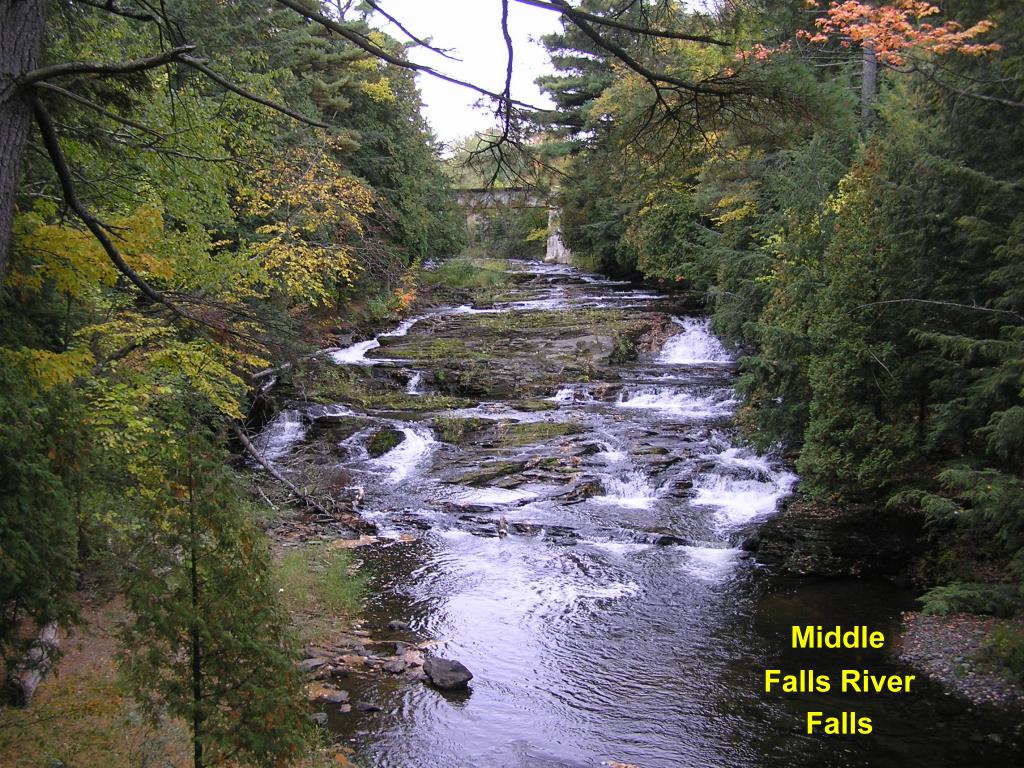
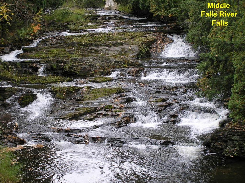
Middle Falls River Falls - This middle set of falls is next-to-last in line before the river drops into Lake Superior.
Middle Falls River Falls Falls - A look at the falls a little further upstream
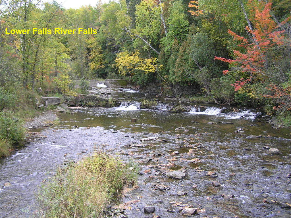
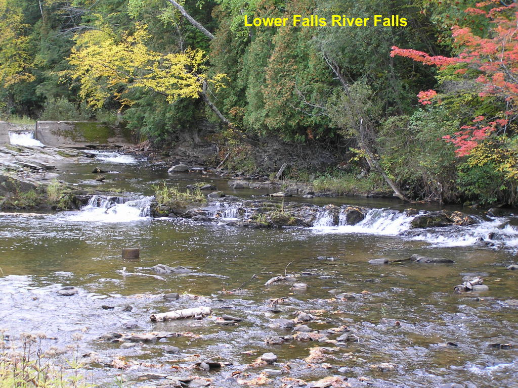
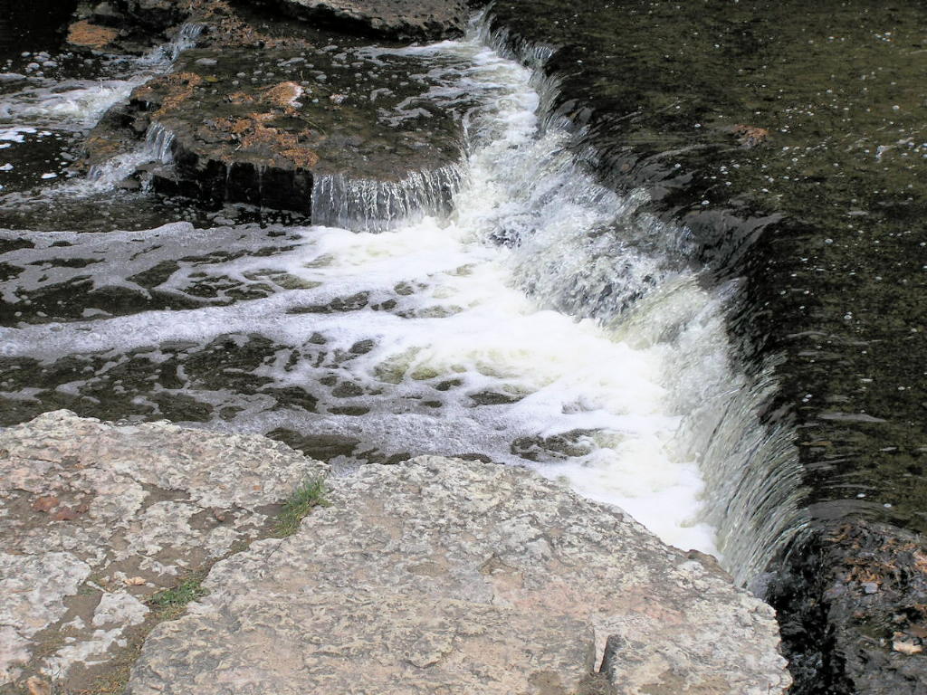
Lower Falls River Falls - This is the final set of falls before emptying into Lake Superior
Lower Falls River Falls - Close-up
Other waterfalls in Baraga County:
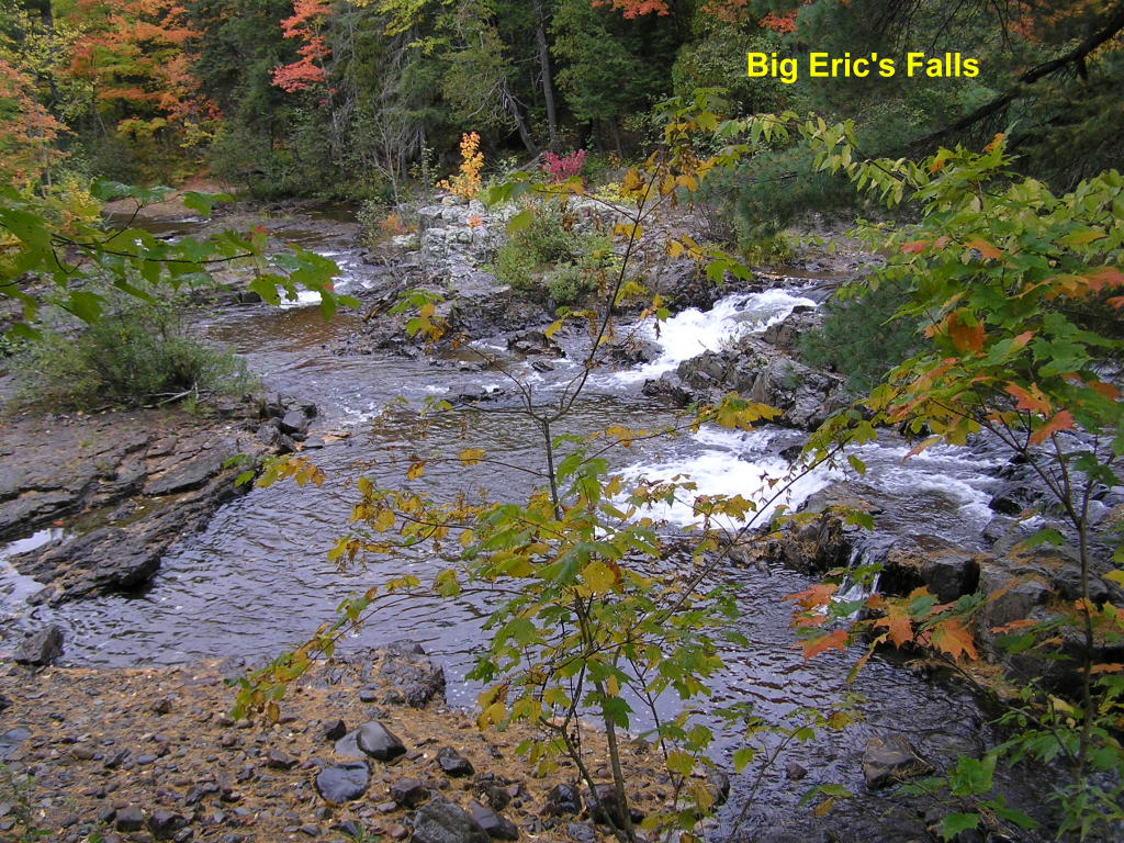
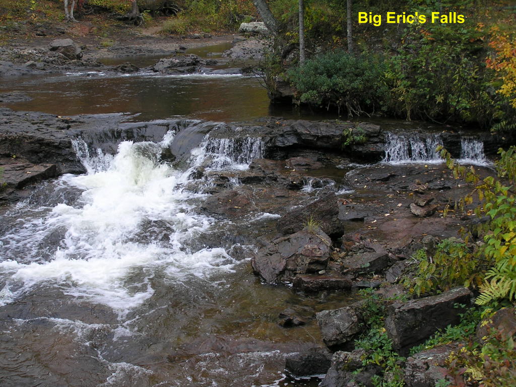
Big Eric's Falls - Wide view of the falls on the Huron River looking downstream
Big Eric's Falls - Close-up
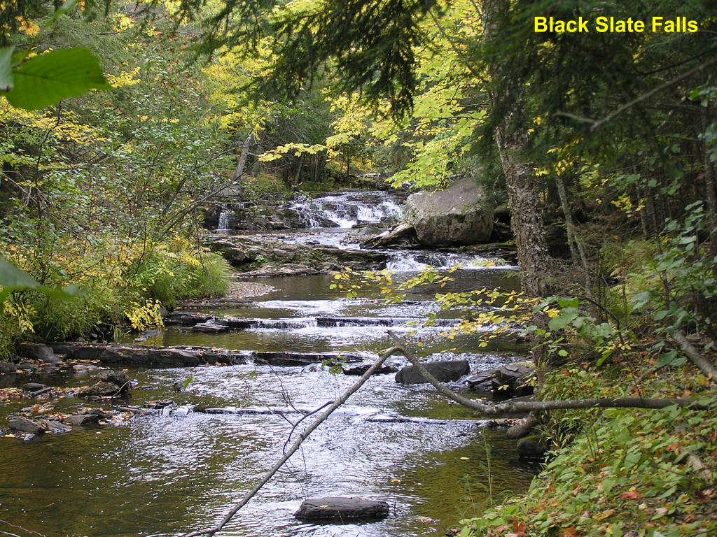
Black Slate Falls - Wide view of the falls along the Slate River
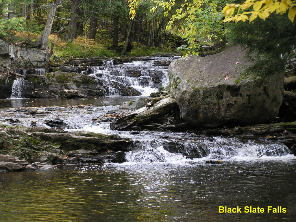
Black Slate Falls - Close-up of the main falls
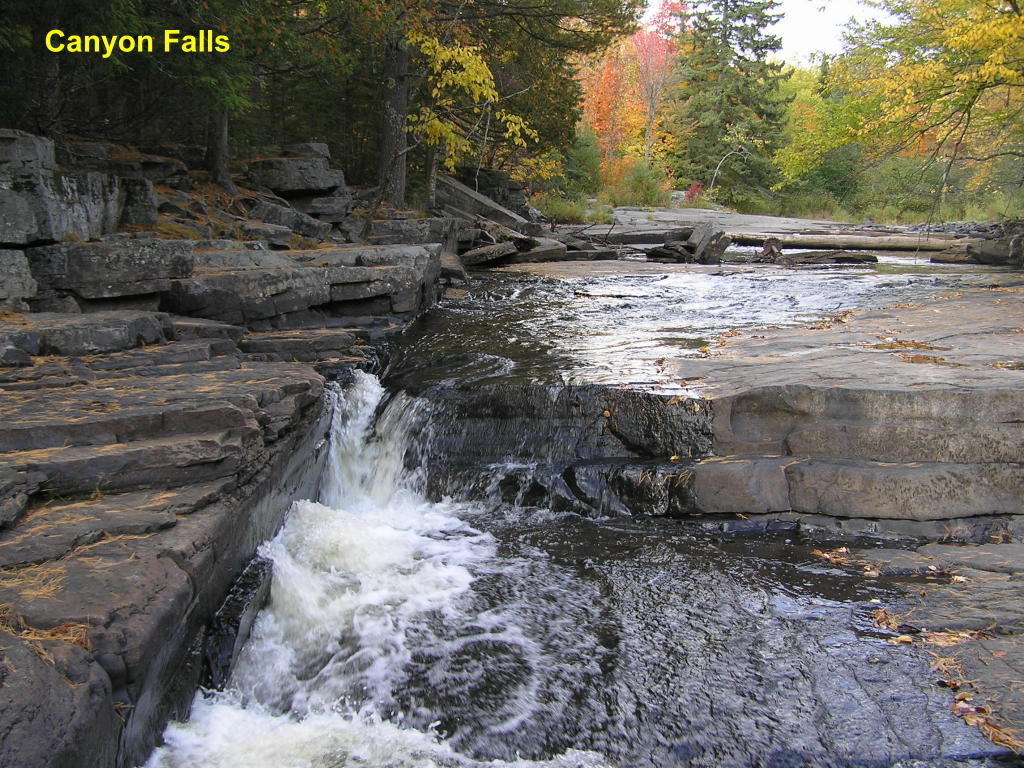
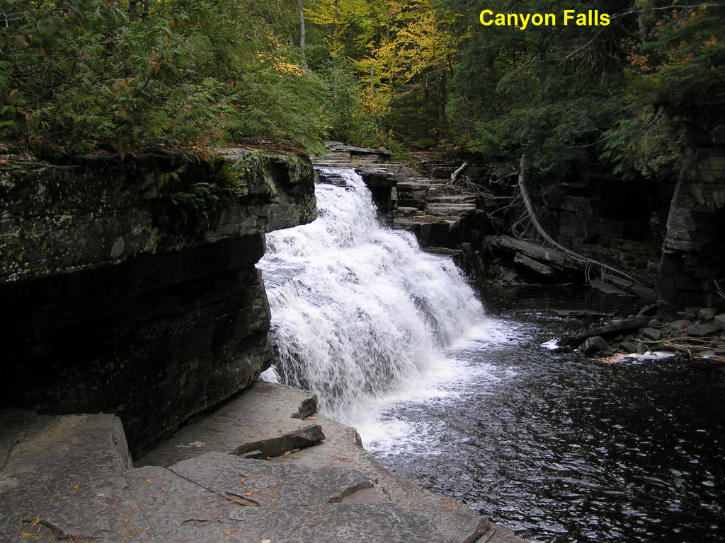
Canyon Falls (prelude) - This falls on the Sturgeon River is upstream from the main falls
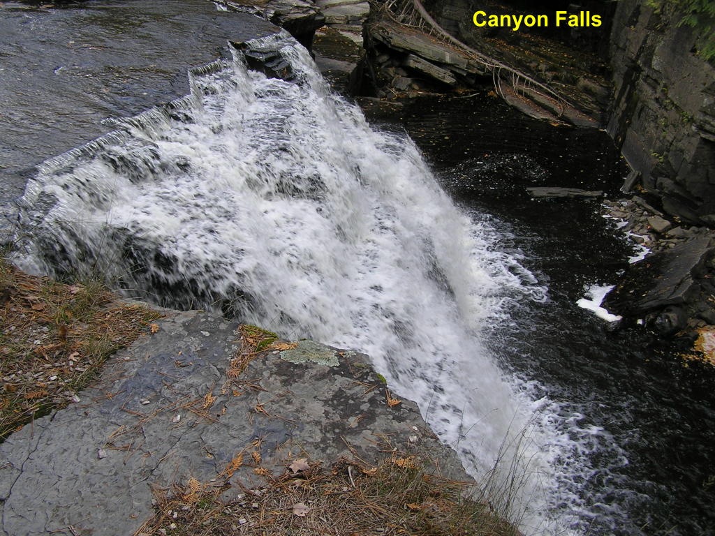
Canyon Falls - The main falls drop about 20-ft.
Canyon Falls Falls - Another view from a bit further downstream
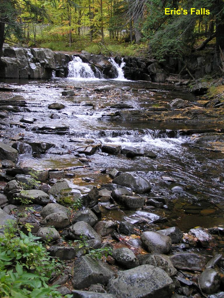
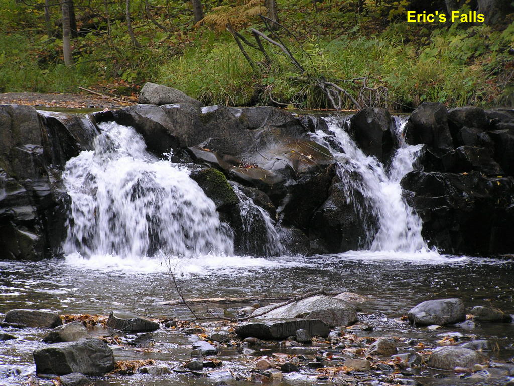
Eric's Falls - Wide view of the falls area on the West Branch of the Huron River
Eric's Falls - Close-up of the main falls
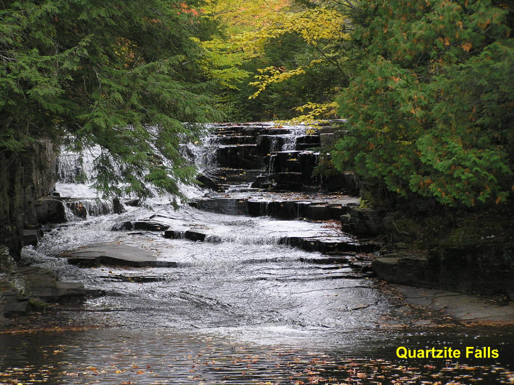
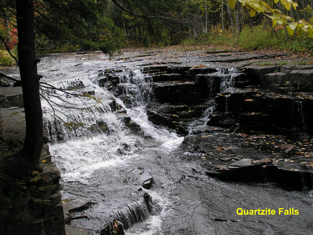
Quartzite Falls - Wide view of the falls on the Slate River (the falls are mostly hidden behind a tree)
Quartzite Falls - These falls are just a little way downstream from the Black Slate Falls on the Slate River
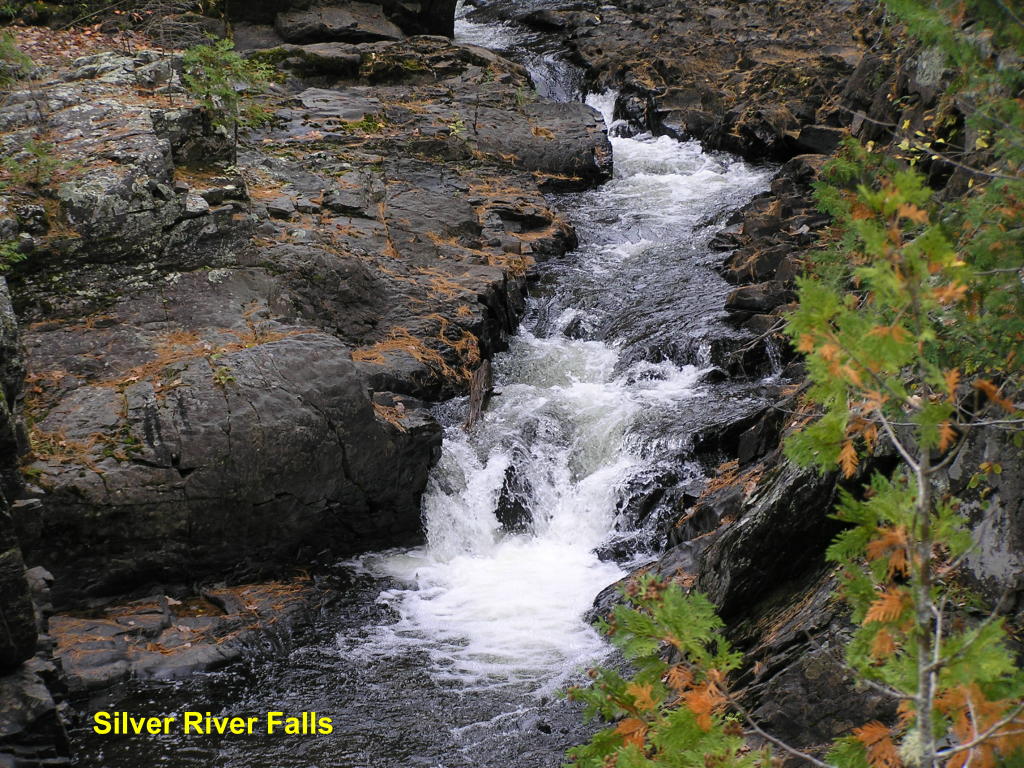
Silver River Falls (prelude) - This narrow falls on the Silver River is at the head of the main falls
Silver River Falls - This is the main falls
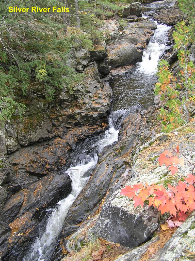
Silver River Falls - A look up at the main falls from downstream
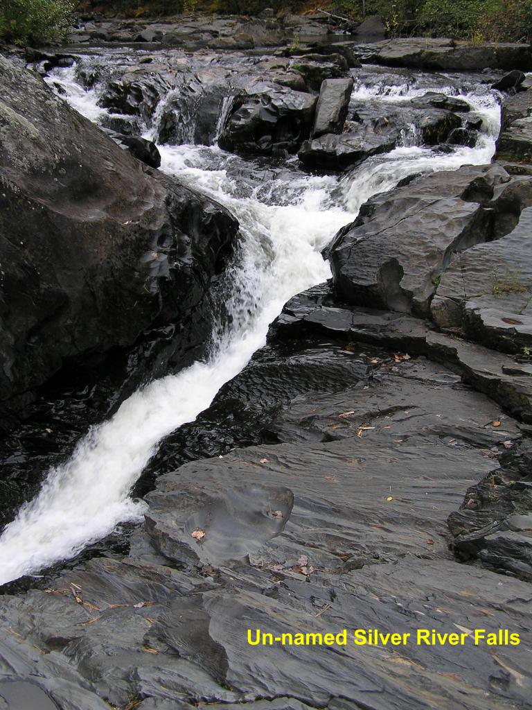
Un-named Silver River Falls - Down-river from the Silver River Falls, this falls cuts through solid rock on its way downstream (looking upstream)
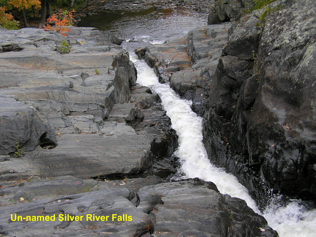
Un-named Silver River Falls - Looking downstream from the same vantage point as the last photo
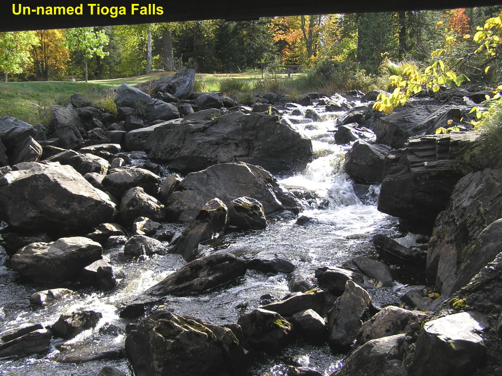
Un-named Tioga Falls - This little falls on the Tioga River is more like a large rapids; but pretty in its own way
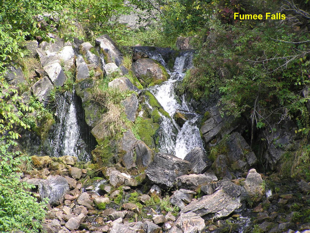
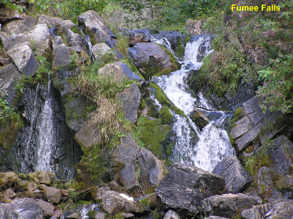
Dickinson County:
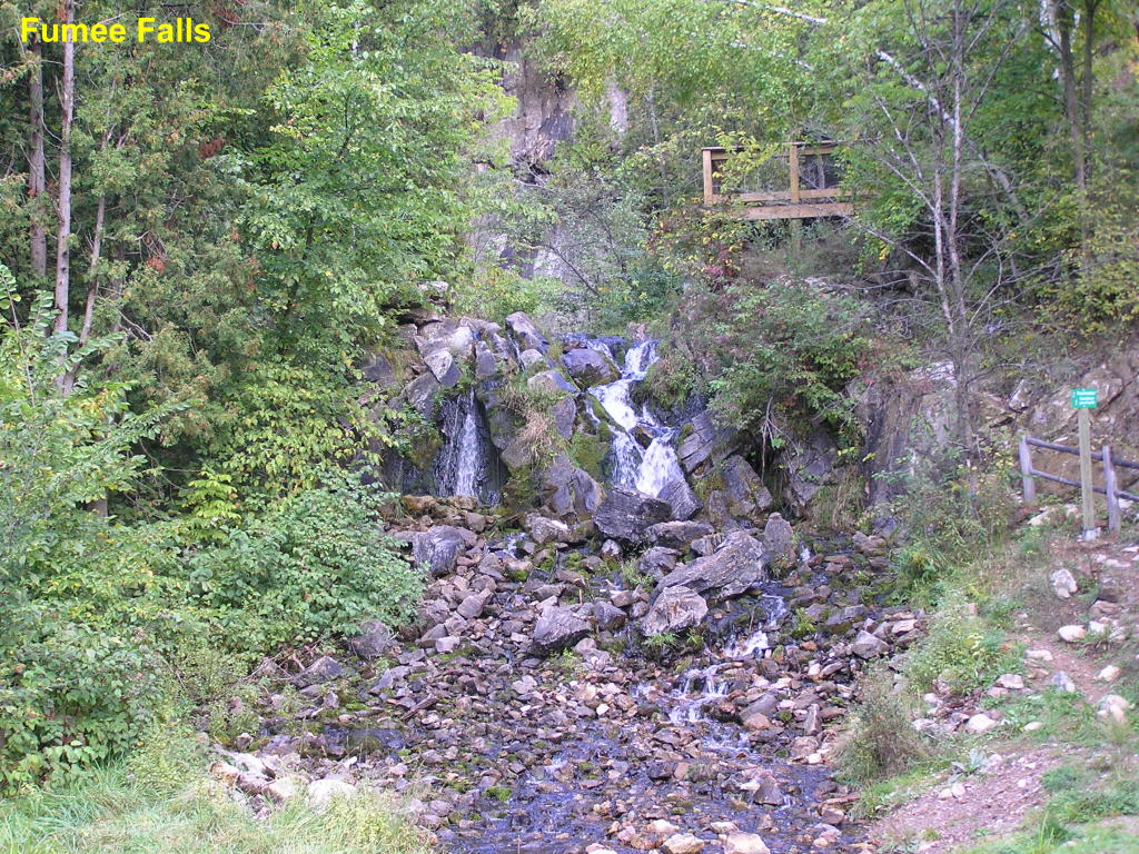
Fumee Falls - This small roadside falls on Fumee Creek is located near Quinnesec on US-2 and is visible from the road
Fumee Falls - Close-up of this water-starved falls
Fumee Falls - Ultra close-up of the falls
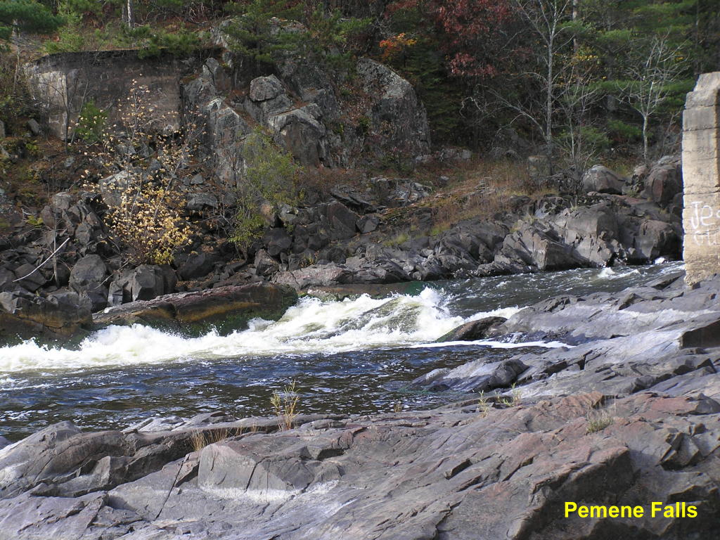
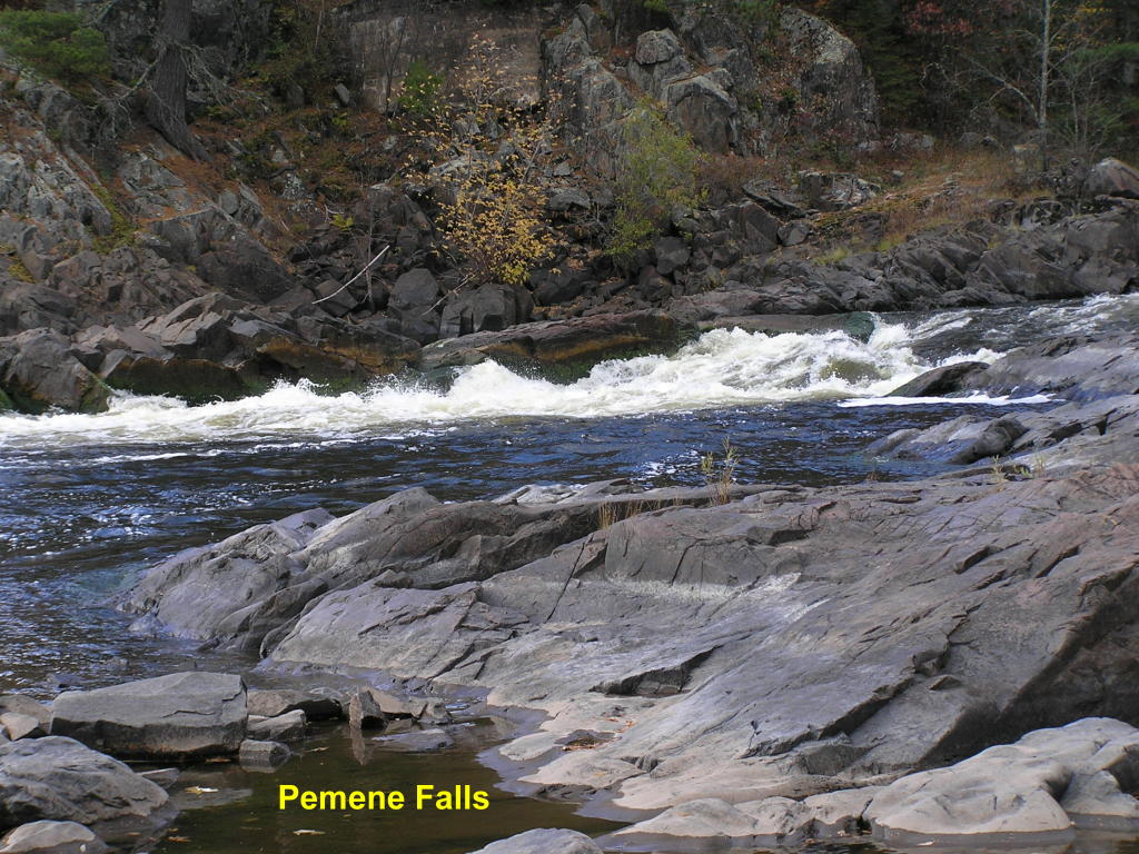
Menominee County:
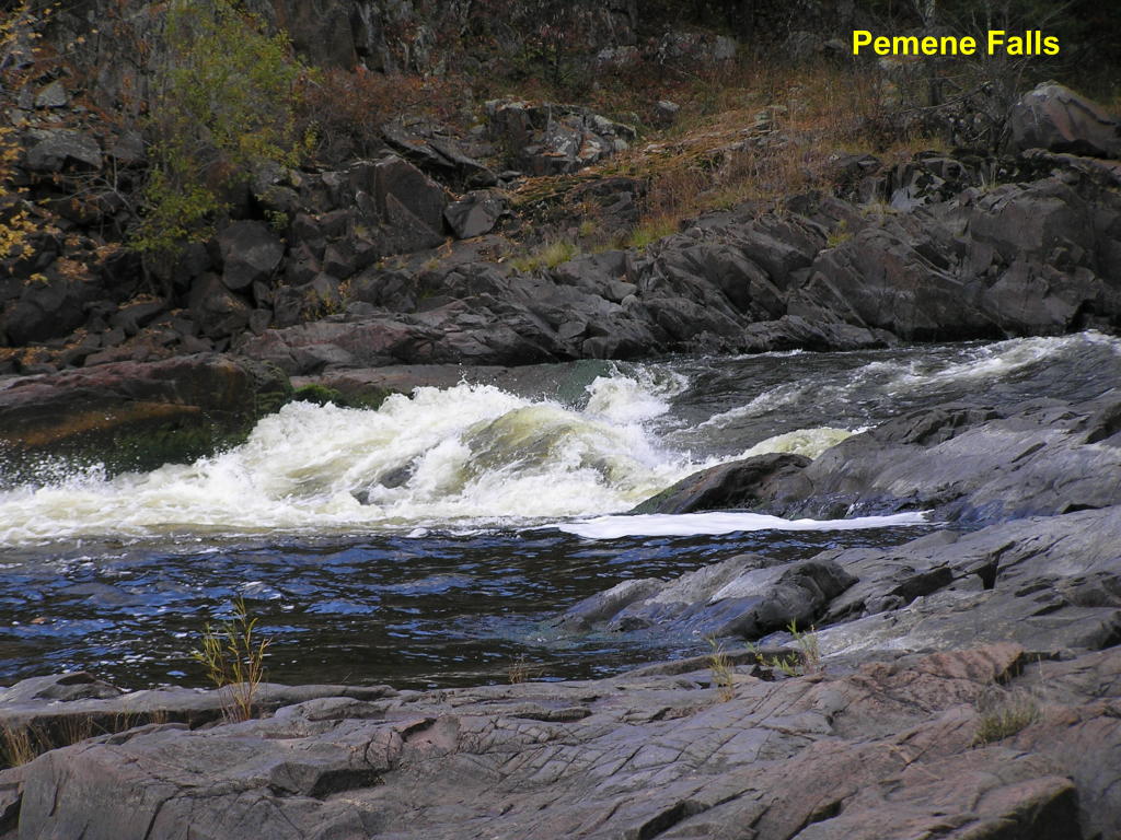
Pemene Falls - Wide view of the falls located west of Carney, MI on the Menominee River (notice the supports for an old bridge on either side of the falls)
Pemene Falls - Another view
Pemene Falls - Close-up of the main falls
Delta County:
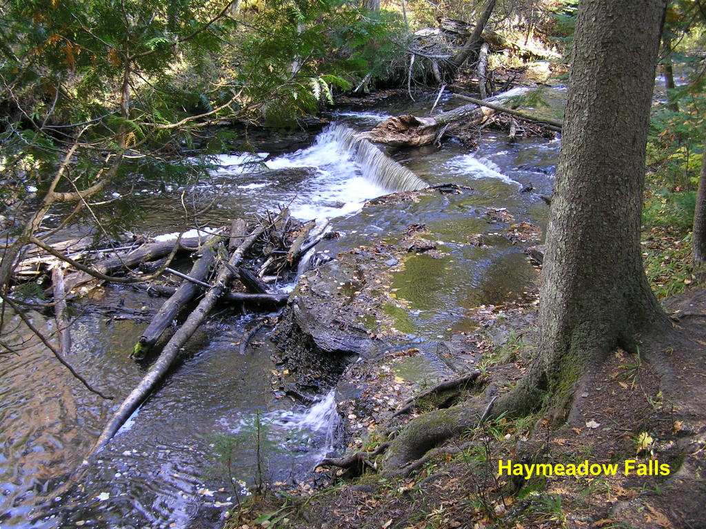
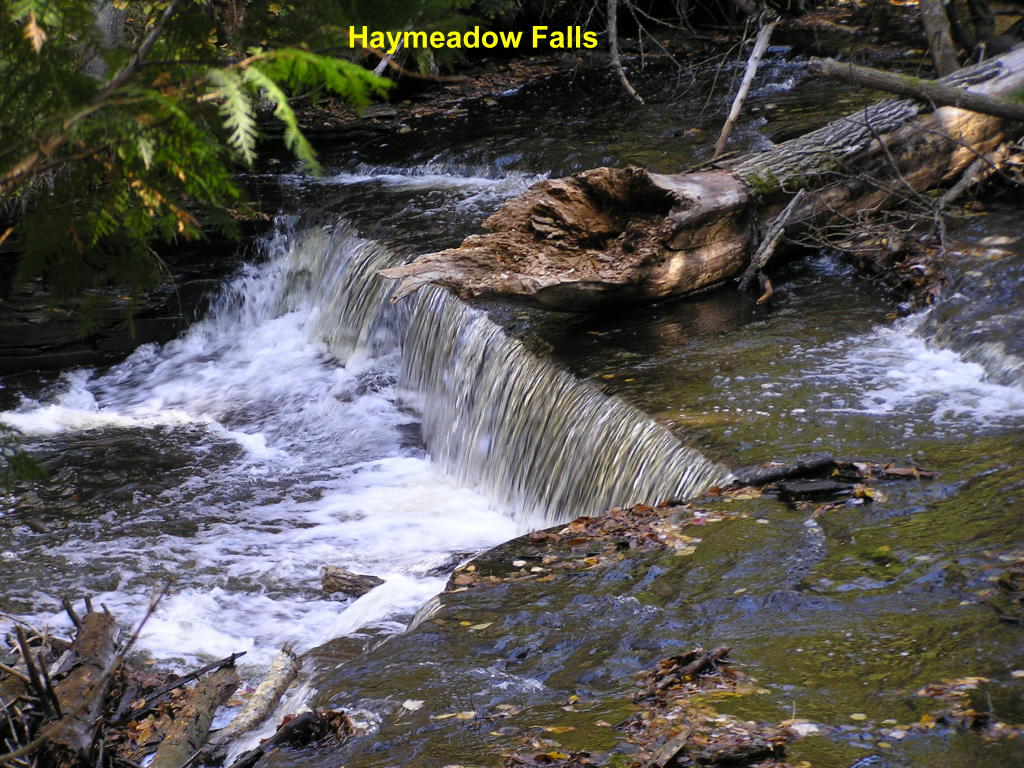
Haymeadow Falls - A 20 minute walk on a good path along Haymeadow Creek brings you to this pretty falls; a wooden foot bridge croses the stream just below the falls.
Haymeadow Falls - Close-up
Rapid River Falls - A view from down-river of the entire falls area along the Rapid River on Oct. 29, 2006
Rapid River Falls - Walking up-river this is the first set of falls
Rapid River Falls - Two more sets of falls greet us as we move further up-river along the opposite bank
Rapid River Falls - Close-up of the middle area of the falls
Rapid River Falls - Close-up of the upper-most falls
Marquette County:
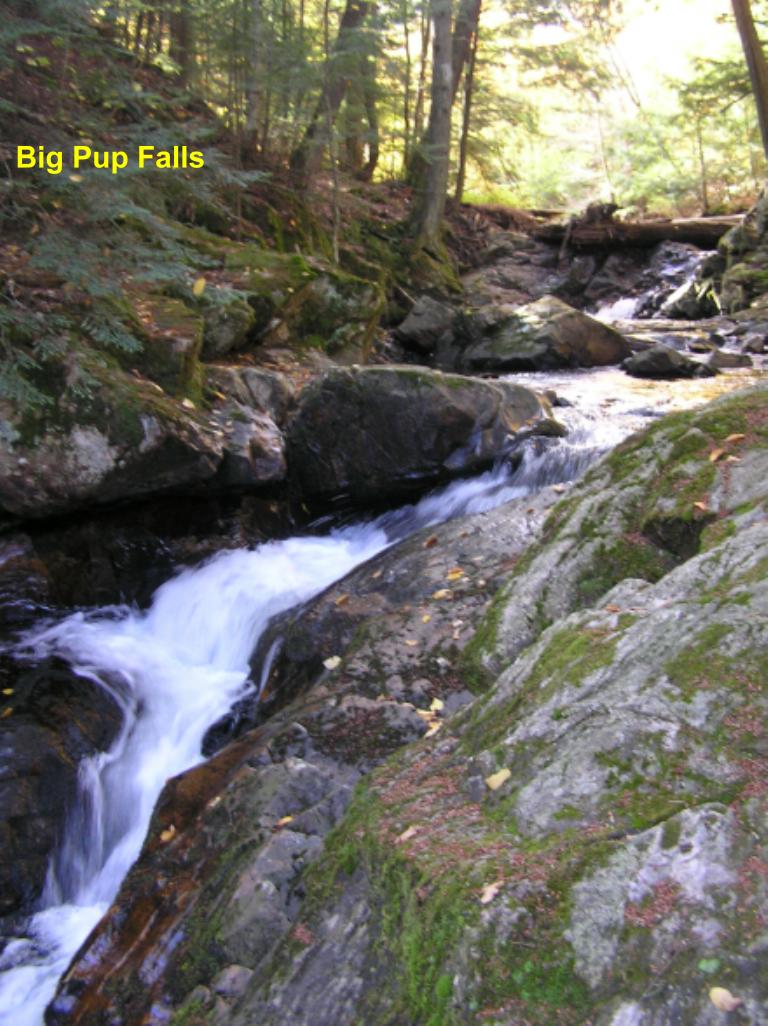
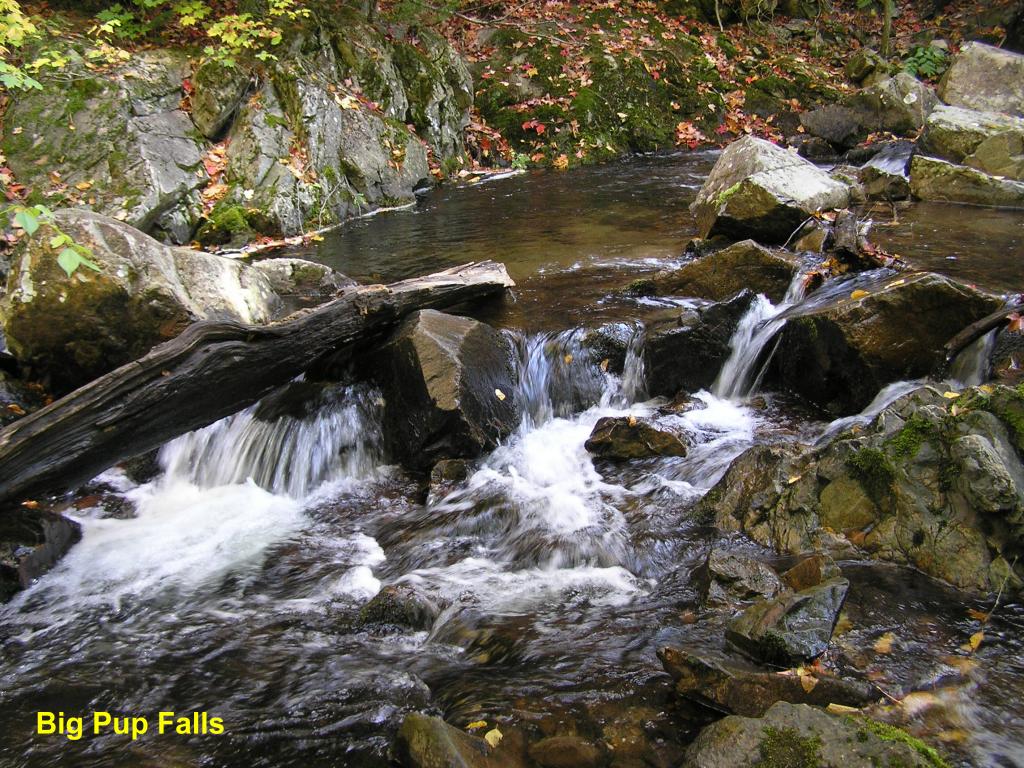
Big Pup Falls - These next 5 photos show a string of falls on Big Pup Creek beginning with the main falls in this photo
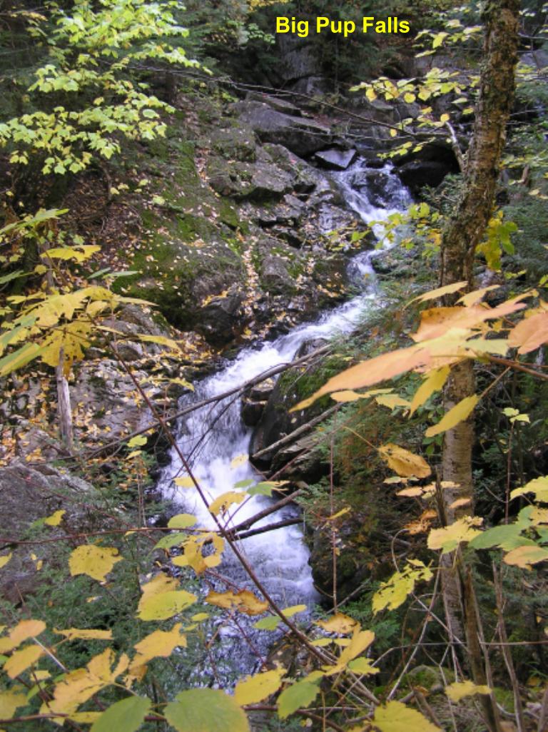
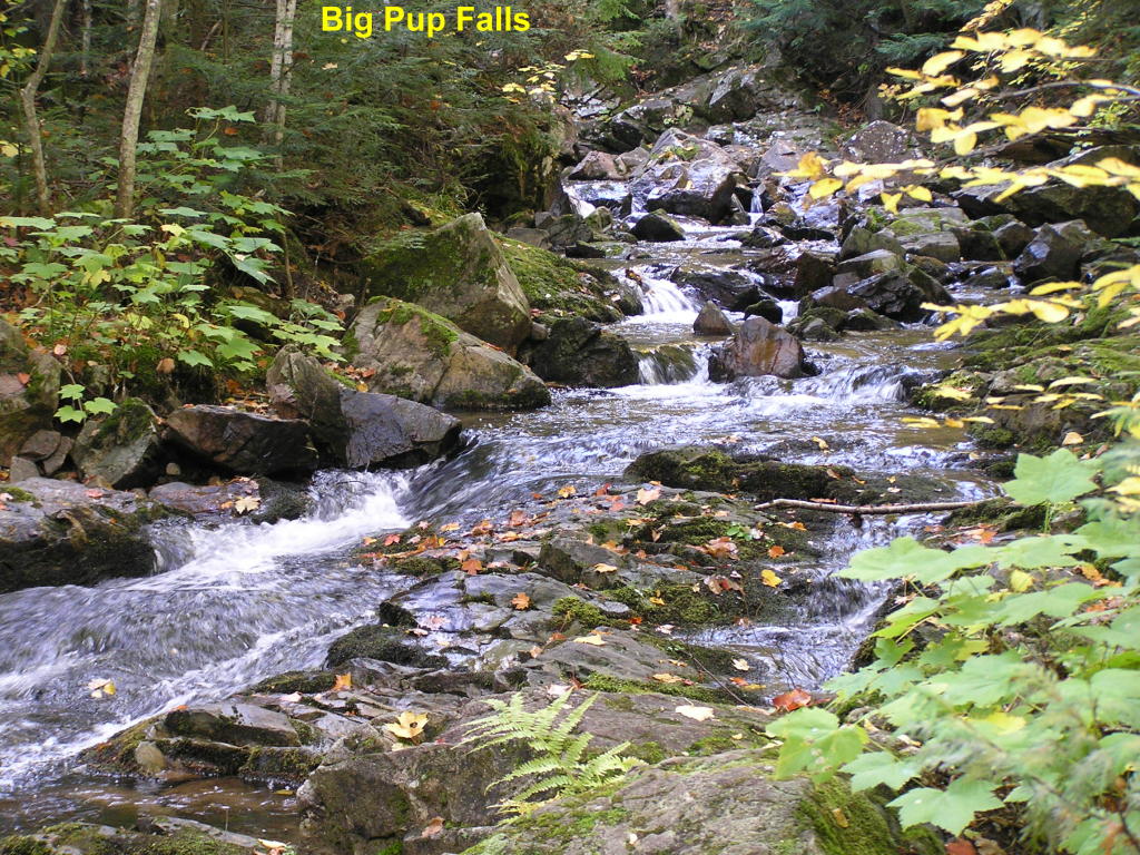
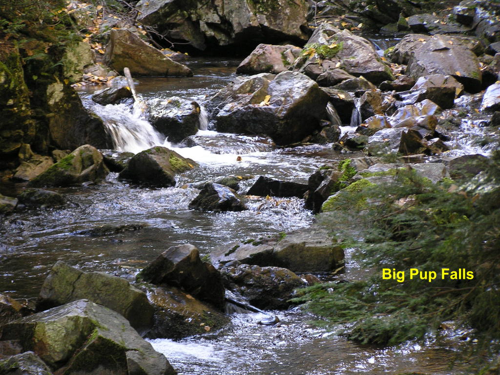
Big Pup Falls - As we continue downstream the water keeps tumbling down
Big Pup Falls - ... And down ...
Big Pup Falls - ... And down ...
Big Pup Falls - ... And down - PHEW!!! :O)
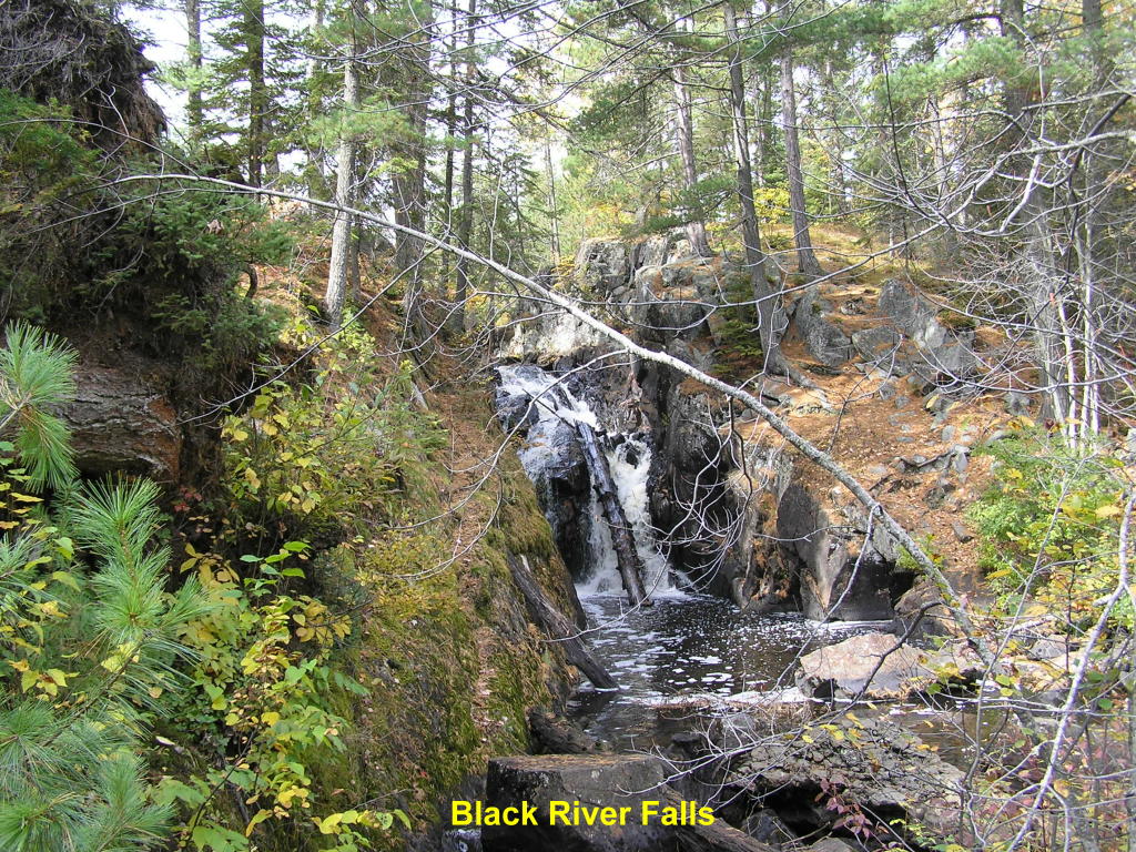
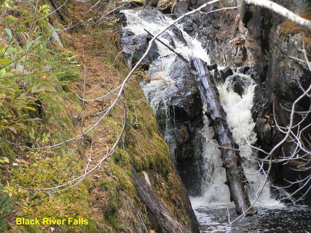
Black River Falls - Wide view of the falls along the Black River
Black River Falls - Close-up
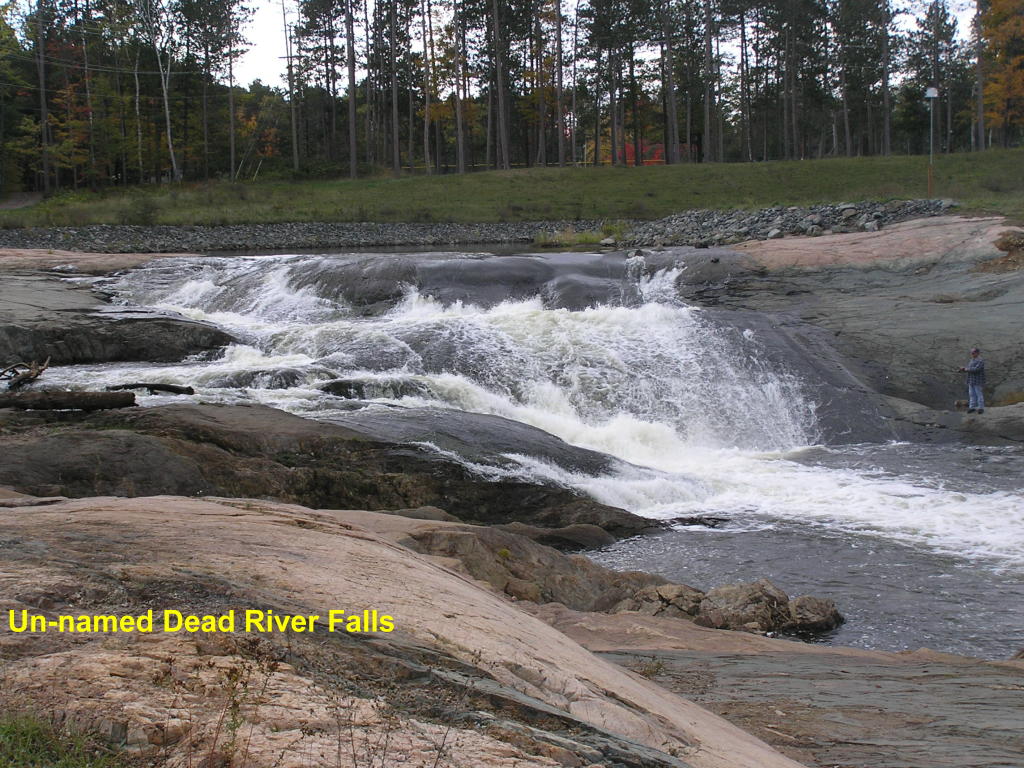
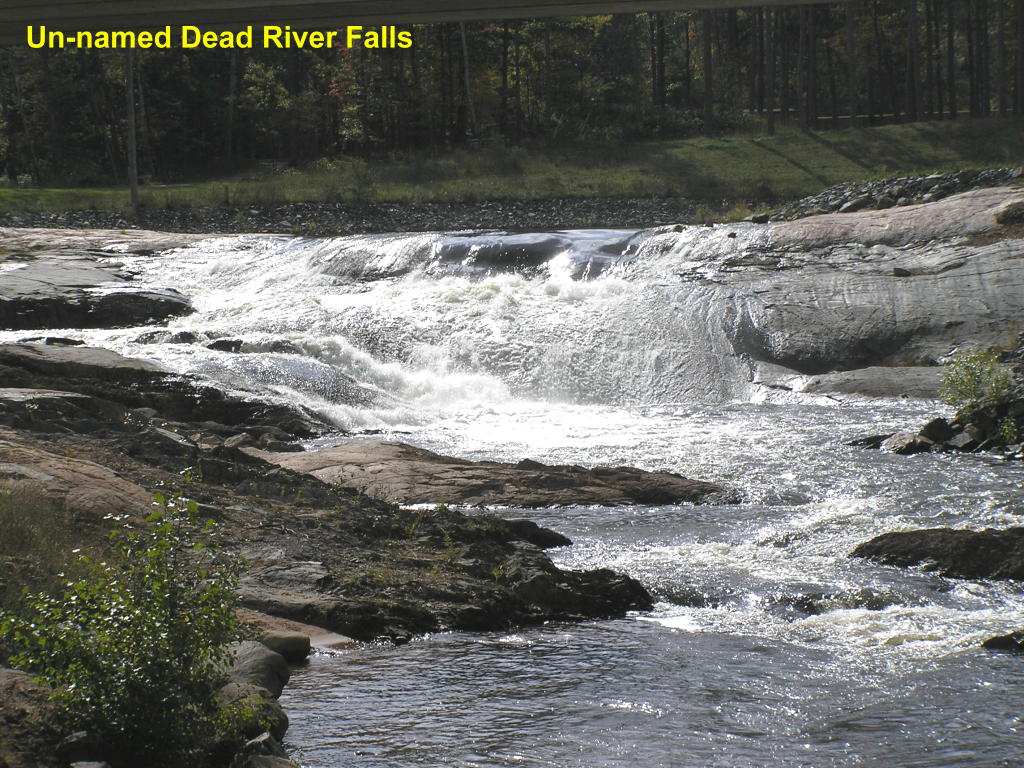
Un-named Dead River Falls - These falls on the Dead River are visible from County Road 550 (Hawley Street)
Un-named Dead River Falls - Close-up from a different angle
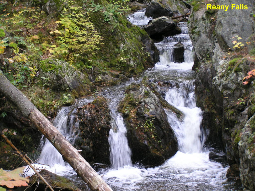
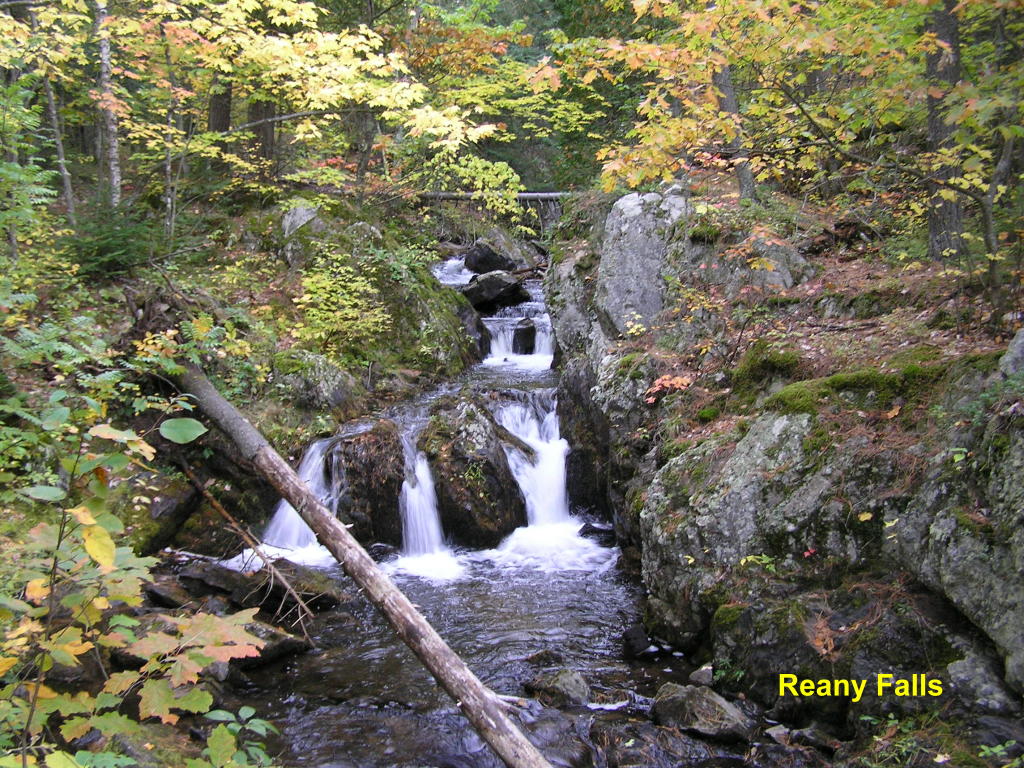
Reany Falls - Wide view of this splendid falls on Reany Creek
Reany Falls - Close-up
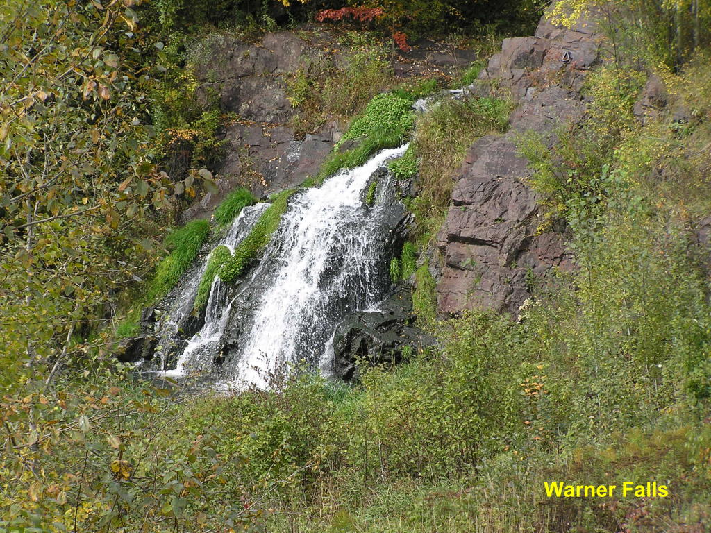
Warner Falls - Wide view of the falls along Warner Creek with a little fall color
Warner Falls - Close-up
Alger County:
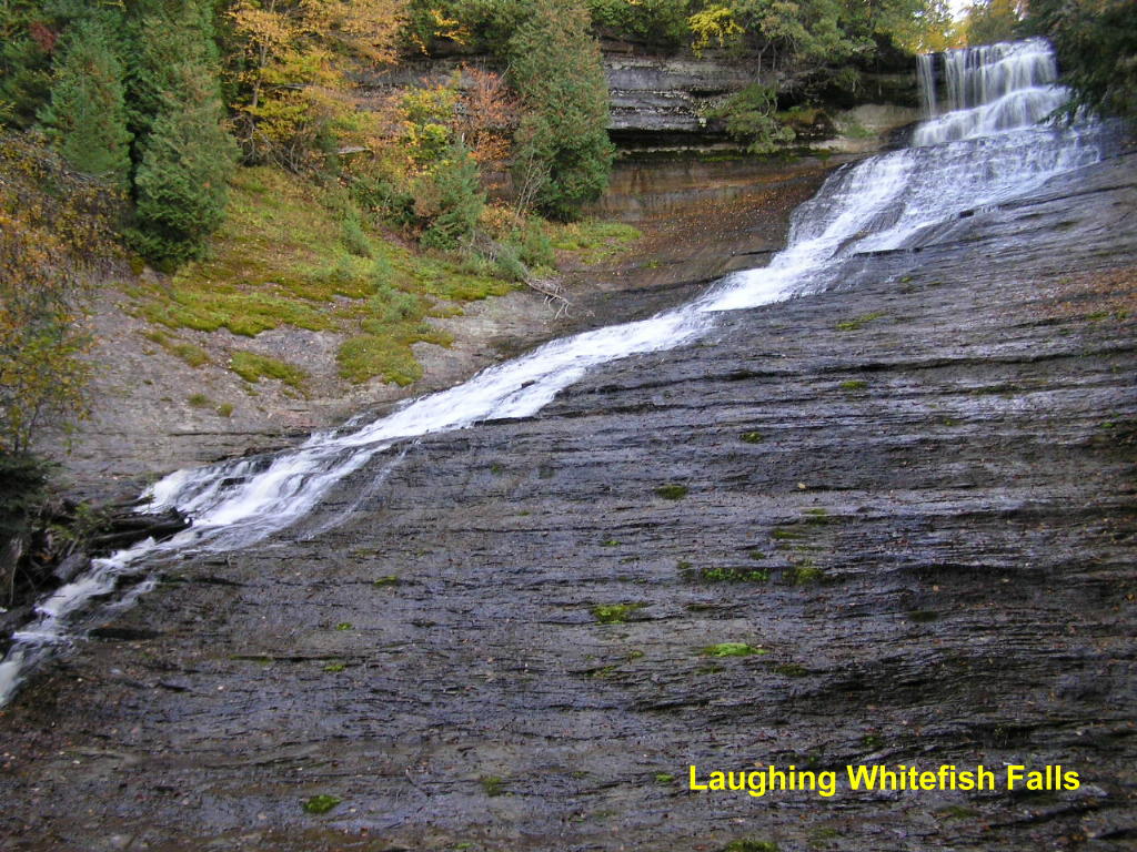
The waterfalls in Alger County have some of the most spectacular "drops" in all of the U.P. Many have drops of over 60-ft.!!
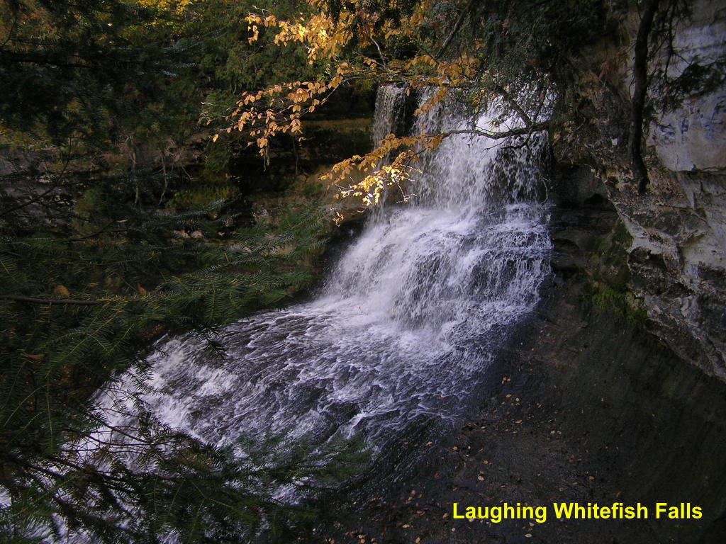
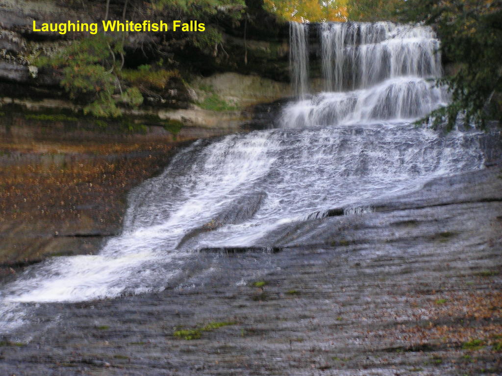
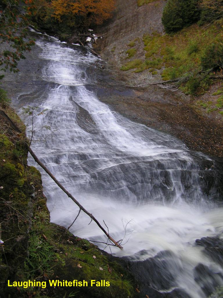
Laughing Whitefish Falls - Let's begin with one of the more spectacular falls in the Munising area. This falls on the Laughing Whitefish River drops over 100-ft. into a deep gorge. A wooden stairway leads down to a breath-taking view of the falls.
Laughing Whitefish Falls - A view from a platform partway down to the base of the falls
Laughing Whitefish Falls - Close-up of the top of this falls
Laughing Whitefish Falls - A view from the top of the falls looking down into the gorge (the top of the falls is at the extreme right of the photo)
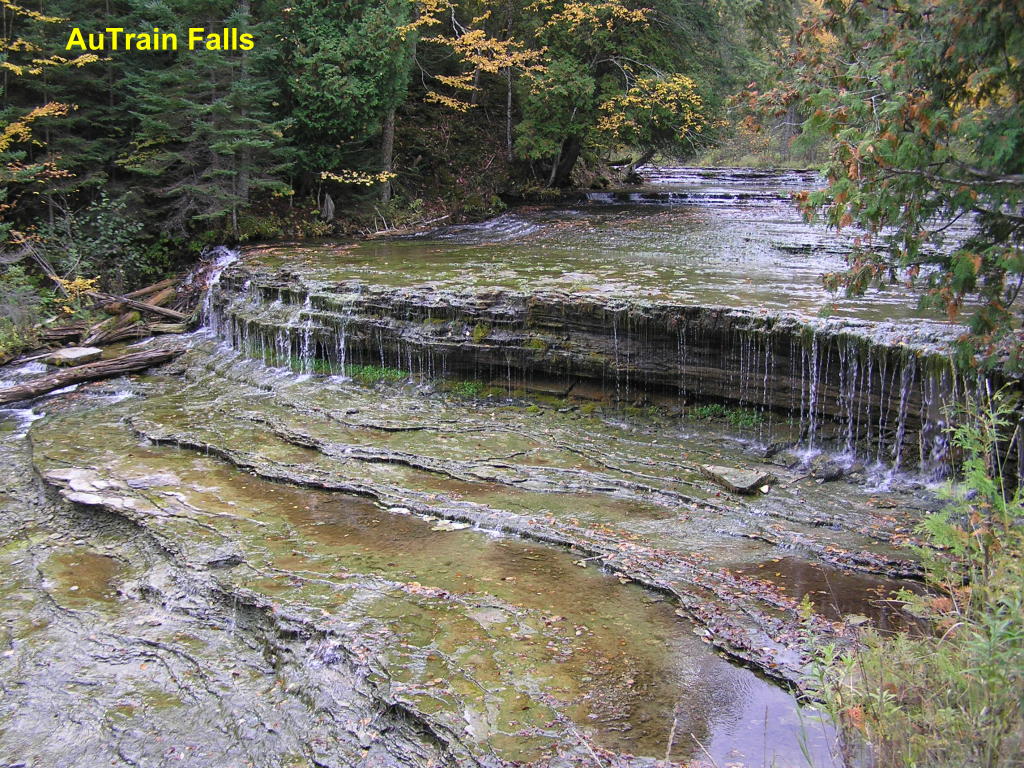
Au Train Falls - Can you imagine what this falls along the Au Train River would look like during high-water times?
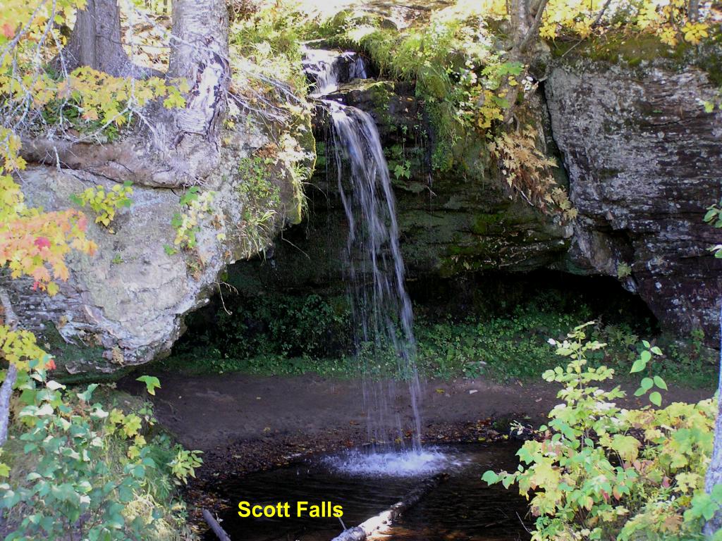
Scott Falls - This quiet little falls along an un-named creek is viewable from M-28. It is a miniature version of some of the larger falls in the area, where the water pours out over a ledge and free-falls into the pool below.
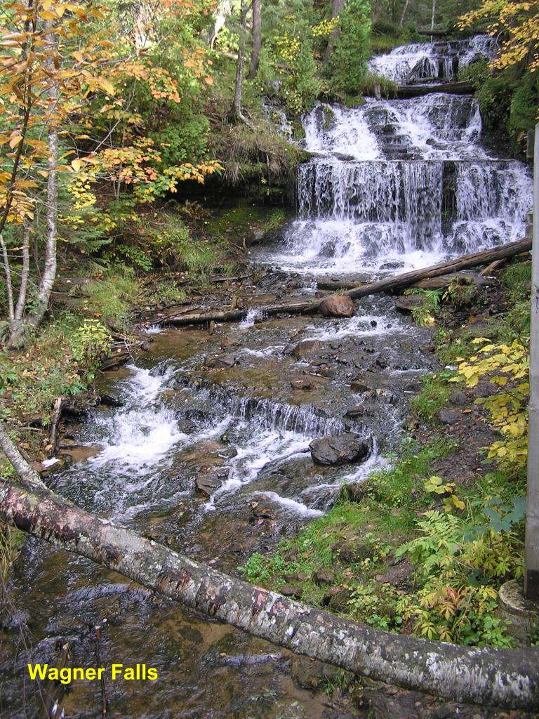
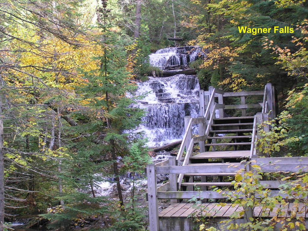
Wagner Falls - This beautiful falls on Wagner Creek is just 100-ft. off M-94 along a groomed pathway.
Wagner Falls - There is a viewing platform near the top of the falls
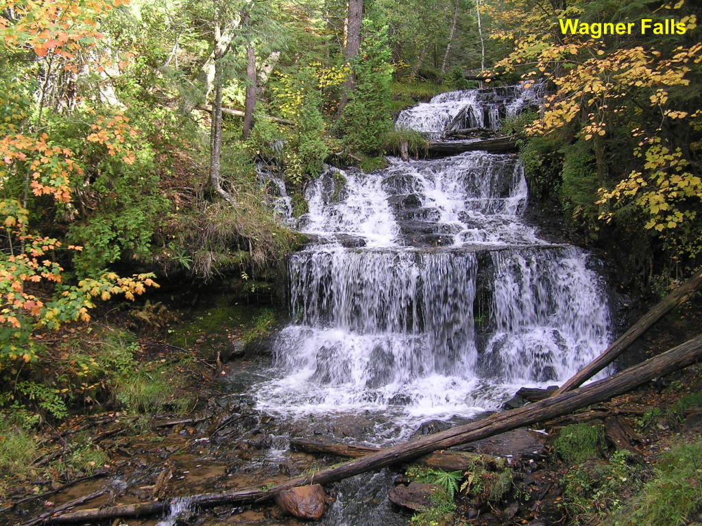
Wagner Falls - Close-up of the main falls
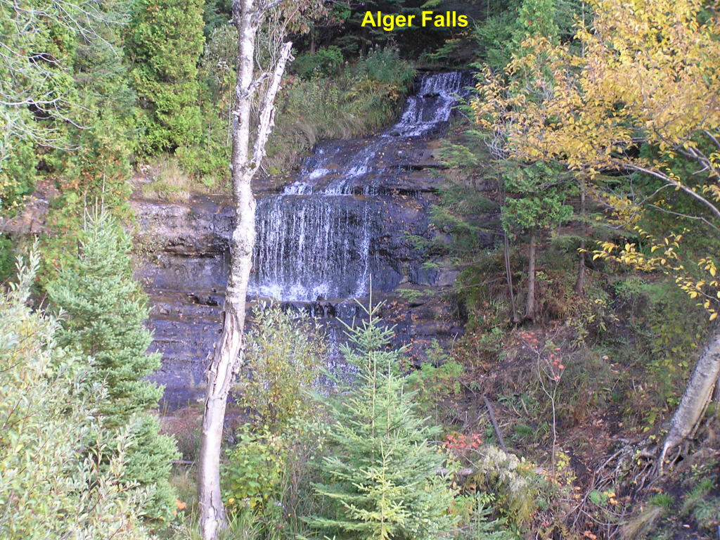
Alger Falls - This falls on Alger Creek is very near Wagner Falls at the junction of M-94 and M-28 in Munising
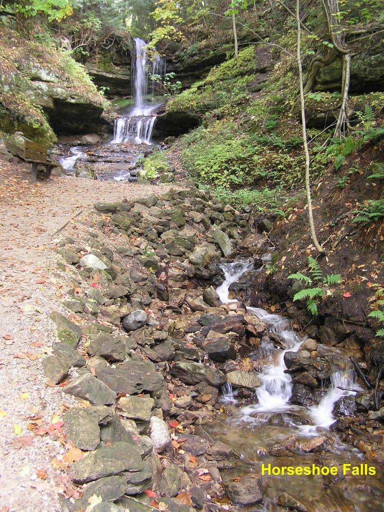
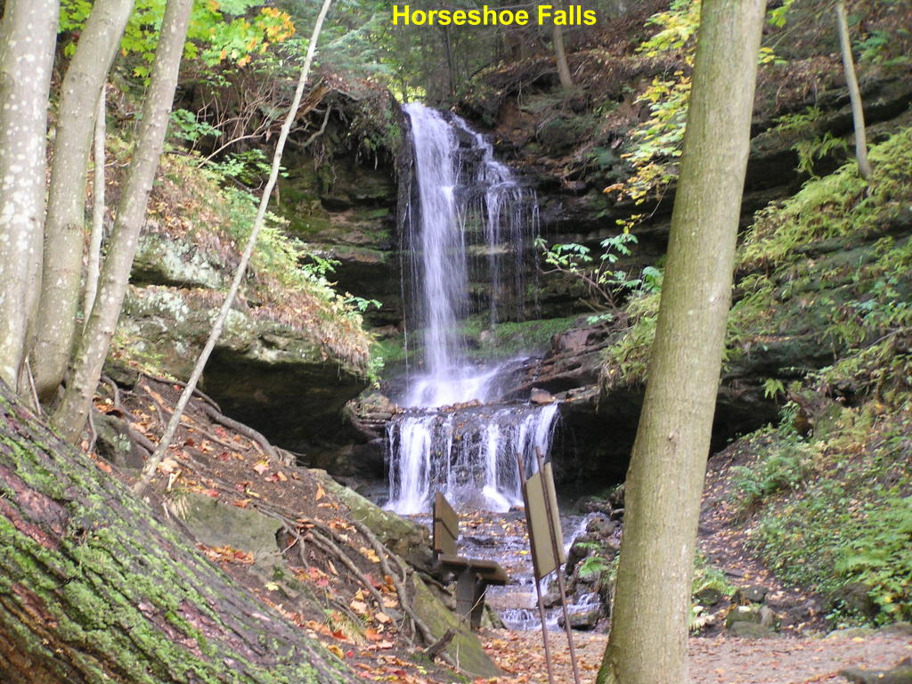
Horseshoe Falls - The entrance to this falls along Stutts Creek is at a gift shop, where a small fee ($5 when I was there) is required to view them. It is worth the money! Don't forget to feed the trout in the pool off to the side of the falls :O).
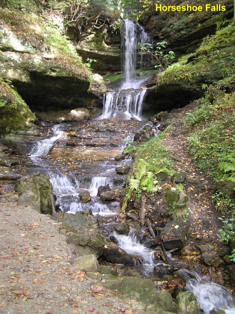
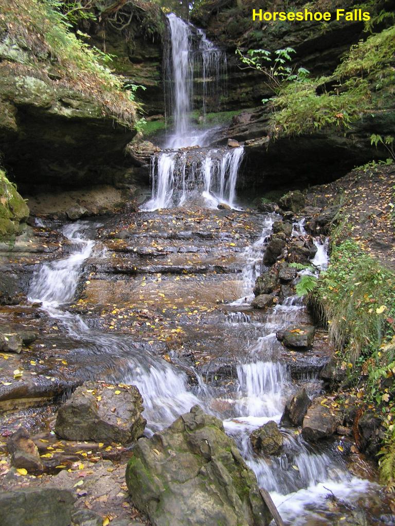
Horseshoe Falls - Closer view
Horseshoe Falls - ... Closer yet
Horseshoe Falls - Close-up of the main falls
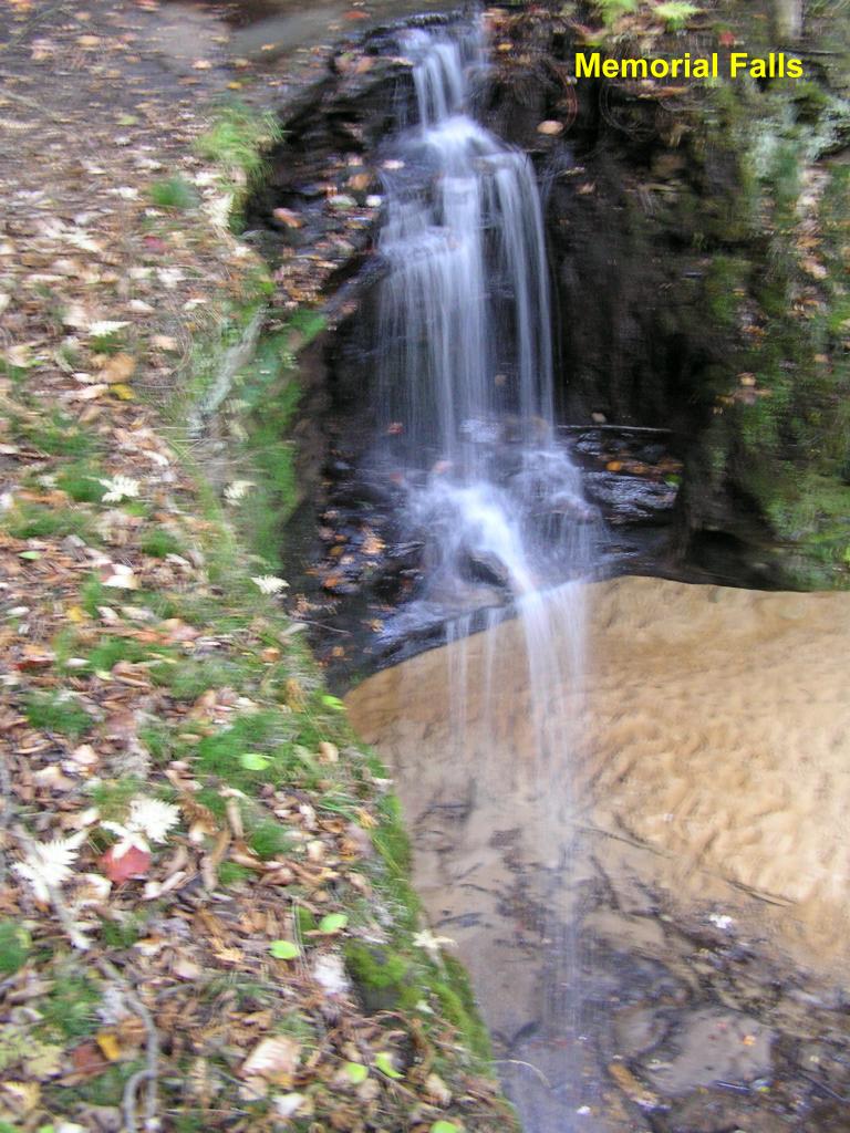
Memorial Falls - Here is one of the larger falls (on an un-named creek) with the "free-fall" drop into a pool below. You cannot see the bottom of this waterfalls because the gorge below is hidden by an overhang on the ground above it. I was standing about 6-INCHES away from a 75-FOOT sheer drop to get this photo. Oh, by the way, I don't like heights!!
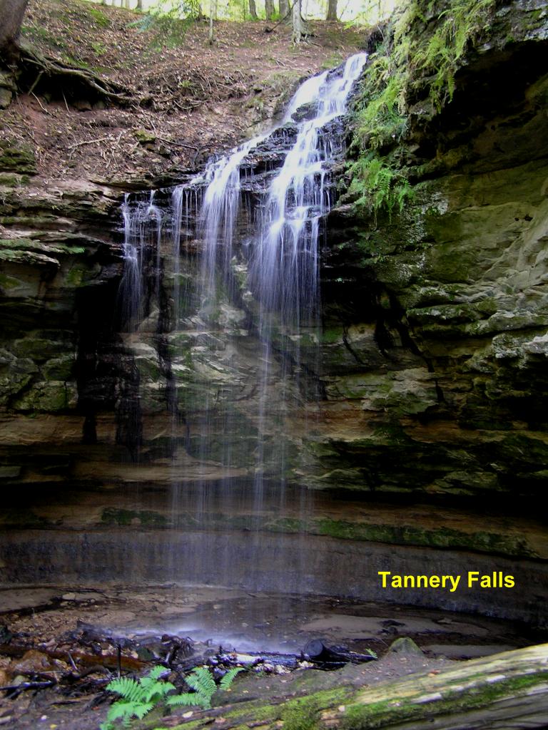
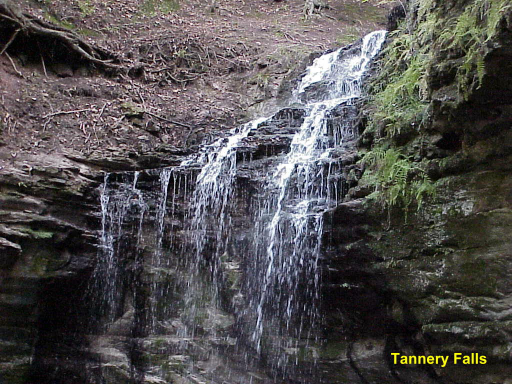
Tannery Falls - Here is another of the larger falls on Tannery Creek with the "free-fall" drop into a pool below
Tannery Falls - Close-up of the top of the falls, which is also known as Rudy M. Olson Memorial Falls
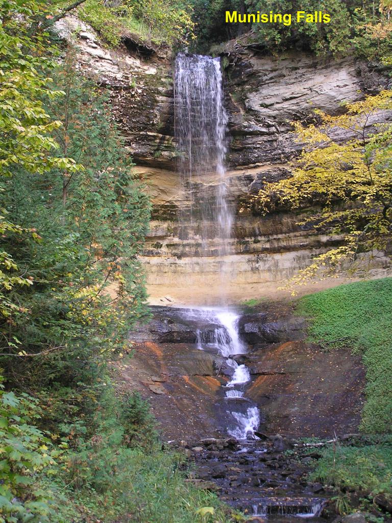
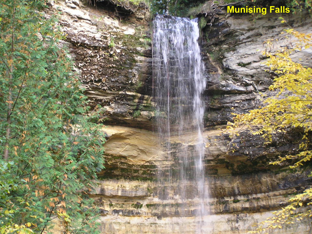
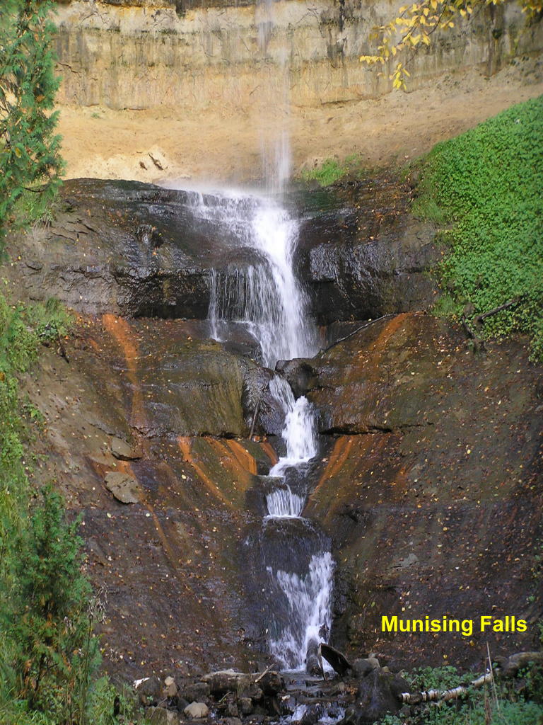
Munising Falls - This "free-fall" waterfall along Munising Creek is probably the best-known in the Munising area.
Munising Falls - Close-up of the main falls
Munising Falls - Close-up of the small falls at the base main falls
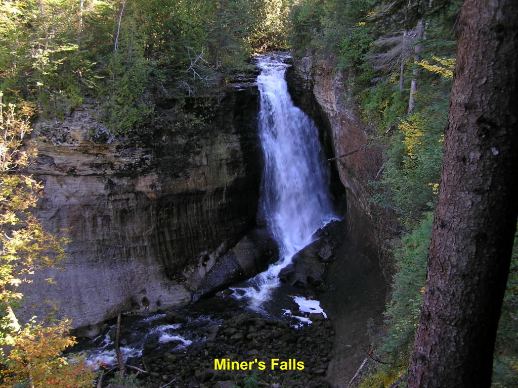
Miners Falls - Another spectacular Munising-area waterfall on Miners River
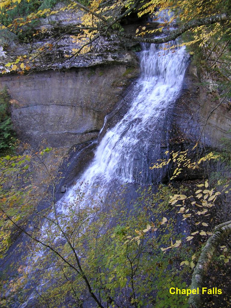
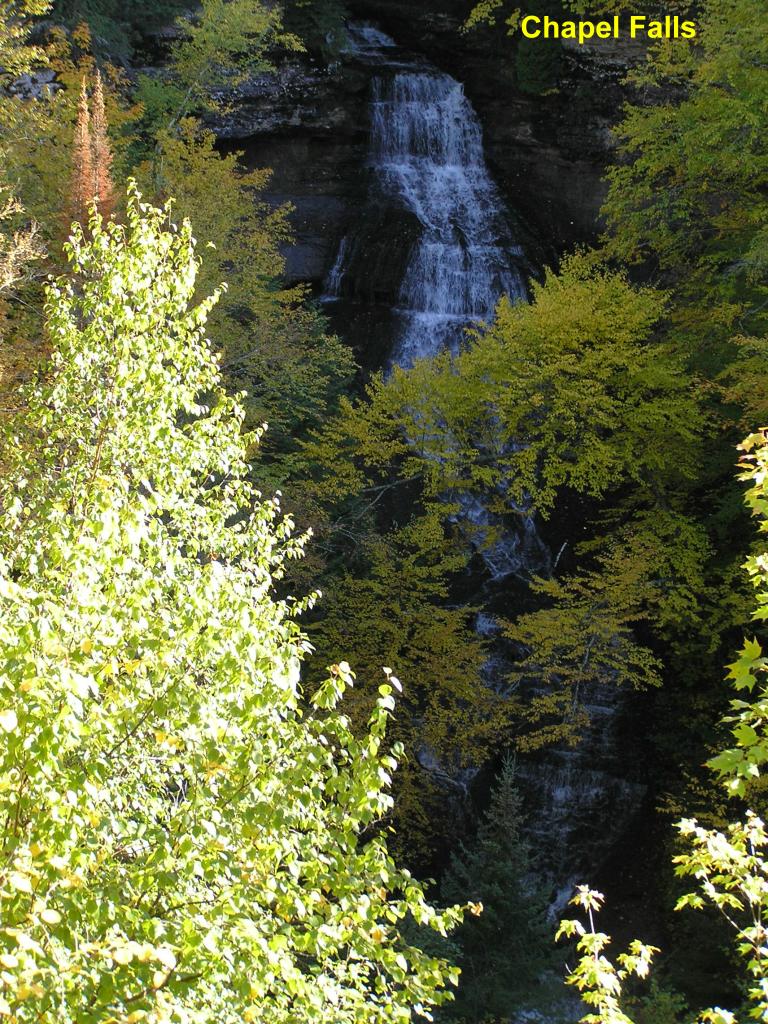
Chapel Falls - This is just a partial view of a huge waterfall along Section 34 Creek
Chapel Falls - Unfortunately, it is not possible to photograph the entire falls - note the white water through the trees and at the very bottom of this photo, then you will get an idea on just how big this falls really is!
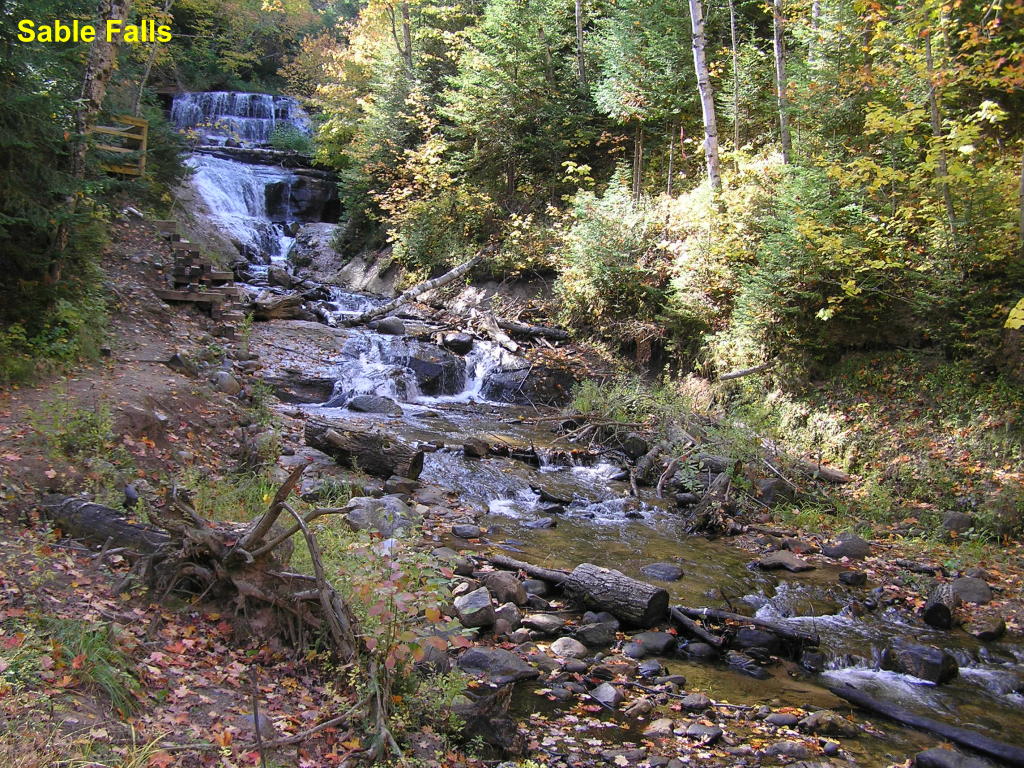
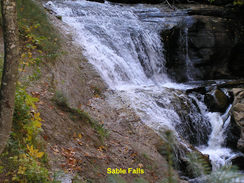
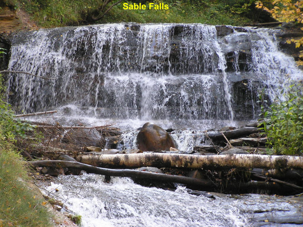
Sable Falls - Wide view of this gorgeous waterfall on Sable Creek which is near Grand Marais
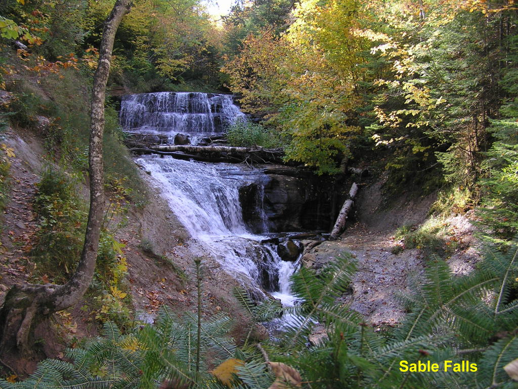
Sable Falls - A closer look at the main falls
Sable Falls - Close-up of the middle-area of these falls
Sable Falls - Close-up of the beautiful top of the falls
Luce County:
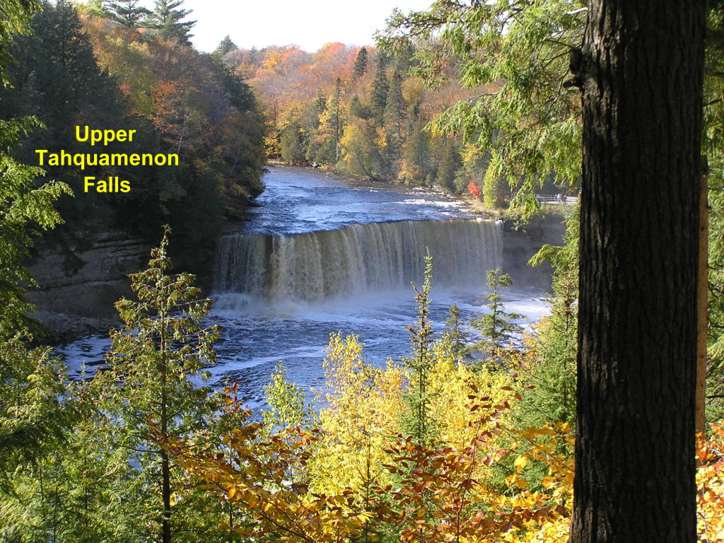
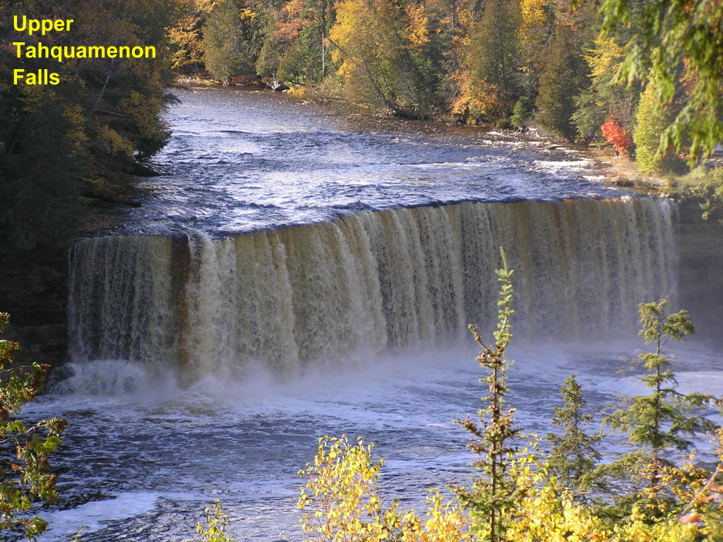
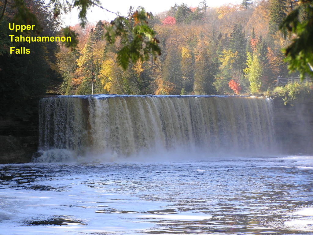
Upper Tahquamenon Falls - A view from above of Upper Michigan's best-known waterfall along the Tahquamenon River
Upper Tahquamenon Falls - Close-up of this spectacular waterfall
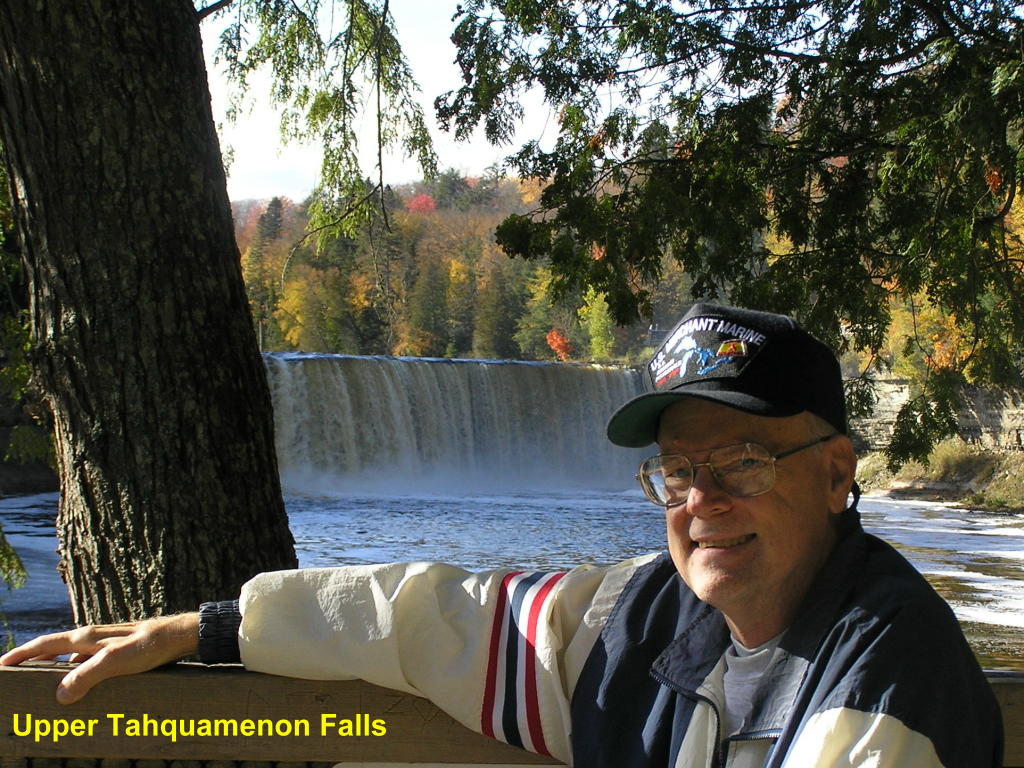
Upper Tahquamenon Falls - A long flight of steps takes you down to a viewing platform with a great view of the falls
Upper Tahquamenon Falls - Yours truly with the falls in the background
Chippewa County:
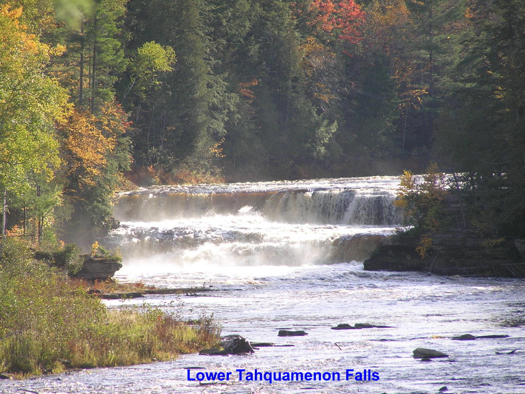
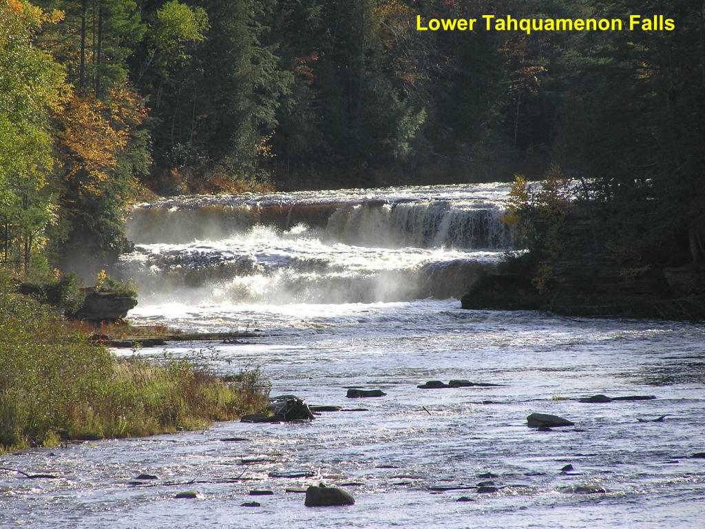
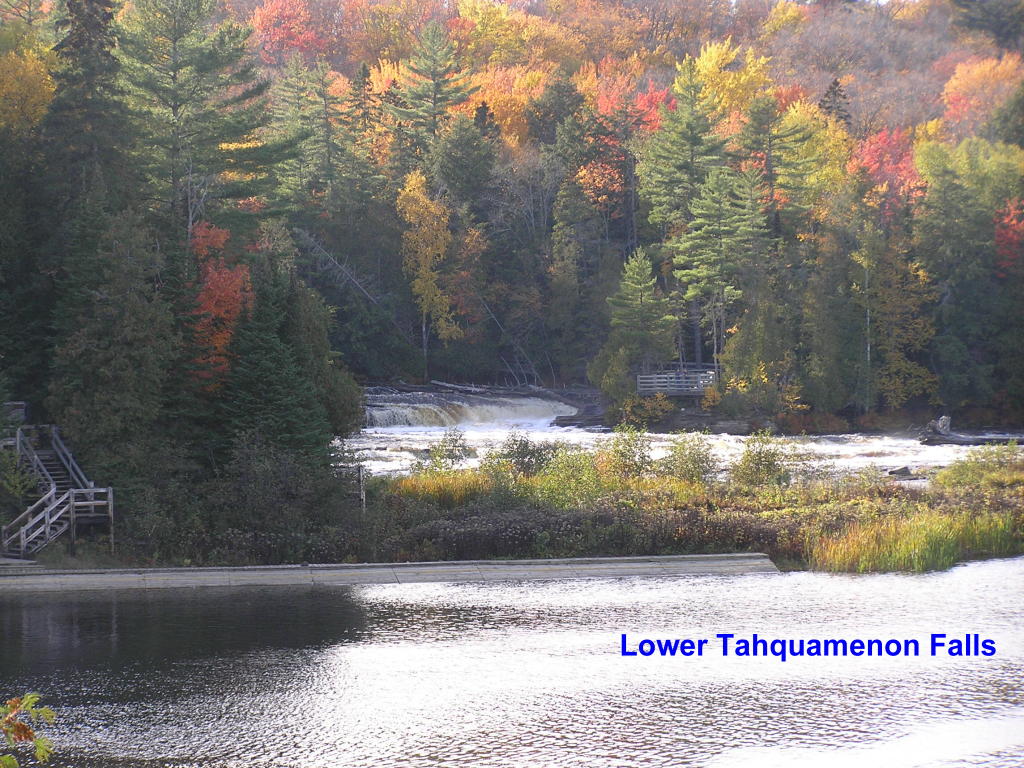
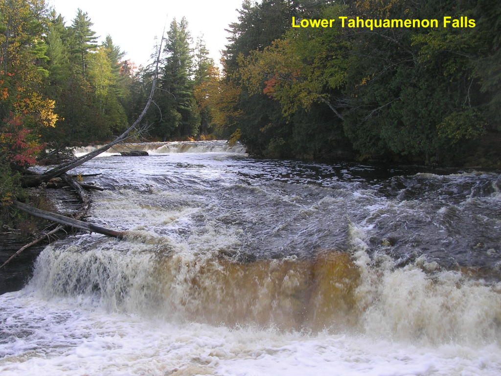
The best way to view these falls on the Tahquamenon River is to rent a rowboat and head out to the island from which you can view multiple falls which surround the island. I got there a half hour too late, so had to settle for a nice long walk around the perimeter of the river. You can see 4 sets of falls this way; but, if I remember right, there are seven sets of falls around the island
Lower Tahquamenon Falls - A view from the boat rental dock of the falls to the left of the island
Lower Tahquamenon Falls - Another view of the same falls
Lower Tahquamenon Falls - Wide angle view of the falls to the right of the island (with fall colors in bloom)
Lower Tahquamenon Falls - Closer view of the same falls
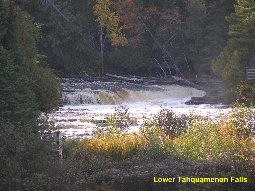
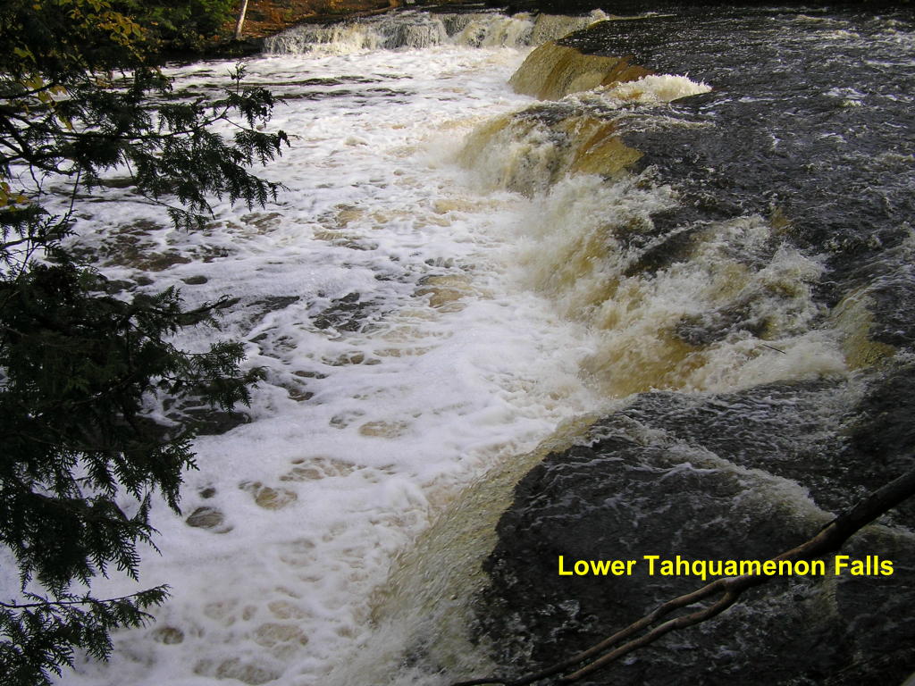
Lower Tahquamenon Falls - These falls are actually split in two by a rock outcropping with a fallen tree. This is the far side of the falls taken from a viewing platform right at these falls.
Lower Tahquamenon Falls - The near side of these falls with more falls in the background
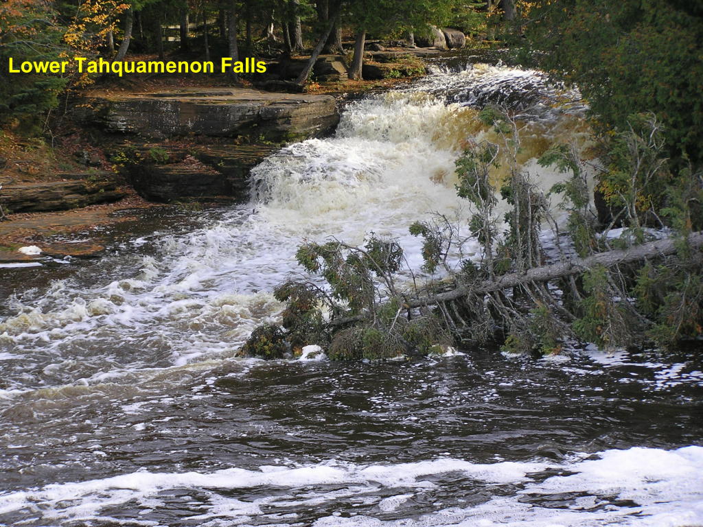
Lower Tahquamenon Falls - A different view of the same area
Lower Tahquamenon Falls - A view of these falls from right alongside the top of them
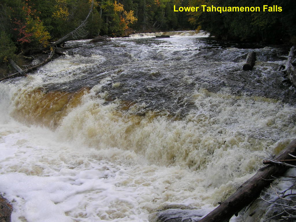
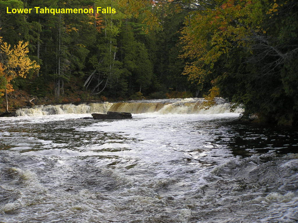
Lower Tahquamenon Falls - As we move up-river, there are more falls
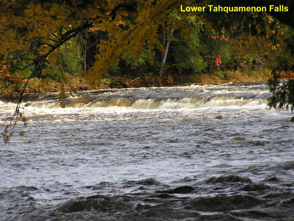
Lower Tahquamenon Falls - ... And near the end of the groomed trail is one more set of falls
The following photos are of scenery other than waterfalls which I photographed during this trip:
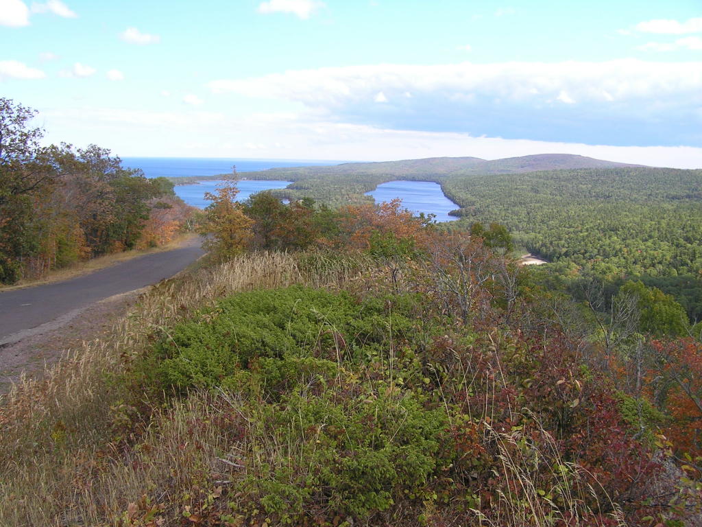
Scenes from Brockway Mountain Drive near Copper Harbor, MI:
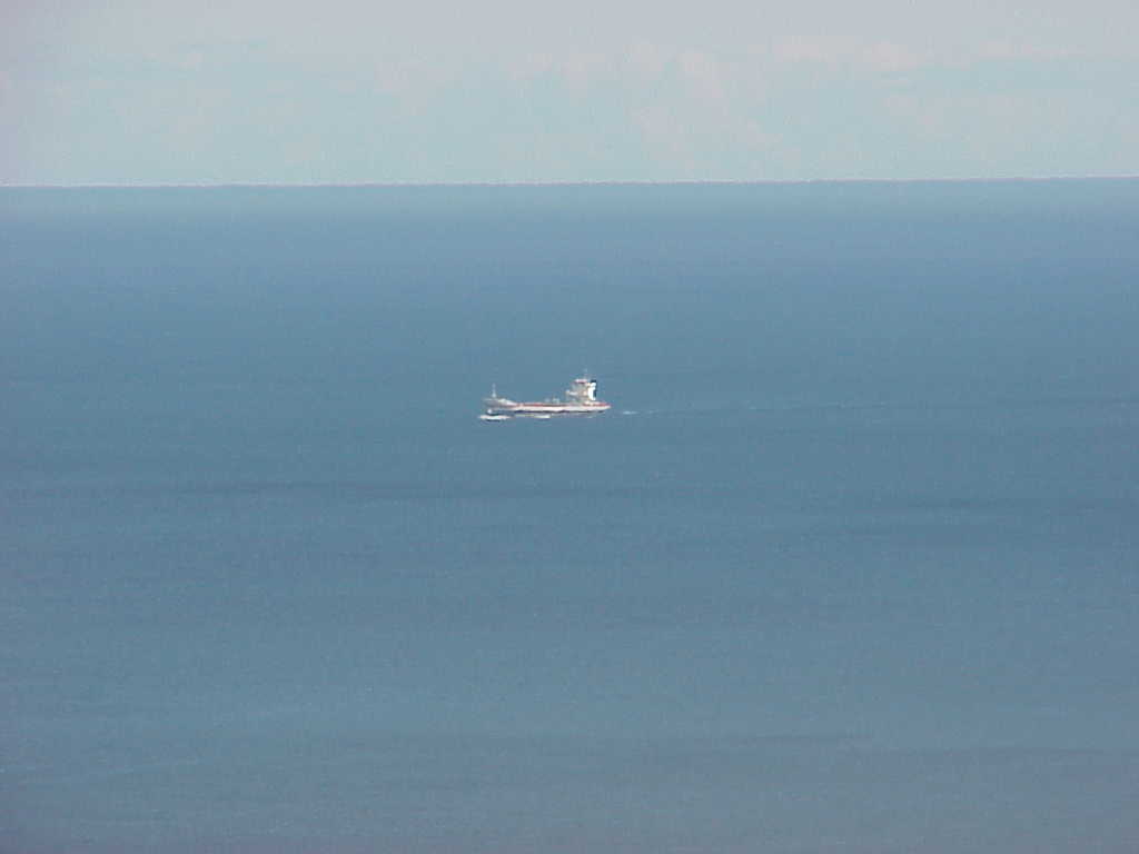
Lake Superior - A small Wagenborg ship, Kroonborg, heads up the lake
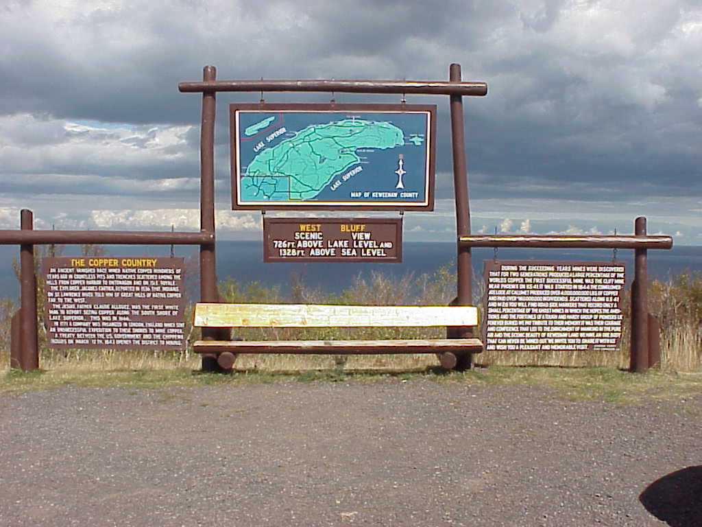
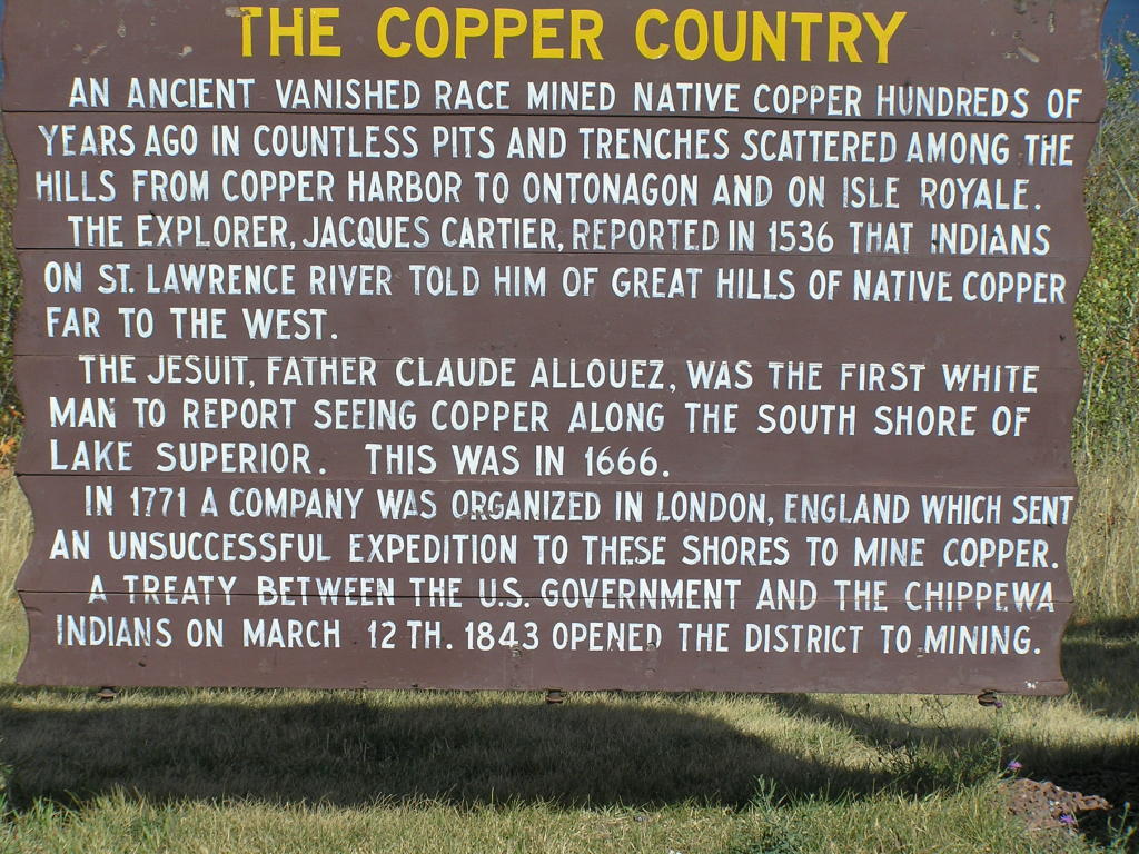
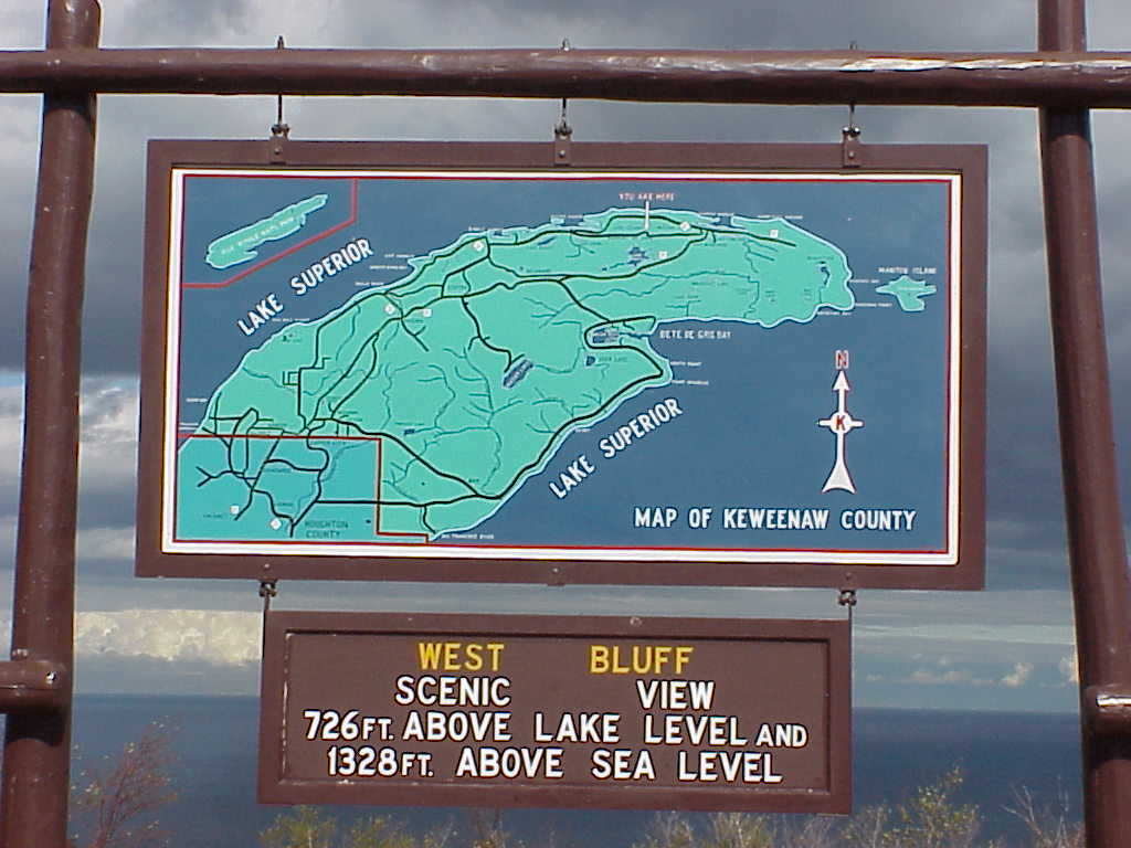
3-Part Sign - Sign atop Brockway Mountain Drive
Sign - Part 1 - Close-up of the left side of the sign
Sign - Part 2 - Close-up of the middle part of the sign
Sign - Part 3 - Close-up of the right side of the sign
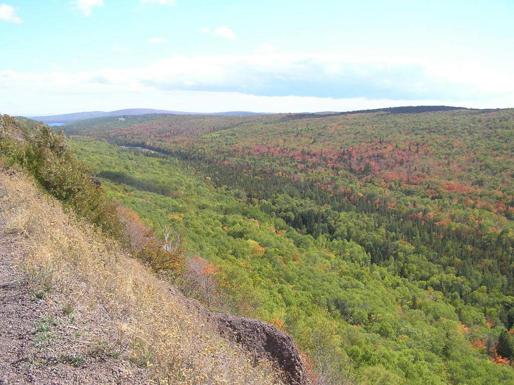
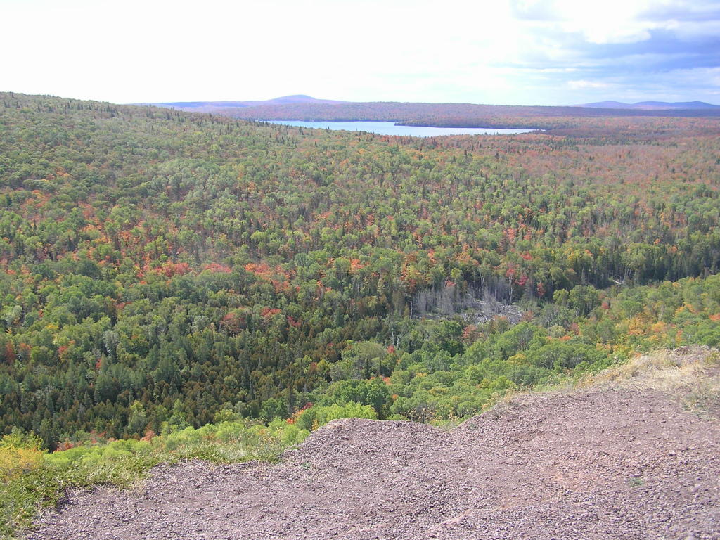
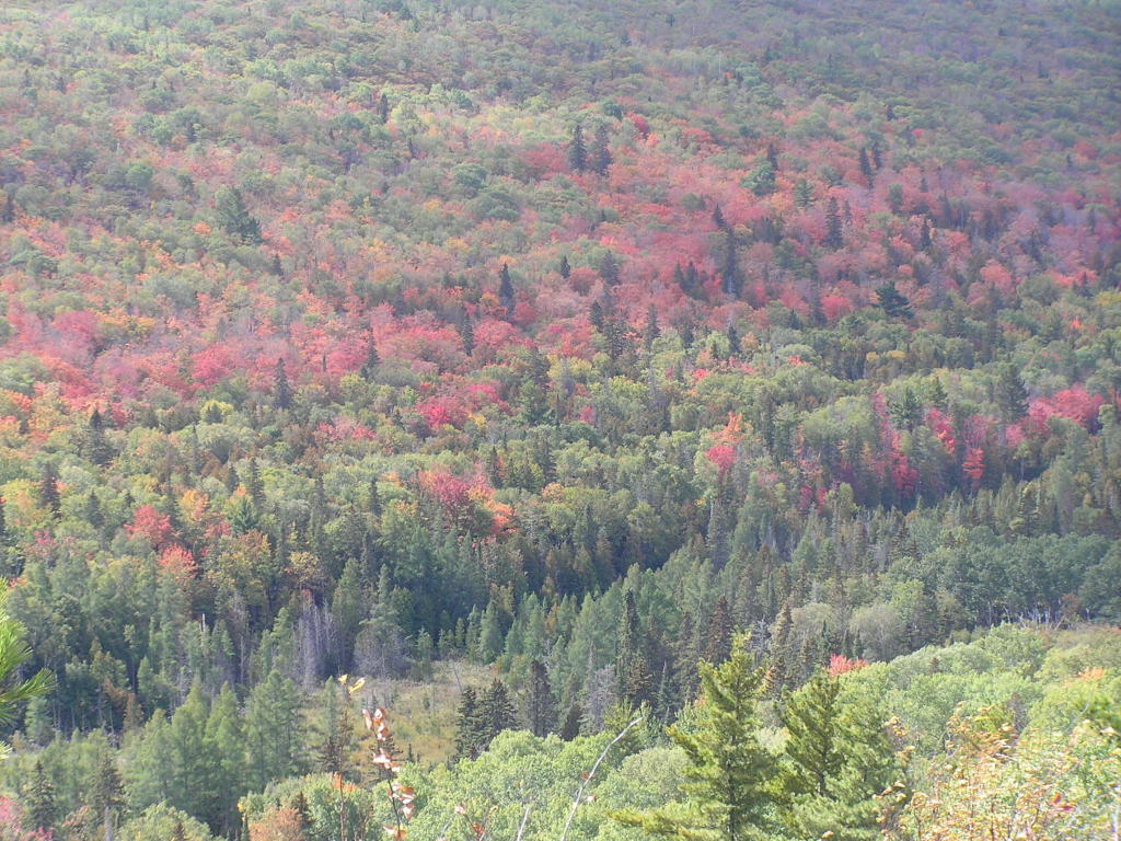
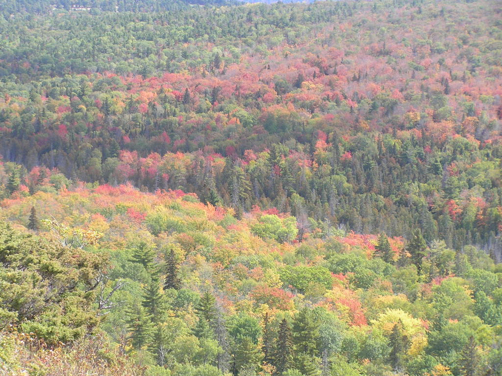
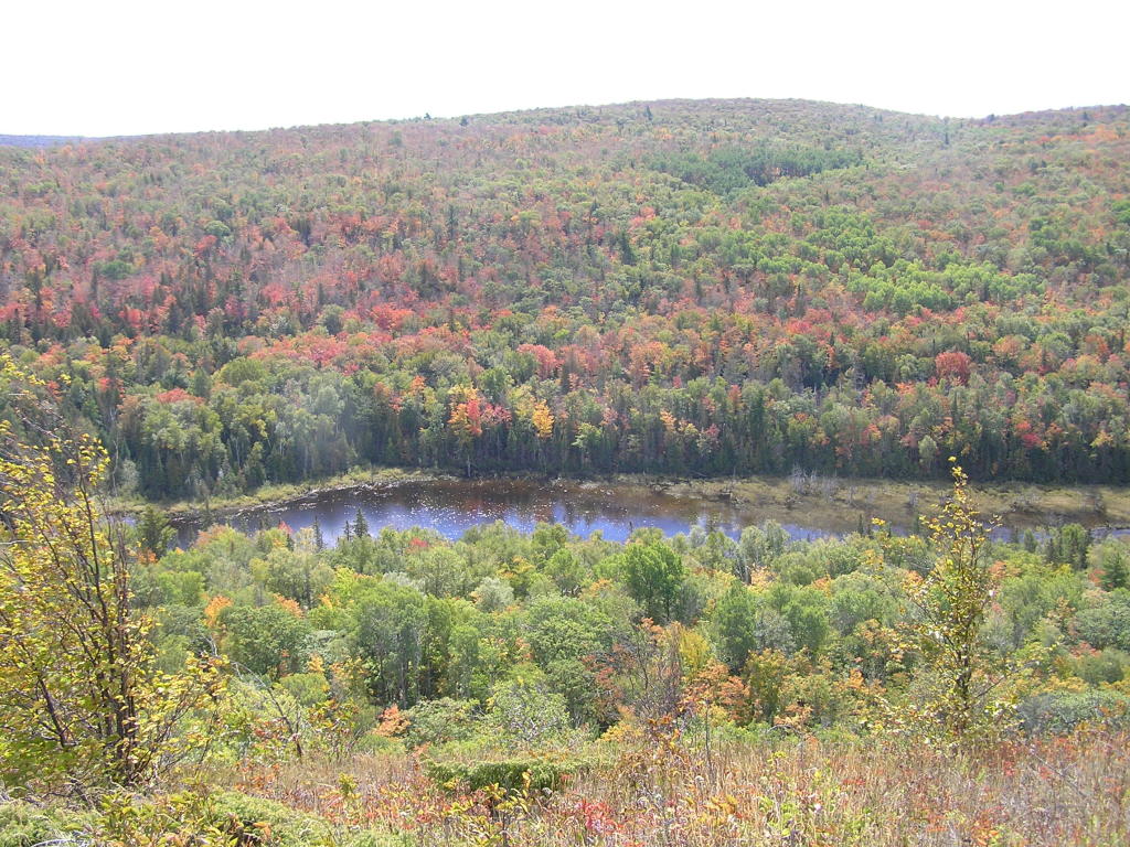
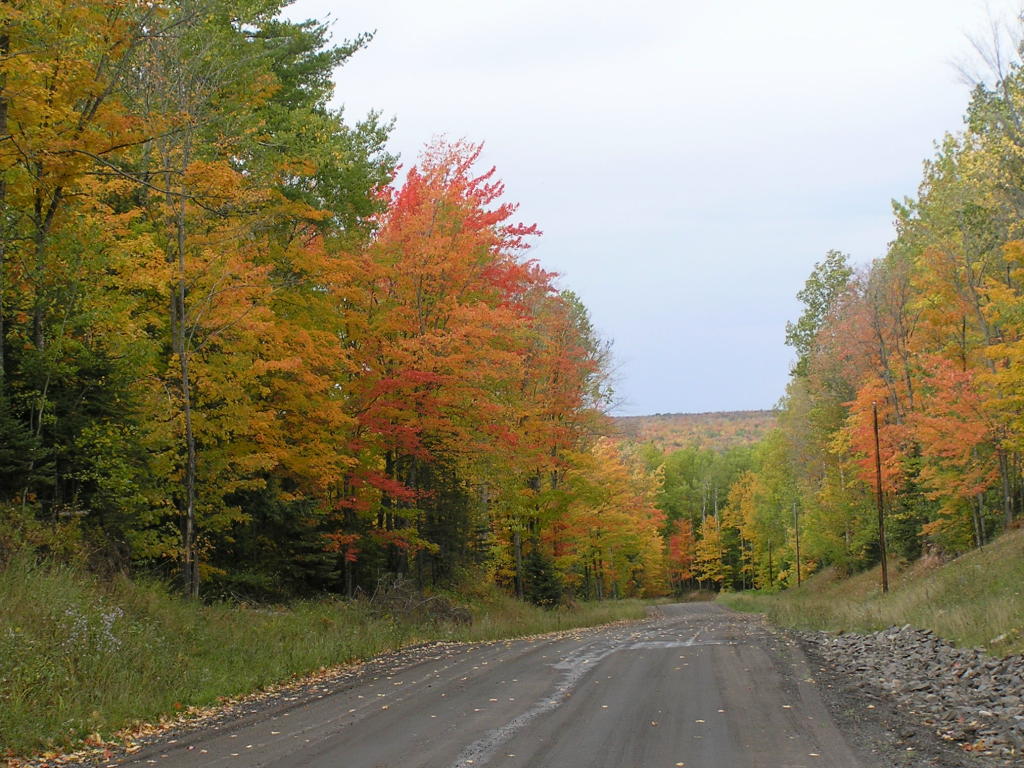
Valley Scenery - The fall colors were coming
Valley Scenery - More fall colors
Valley Scenery - Close-up fall colors
Valley Scenery - More fall colors
Valley Scenery - Still more fall colors
Valley Scenery - Looking off toward Copper Harbor
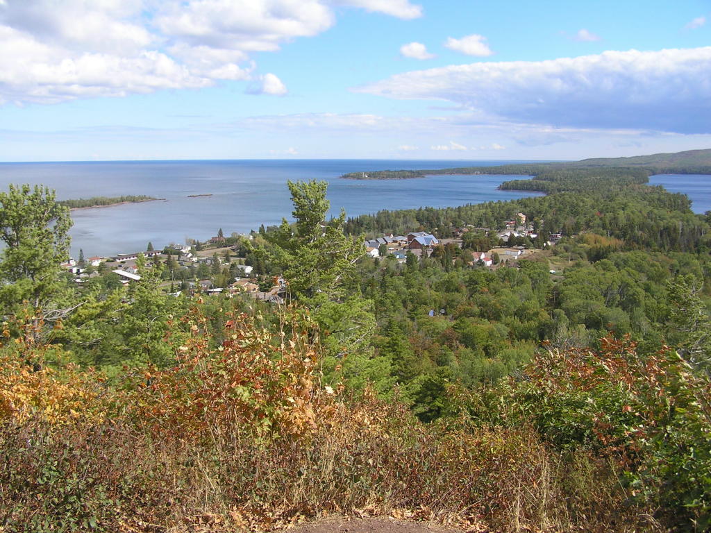
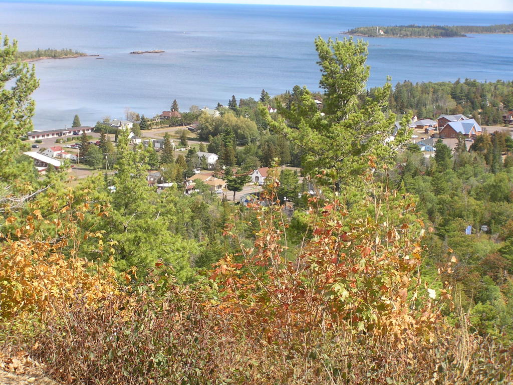
Overlook - Copper Harbor down below
Overlook - Closer view of Copper Harbor from above
Scenes from Calumet, MI:
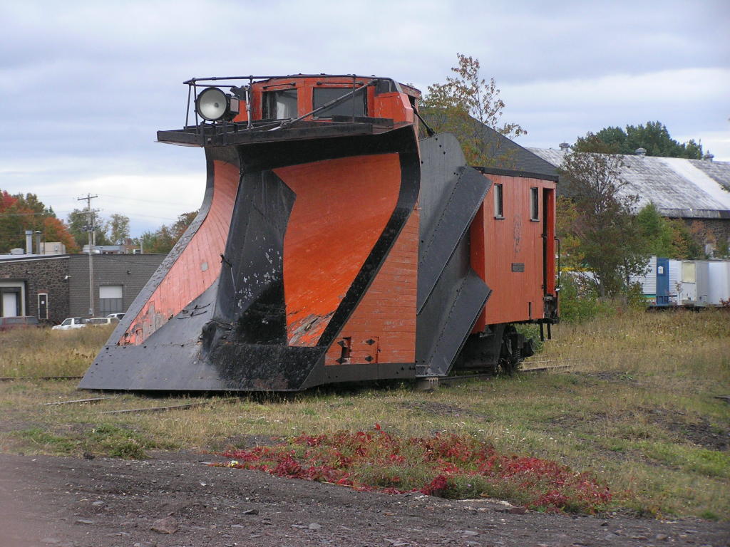
RR Snowplow - An old railroad snowplow on display
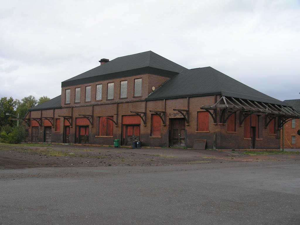
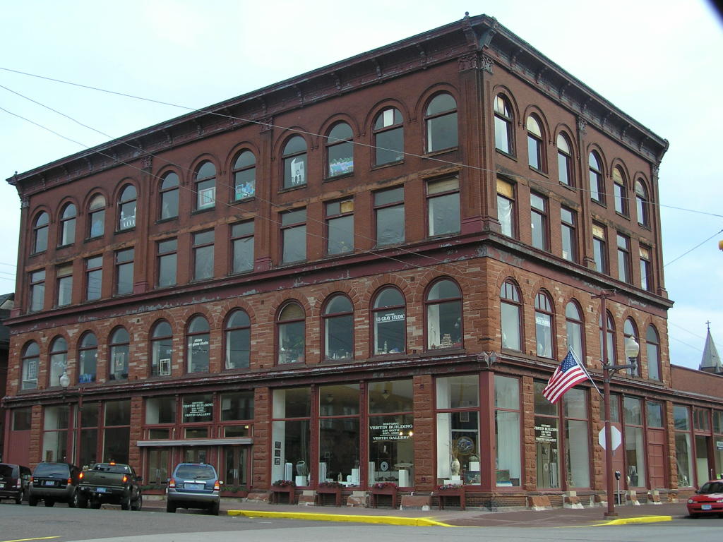
Building - One of the old buildings in an old U.P. town
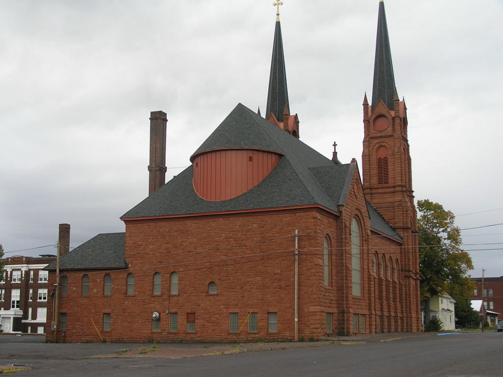
Church - One of the old churches
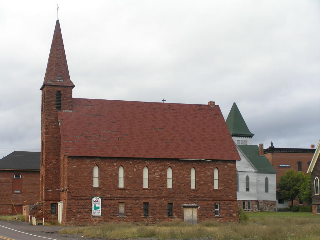
Church - Another of the old churches
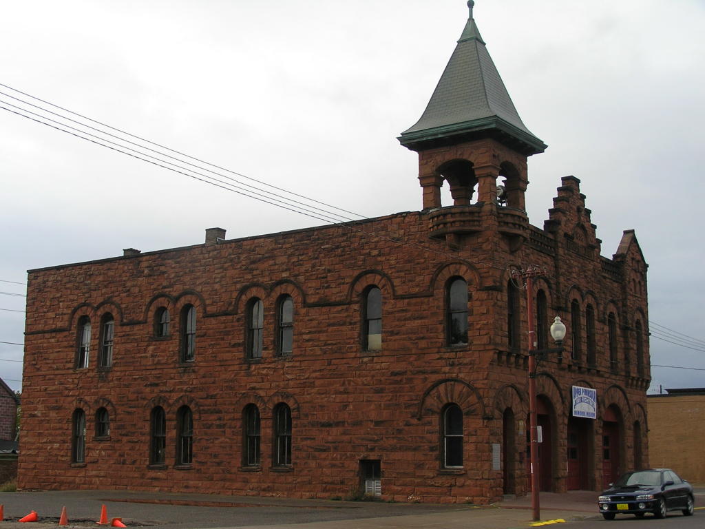
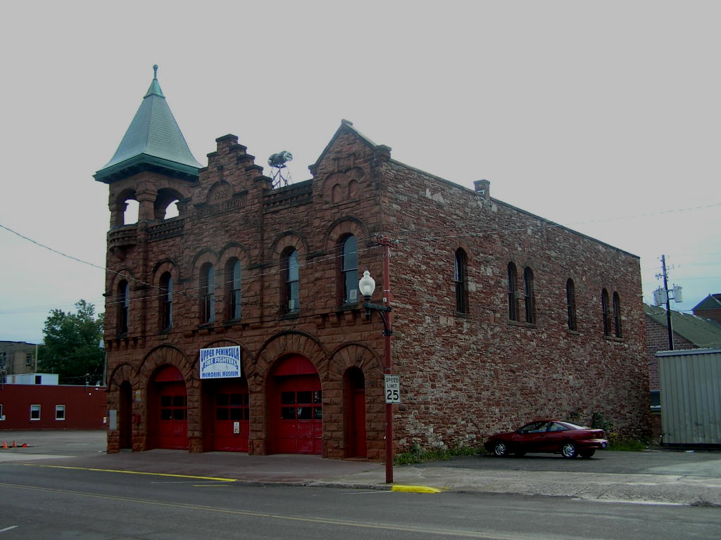
Building - Upper Peninsula Firefighter's Memorial Museum building
Building - Another view of the previous building
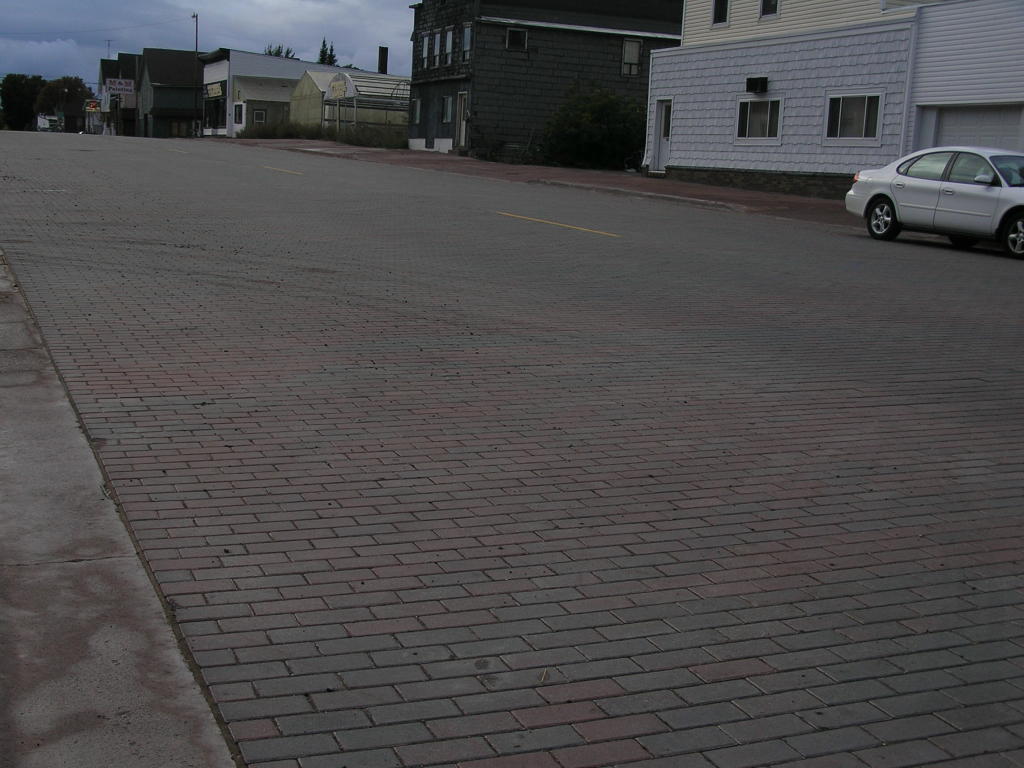
Street - An old brick street in the historic part of town
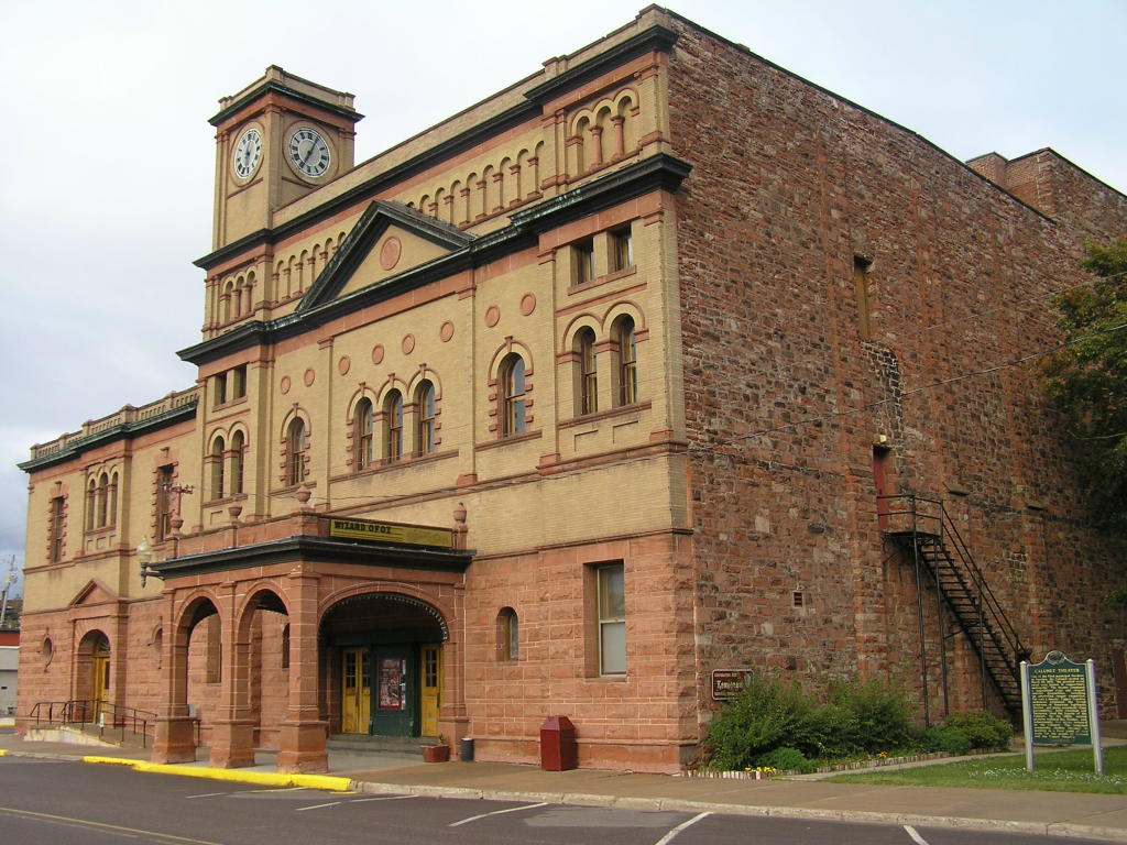
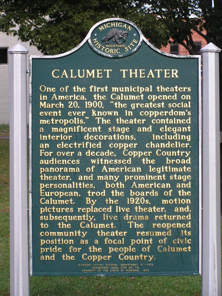
Calumet Theater - One of the first municipal theaters in the U.S.!
Calumet Theater - Another view of the magnificent old restored theater
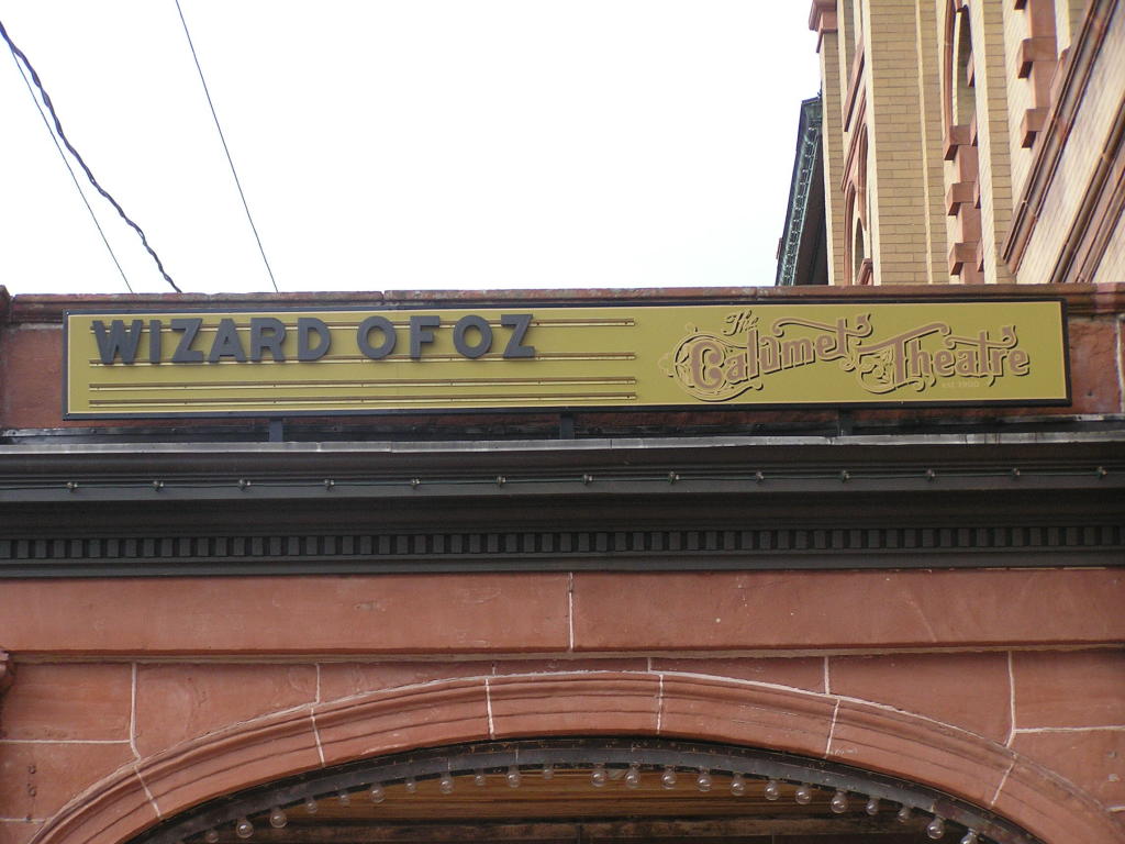
Calumet Theater - Close-up of the marquee atop the theater entrance
Calumet Theater - Signpost in front of the building
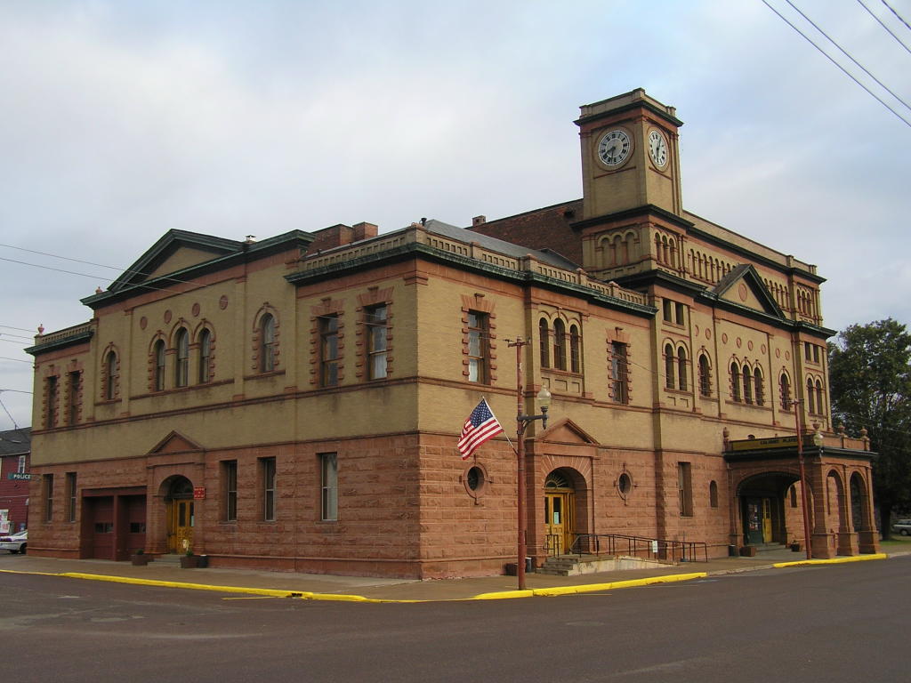
Building - Another "old architecture" building
Misc. scenic photos from around the U.P.:
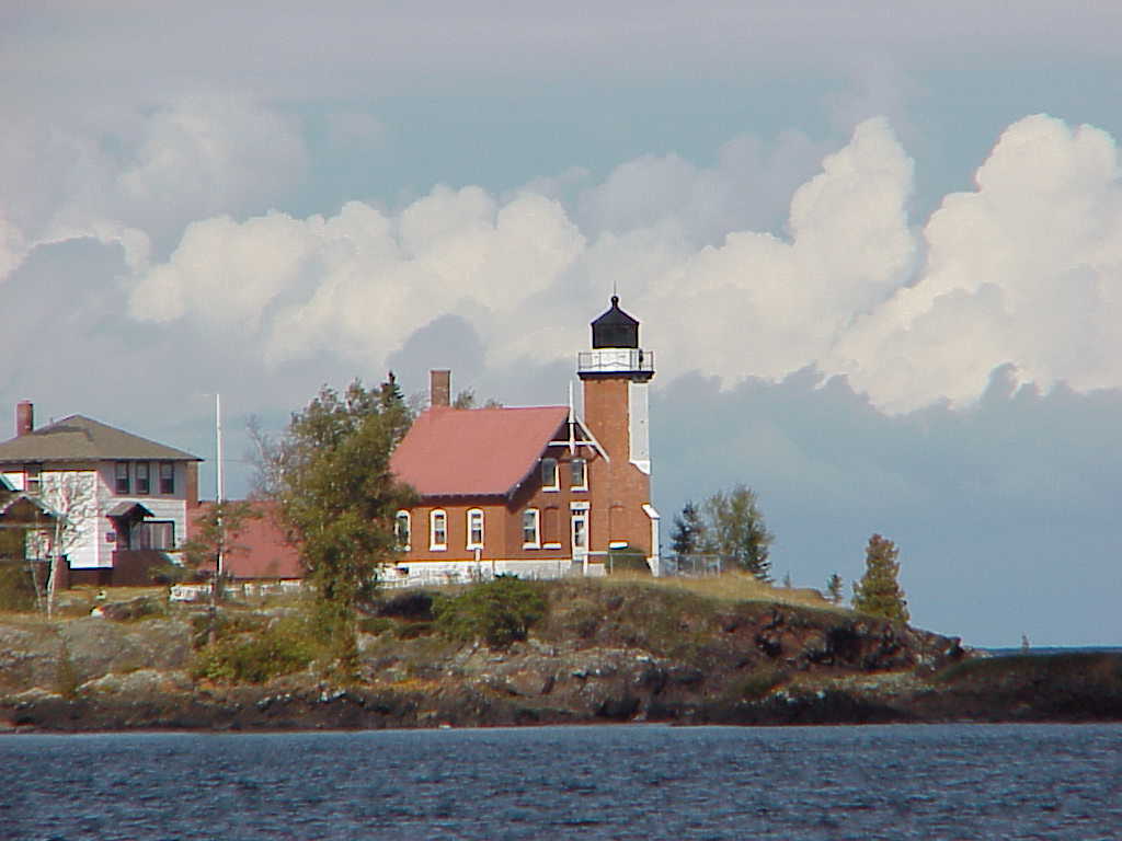
Lighthouse - The beautiful Eagle Harbor Lighthouse
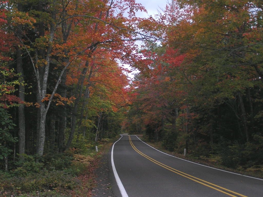
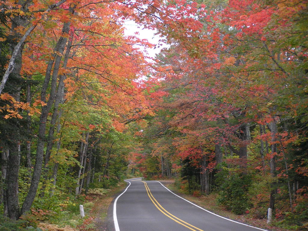
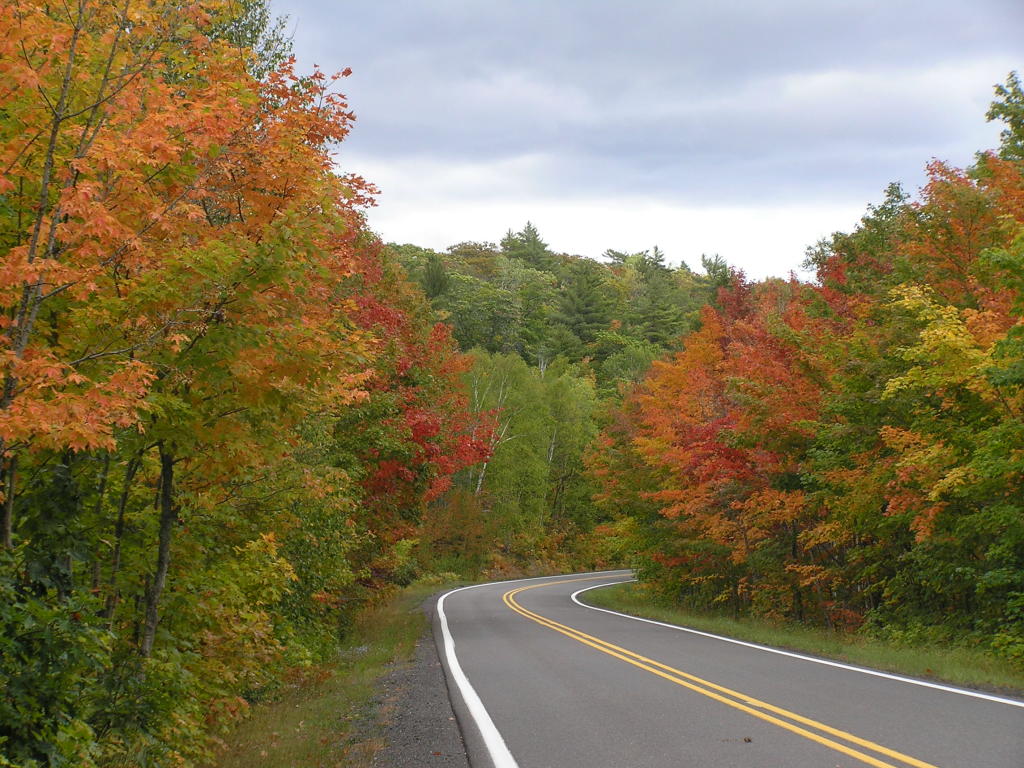
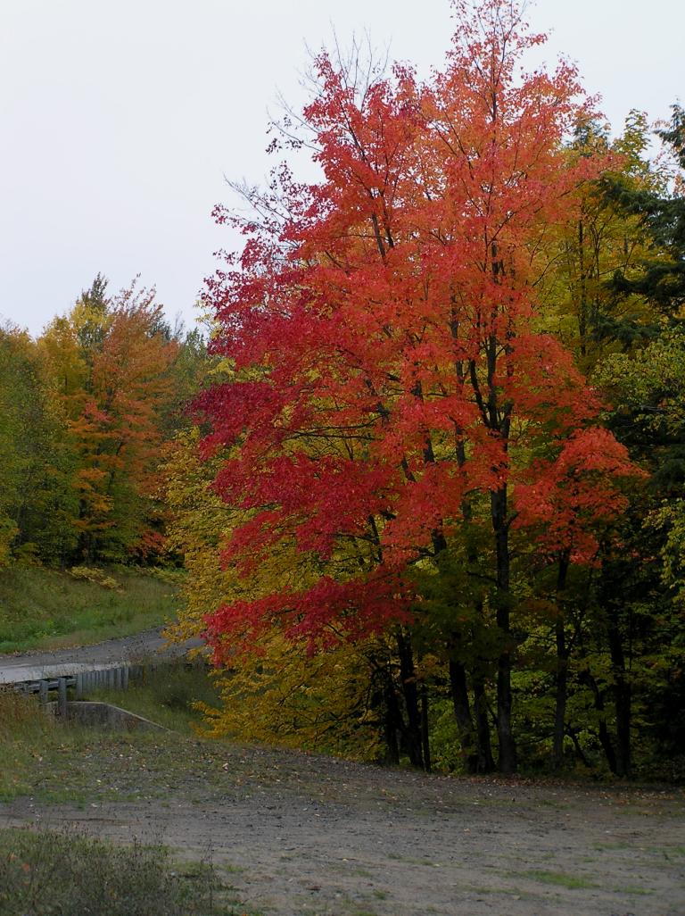
US-41 - A canopy of colors literally covers US-41 south of Copper Harbor
US-41 - Same area different lighting
US-41 - More fall colors along the highway
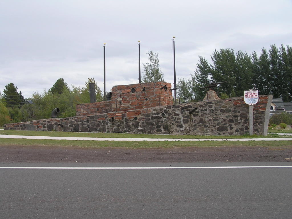
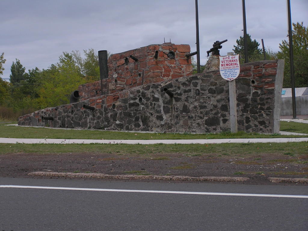
Stone Monument - A warship sculptured of stone in Kearsarge, MI
Stone Monument - Another view of the stone warship
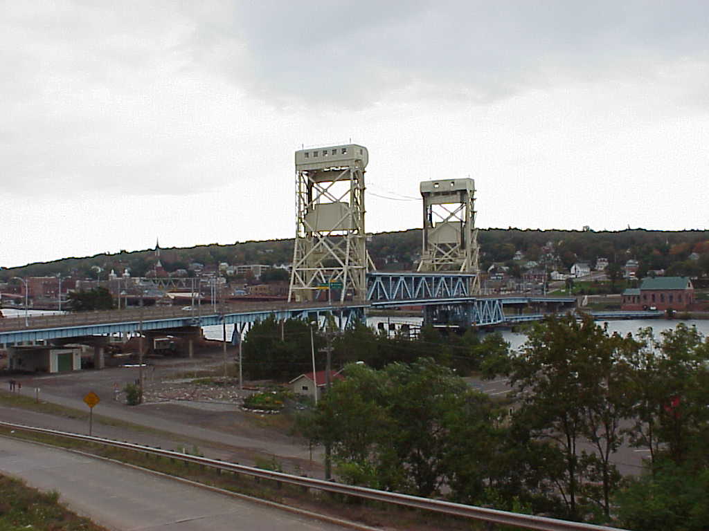
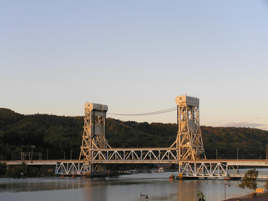
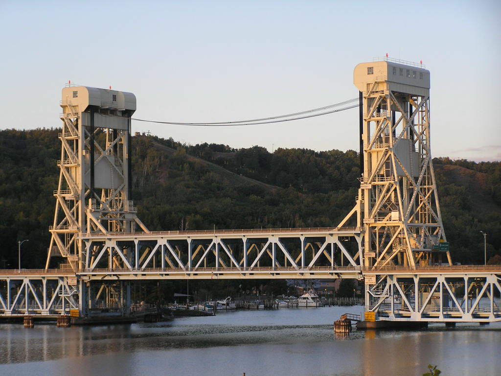
Houghton Lift Bridge - Viewed from Hancock, MI
Houghton Lift Bridge - Viewed from Houghton, MI
Houghton Lift Bridge - Close-up as viewed from Houghton, MI
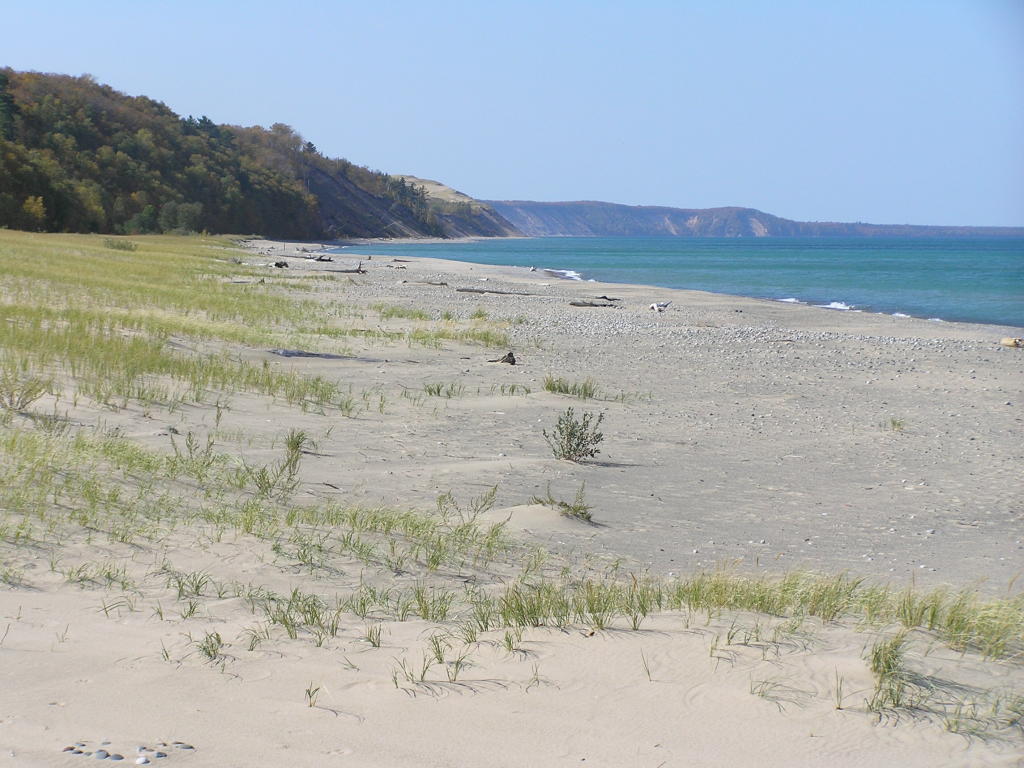
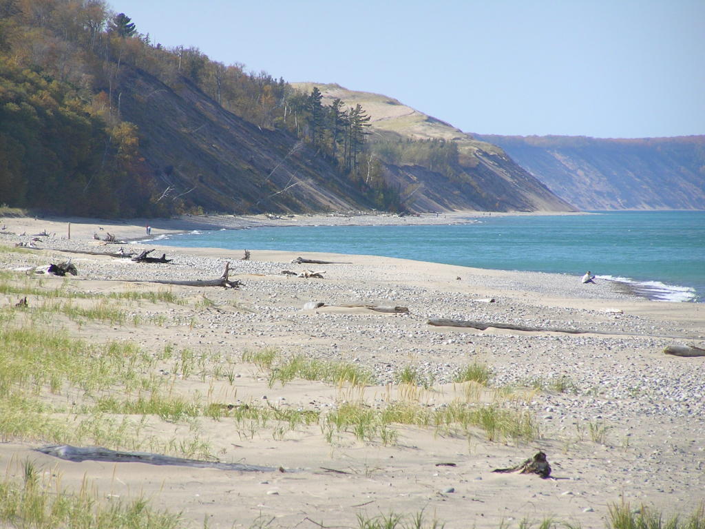
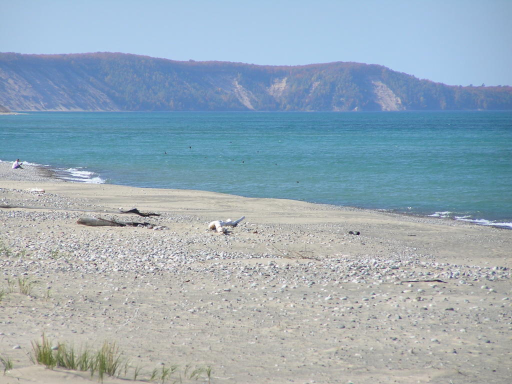
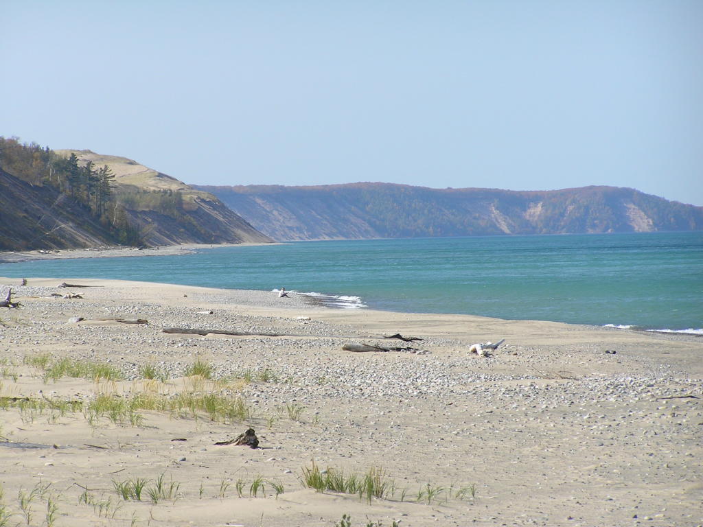
Grand Marais - A view of the beach and sand dunes from Coast Guard Point
Grand Marais - Close-up of one of the dunes (they are grown over with grass)
Grand Marais - A sand dune further along the coast
Grand Marais - Another view of the dunes
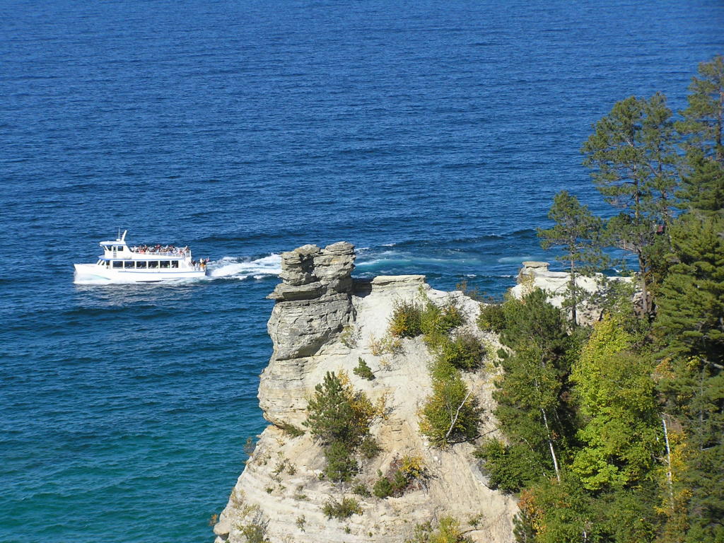
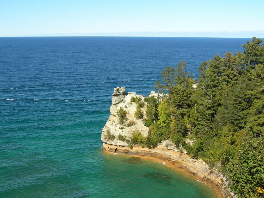
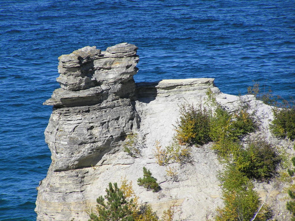
Miners Castle - A tour boat passes the landmark (or what is left of it). One of the "turrets" fell into Lake Superior this past spring
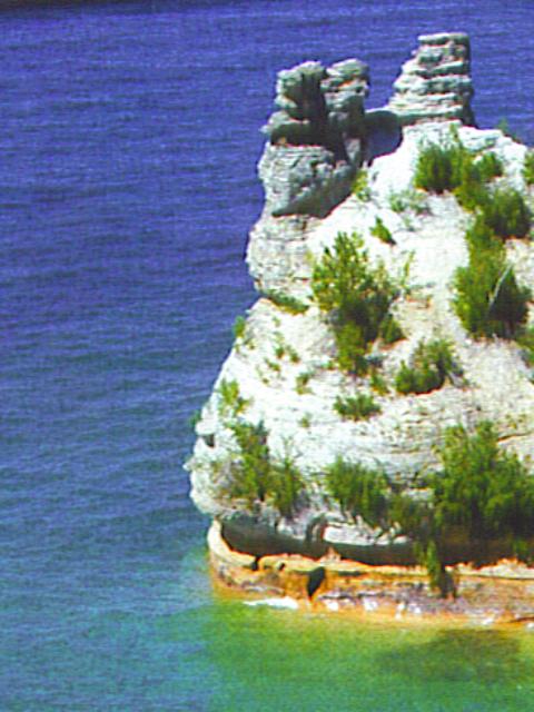
Miners Castle - This is what the natural sandstone formation used to look like (from brochure)
Miners Castle - Wide view of the area
Miners Castle - Close-up of the remaining "turret"
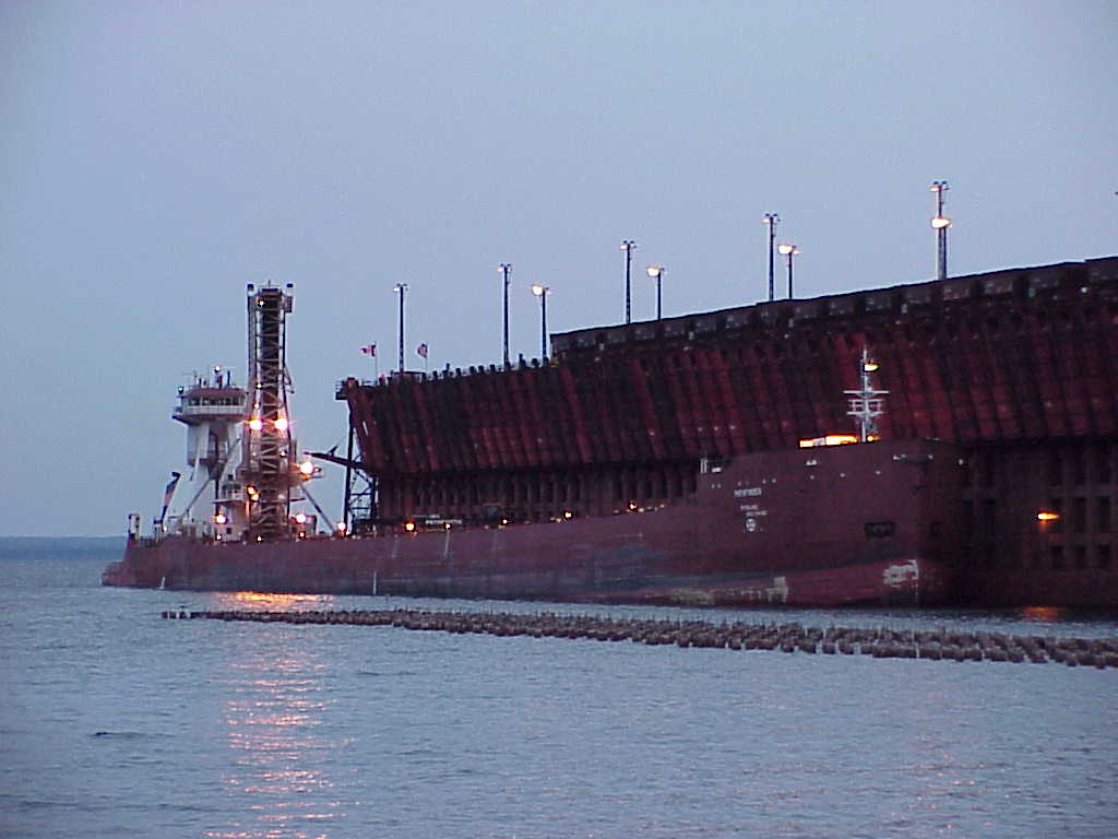
Marquette - The Pathfinder loading taconite pellets at the ore dock on Sept. 29 at nightfall
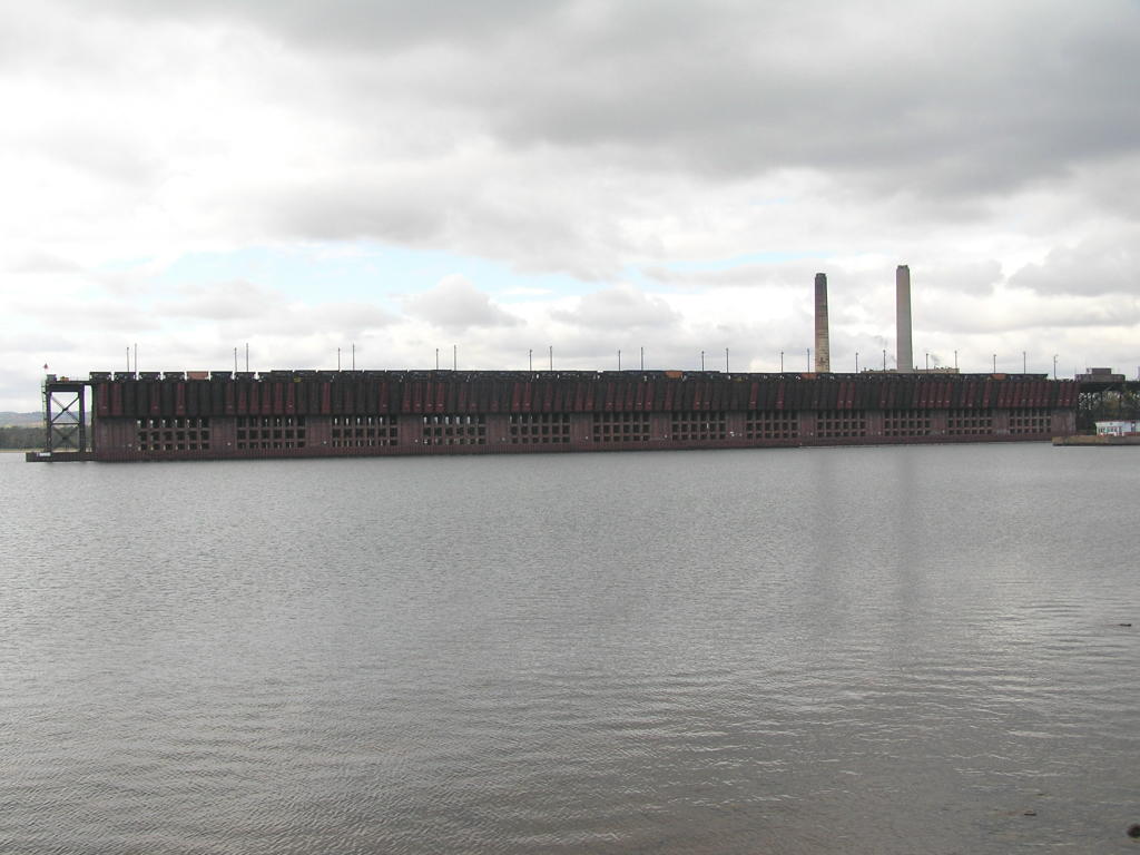
Marquette - A view of the ore dock from Presque Isle park
Marquette - A view of the opposite side of the ore dock
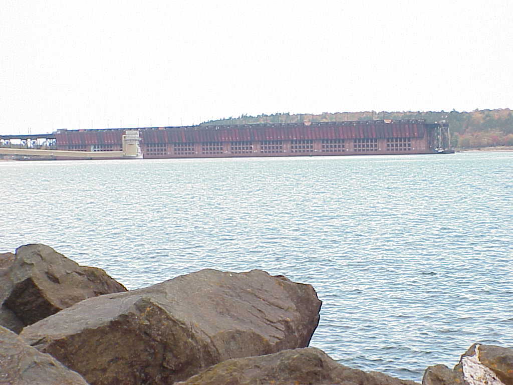
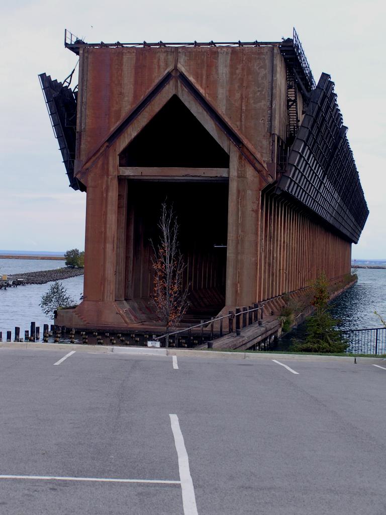
Marquette - The old ore dock in the lower harbor awaits its fate
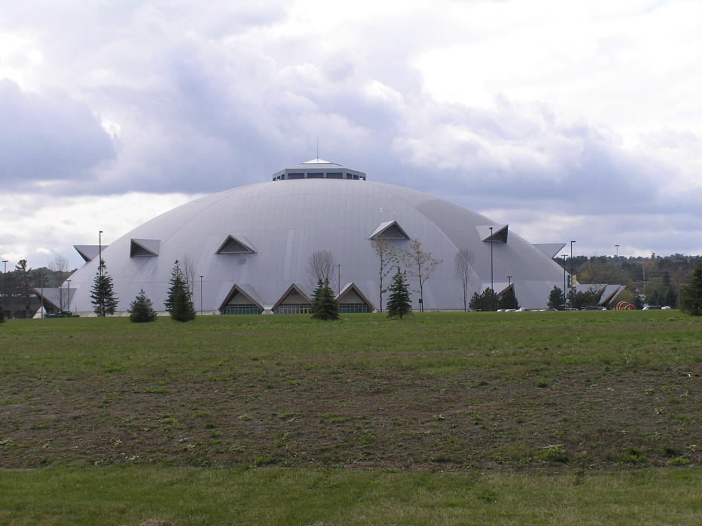
Marquette - Northern Michigan University's "Superior Dome" (nicknamed the "Yooper Dome" by some)
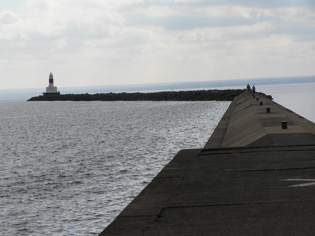
Marquette - Breakwater on Lake Superior
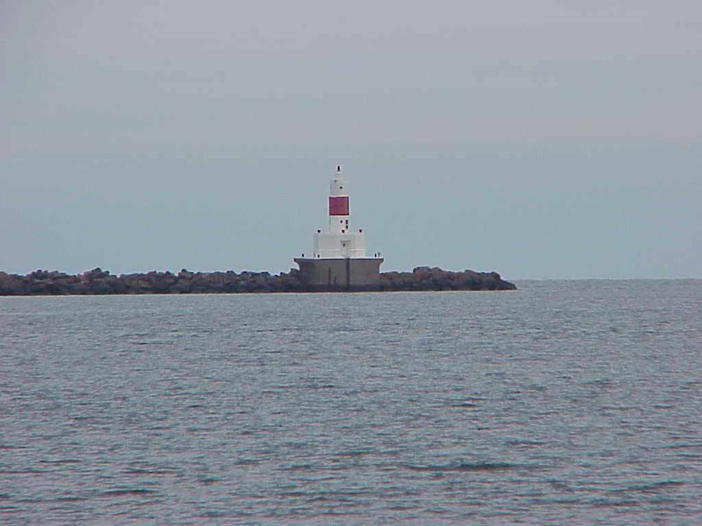
Marquette - Close-up of the light at the end of the breakwater
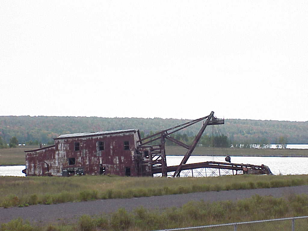
Old dredge - This vessel near Mason, MI was used to reclaim copper ore "tailings" (the left over material after the copper was removed) from the riverbed where it had been dumped as waste years earlier. New technology made the discarded "tailings" (which still contained some ore) viable, so the material was dredged and reprocessed to reclaim the ore still in the "tailings."
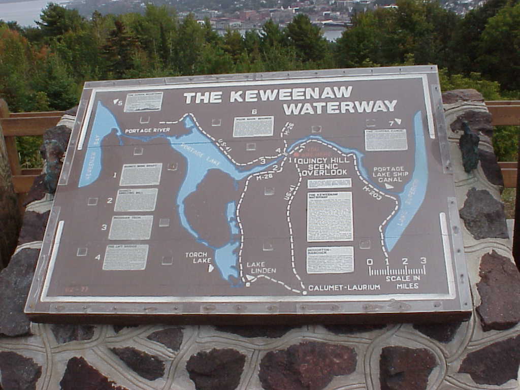
Sign - A map of the Keweenaw Waterway (sometimes called the Portage Canal)
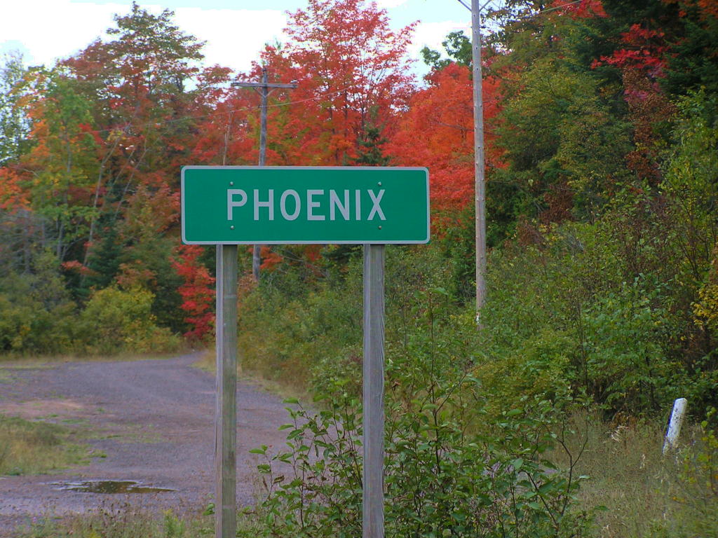
Sign - No, I wasn't in Arizona, this is a sign entering Phoenix, MI (with some fall colors in evidence)
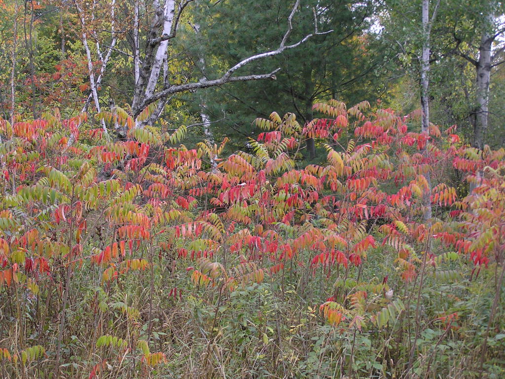
Beautiful leaves - In L'Anse near one of the falls
Fall colors - Along a backroad in the L'Anse area
Fall Colors - A pretty tree also in the L'Anse area
Mountain? - No, this is manmade! This hill (and others in the area) are all mine waste. When the iron ore is removed from the rock, the left-over material is dumped and the result is huge mountain-like hills! This mound is near Palmer, MI.
Fall Colors - More beauty found along the road in the mid-U.P.
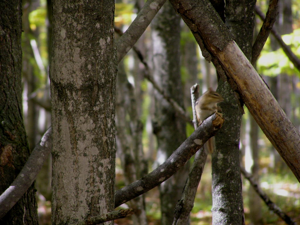
Chipmunk - One of many I encountered as I hiked into the Chapel Falls
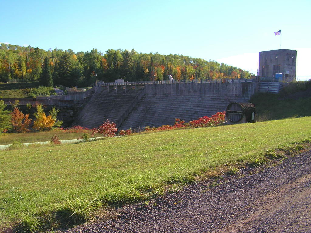
Old Victoria Dam - An old dam west of Rockland
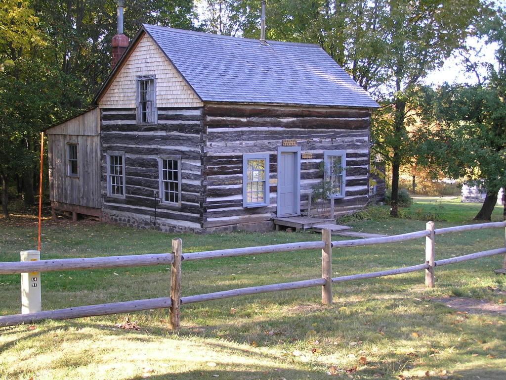
Visitor's Center - At the Restoration Mining Site in Rockland (they are rebuilding part of "Old Victoria" back to colonial days)
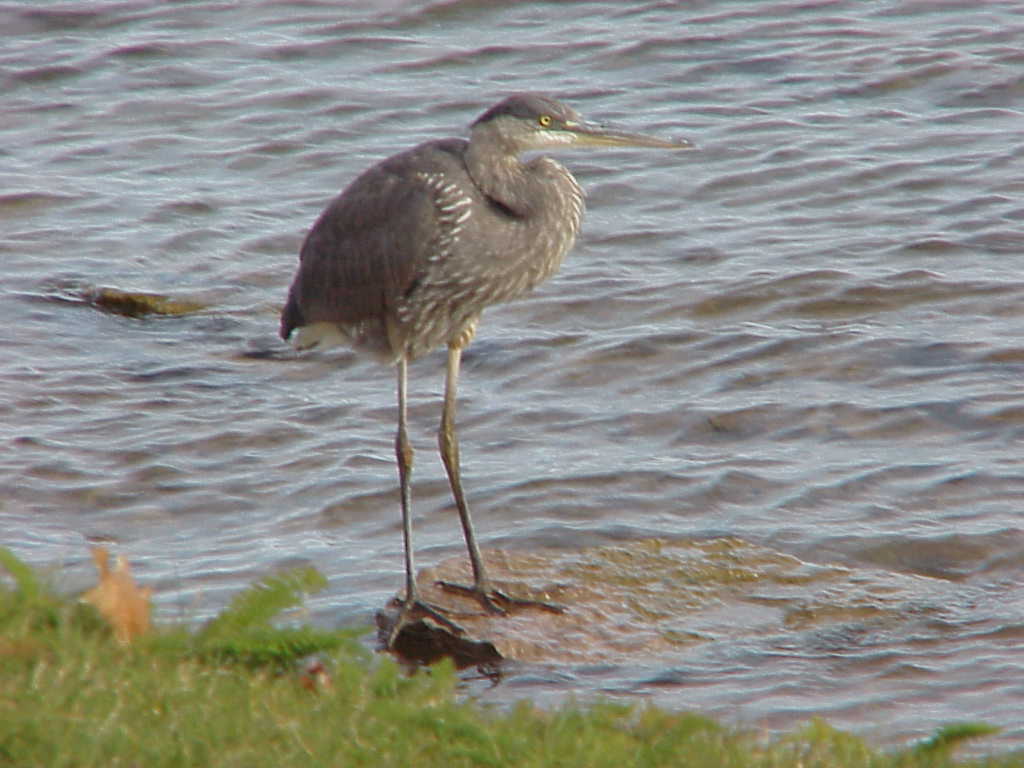
Great Blue Heron - Found at Mission Point in Sault Ste. Marie
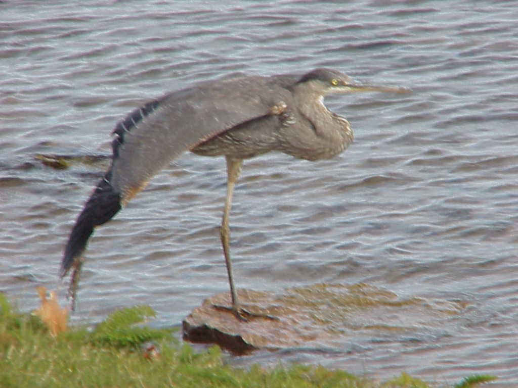
Great Blue Heron - Doing its morning stretching (I was able to walk to within about 15 feet of this bird and it never budged)
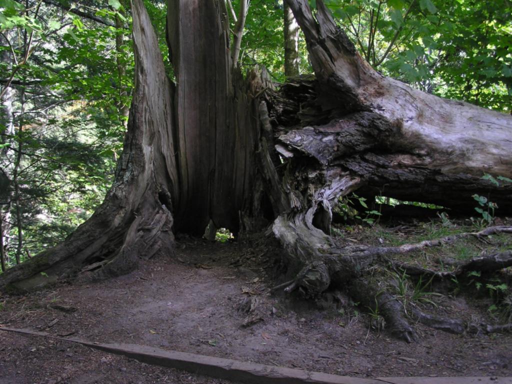
Old toppled tree - Found along a trail beside the Presque Isle River in the Porcupine Mountains
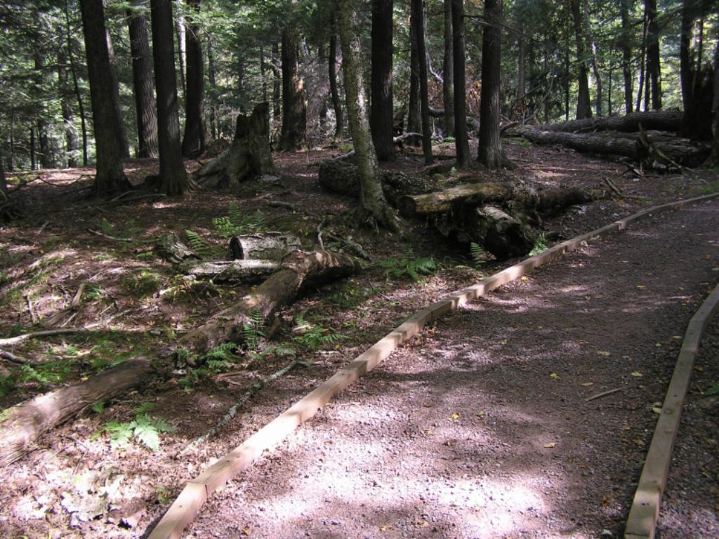
"Groomed" Trail - One of many along the Black River in Gogebic County
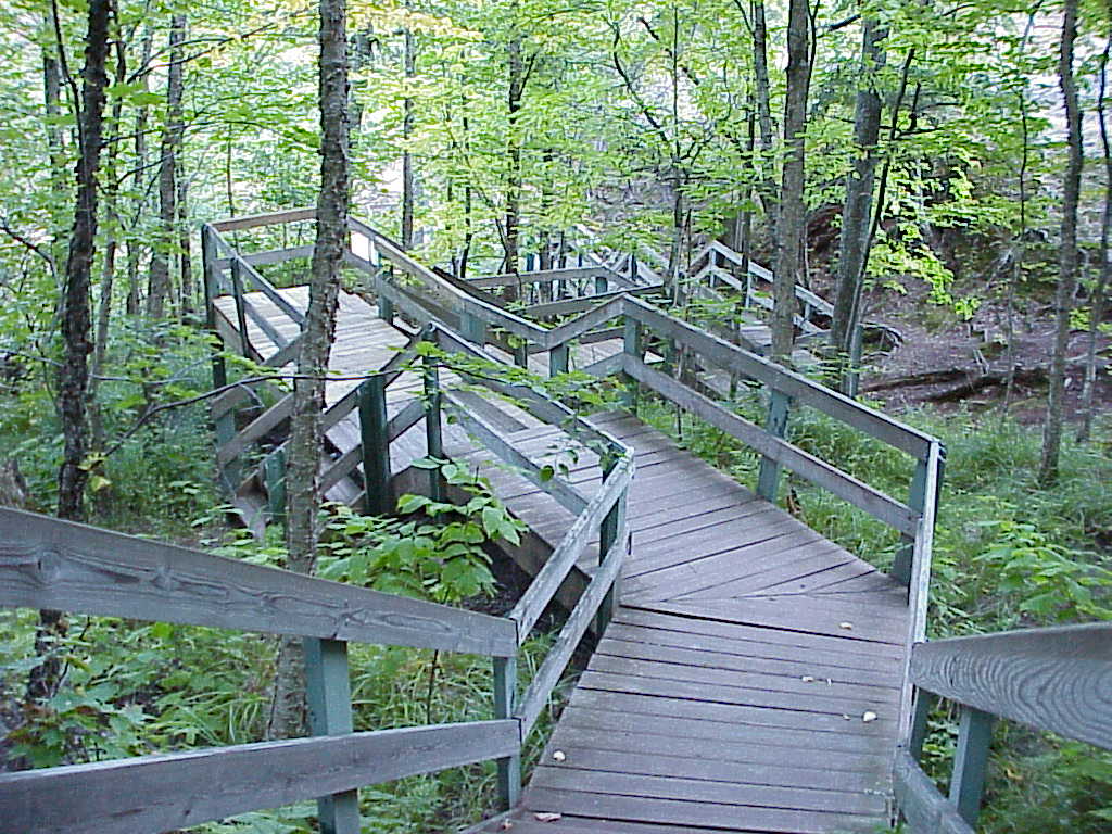
Wooden Stairway - One of many found along rivers and streams located within scenic areas maintained by the State Parks system
Well, that's it for this trip. I hope you enjoyed your visit ... I know I did while taking these photos of our beautiful Upper Peninsula!!! Don't be surprised if I add content to this page next spring; I would love to revisit some of the waterfalls up in the Keweenaw (and some others) when there is much more water coursing through them at the time of the Spring run-off (when the snow melts). I hope I get the chance to do that :O)!
|